

Today’s Forecast:
While the big weather story late this week will be the potential for all-time record breaking heat in Southern Colorado, it won't feel that way this morning when you head out the door. Temperatures have been in the 0s, 10s and 20s this morning, with single digit wind chill temperatures in some areas. A few flurries have also been spotted this morning across parts of the Pikes Peak Region. Periods of snow will continue in the central and northern mountains on Monday, with 1-3" of accumulation possible.
On the Plains, temperatures will be stunted by continued northwest flow in the mid and upper levels of the atmosphere. Highs will be around 8-12 degrees below average today, only warming into the 40s and 50s.
Colorado Springs forecast: High: 45; Low: 29. A flurry or two can't be discounted this morning, but most of today's action will stay in the mountains to our west. The big story today will be the lingering cold, with morning temps in the single digits and teens, and highs today in the middle 40s.
Pueblo forecast: High: 50; Low: 27. Lingering cold this morning will give way to a cool, mid-March afternoon, with our high today only warming to around 50 degrees.
Canon City forecast: High: 52; Low: 34. Mostly cloudy skies and cold temperatures this morning will give way to a bright and chilly afternoon. Highs today will warm into the lower 50s, with our low tonight dropping down to the middle 30s.
Woodland Park forecast: High: 46; Low: 28. After snow and cold on Sunday, the big chill remains this morning. Highs today will moderate into the middle 40s, with St. Patrick's Day temps climbing into the 60s.
Tri-Lakes forecast: High: 40s; Low: 20s/30s. Single digit wind chills this morning will give way to a cool, but pleasant afternoon. Our high today will warm into the 40s, with the wind expected to be much lighter than this past weekend.
Plains forecast: High: 40s/50s; Low: 20s. Once the morning chill wears off, the rest of our Monday will be nice. Light southeast winds and mostly sunny skies will be a nice compliment to afternoon highs today in the 40s and lower 50s.
Walsenburg and Trinidad forecast: High: 40s/50s; Low: 20s/30s. After a wild and windy weekend, Monday has gotten off to a cold start as out the door temperatures have been in the single digits. Temperatures will be slow to warm this afternoon, only reaching the upper 40s and 50s.
Mountains forecast: High: 40s; Low: 20s. While the central and northern mountains will see additional snow showers on Monday, the southeastern mountains will stay dry. It will be a breezy to gusty day in the high country, with peak W/NW wind gusts today around 35 mph.
Extended outlook forecast:
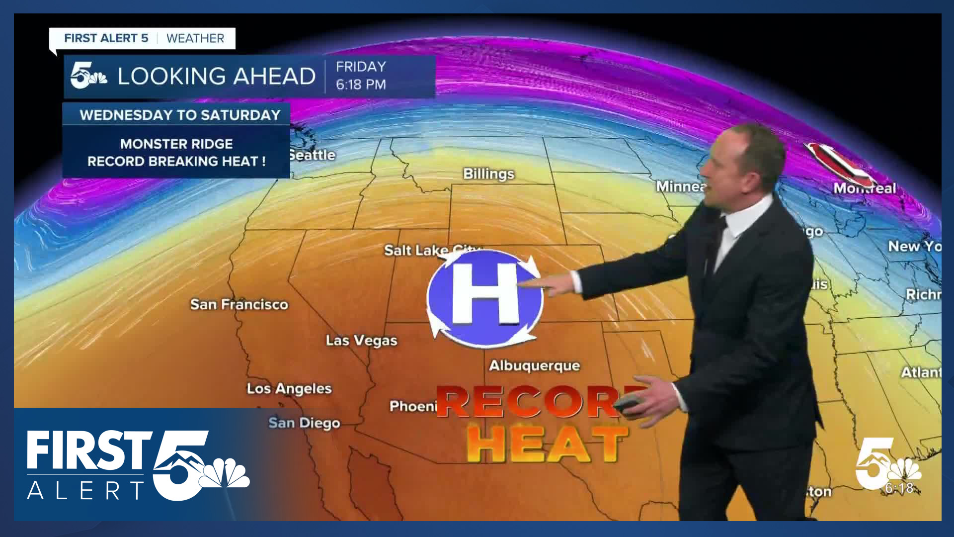
High pressure building into the West Coast will allow for a quick warm-up on Tuesday. Our high in Colorado Springs will top out in the lower 70s, with upper 70s by Wednesday.
The peak period of heating will occur from Thursday to Saturday. Daily heat records are likely to fall each afternoon during this period as afternoon highs climb into the lower to middle 80s. In Colorado Springs, the all-time heat record in March sits at 81 degrees. This will be in jeopardy as well!
In Pueblo, and parts of the southeastern Plains, some areas could soar into the 90s! Pueblo's current all-time hottest March day on record is 86 degrees. We are likely to surpass that each day from Thursday to Saturday.
____
Curious about the First Alert 5 Weather Storm Impact Scale? Check out our cheatsheet explainer.
Watch KOAA News5 on your time, anytime with our free streaming app available for your Roku, FireTV, AppleTV and Android TV. Just search KOAA News5, download and start watching.
