

Today’s Forecast:
A strong, blocking ridge of high pressure over the northern Rockies will slowly translate east over the next 24-48 hours, bringing us a nice and warm end to the work week. Highs today will be around 8-12 degrees warmer than yesterday, with 70s and 80s on the Plains.
Sunshine will stick around throughout the day on Thursday, with no real threats of rain or snow state-wide for the next 24 hours.
Colorado Springs forecast: High: 77; Low: 46. Cool temperatures this morning will give way to a bright and much warmer afternoon, with our highs today climbing into the upper 70s.
Pueblo forecast: High: 82; Low: 46. Sweater weather this morning will quickly give way to a warm and sunny afternoon as highs today look to top out in the lower 80s.
Canon City forecast: High: 80; Low: 52. Warming highs late this week will bring a return to above average highs in Canon City as we'll close out the last week of September in the 80s.
Woodland Park forecast: High: 70; Low: 40. Today's weather can best be described as a Goldilocks forecast. Not too hot, not too cold, just about right.
Tri-Lakes forecast: High: 70s; Low: 40s. After seeing a return to sunshine Wednesday afternoon, sunny skies will continue today, along with warmer than average highs for the Tri-Lakes area.
Plains forecast: High: 70s/80s; Low: 40s/50s. We'll follow up today's chilly morning temperatures with sunshine and a return to 70s and 80s this afternoon.
Walsenburg and Trinidad forecast: High: 70s/80s; Low: 40s. Warm and sunny, with no complaints weather wise on Thursday after seeing windy, wet and cooler weather earlier this week.
Mountains forecast: High: 60s; Low: 30s/40s. Sunshine will be in high supply in the mountains on Thursday, with zero threats for rain or snow in the Sangres and Wet Mountains until the upcoming weekend.
Extended outlook forecast:
Our high in Colorado Springs will go from the upper 70s today to the lower 80s on Friday. This will be our warmest day of the week.
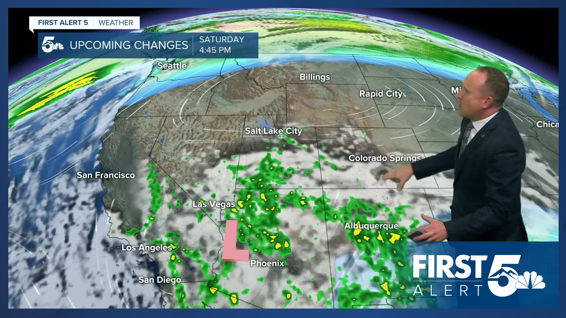
Storm energy coming out of California will bring an increase in moisture to the Four Corners Region this weekend. If you're traveling into the mountains, there's a pretty good chance of rain and high elevation snow each day. On the Plains and I-25 corridor, we'll see slightly cooler highs this weekend, with a few showers pushing east into the Pikes Peak Region by Sunday afternoon.
___
Curious about the First Alert 5 Weather Storm Impact Scale? Check out our cheatsheet explainer.
Watch KOAA News5 on your time, anytime with our free streaming app available for your Roku, FireTV, AppleTV and Android TV. Just search KOAA News5, download and start watching.
