

Today’s Forecast:
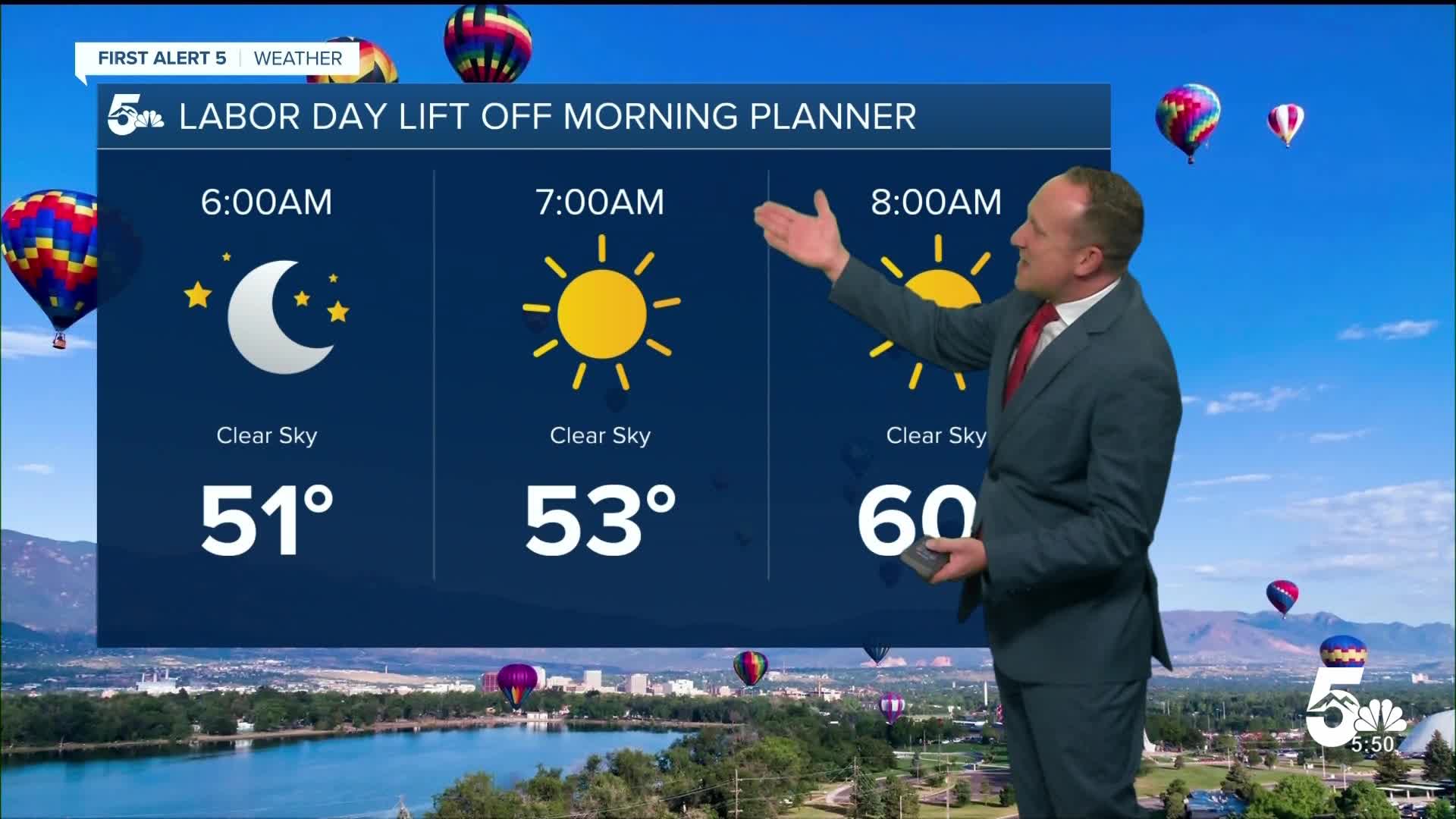
After a mixed bag of weather this weekend, our forecast on Labor Day will be a gorgeous one for Southern Colorado. This of course is mostly good news (fingers crossed) for the final morning of Labor Day Lift Off in Colorado Springs. For the final launch of the three-day event, skies will be clear and wind gusts will be fairly light, with gusts expected to remain under 15 mph. This may impact operations for some of the special shaped balloons, but we're hoping that any stronger gusts stay north of Memorial Park and won't impact the balloon launch.
Cool, fall-like temperatures this morning will give way to highs in the 70s and 80s this afternoon. Other than a rogue shower in the mountains this afternoon, no significant threats of rain are expected today for Southern Colorado.
Colorado Springs forecast: High: 81; Low: 51. Labor Day will be a dry and seasonably warm one for Colorado Springs, with today's high topping out in the lower 80s. A breezy cold front this afternoon will bring moderate northerly gusts to our area, peaking around 15-25 mph.
Pueblo forecast: High: 88; Low: 54. For the final day of the Colorado State Fair, it will be nice and sunny. Today's high of 88 degrees will be on par with our 30-year climate average for September 1.
Canon City forecast: High: 85; Low: 56. After a gorgeous Sunday, skies will remain bright and sunny again on Monday, with highs up a few degrees across eastern Fremont County.
Woodland Park forecast: High: 72; Low: 42. Dry weather conditions will allow for a nice warm-up this afternoon after seeing morning temperatures in the lower 40s. Rain is not expected on Labor Day.
Tri-Lakes forecast: High: 70s/80s; Low: 40s/50s. Bright and cool conditions this morning will give way to a warm and breezy afternoon, with peak wind gusts up around 20 mph.
Plains forecast: High: 80s/90s; Low: 50s. Dry and breezy, with our highs today climbing into the 80s and lower 90s. Northerly wind gusts to 25 mph will be possible this afternoon, with the wind kicking up behind an incoming frontal boundary.
Walsenburg and Trinidad forecast: High: 80s; Low: 50s. We're expecting a really nice end to the holiday weekend across the southern I-25 corridor, with near average highs and variable winds of 10-15 mph.
Mountains forecast: High: 60s; Low: 30s/40s. Cool and sunny conditions this morning will give way to increasing clouds this afternoon and a small chance of rain or thunderstorms into the southeastern mountains. Any rain today should favor the Sangres over the Wet Mountains.
Extended outlook forecast:
A return to the lower 80s can be expected on Tuesday in Colorado Springs, with the main difference from today being a few more clouds in the afternoon. In the mountains, a better chance for scattered showers and thunderstorms will return tomorrow.
Our next cold front will arrive on Wednesday and while it won't do much to cool down our temperatures across Southern Colorado, it will bring the potential for a few spotty showers. Thursday will be dry, with highs in the 80s and 90s on the Plains. Another cold front Friday will drop highs back down to the 70s here in Colorado Springs, with a region-wide chance of thunderstorms possible each day through the weekend.
____
Curious about the First Alert 5 Weather Storm Impact Scale? Check out our cheatsheet explainer.
Watch KOAA News5 on your time, anytime with our free streaming app available for your Roku, FireTV, AppleTV and Android TV. Just search KOAA News5, download and start watching.
