


Today’s Forecast:
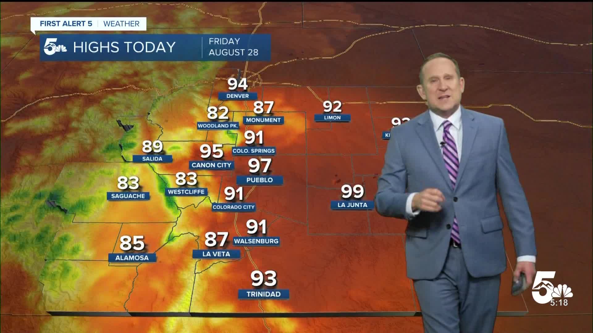
The final Friday of August will be hot, with highs this afternoon rising as much as 5-8 degrees region-wide. Temperatures in the Pikes Peak Region will warm into the 90s in the lower elevations, and the 80s for higher terrained areas. Temperatures on the Plains today will warm into the middle to upper 90s, and it will be even hotter on Saturday.
As for storms, we will see a downturn in convection this afternoon as storms will favor the mountains and foothills. Storms will mainly fizzle out as they move east towards the I-25 corridor and eastern Plains. Rain chances today in Colorado Springs and Pueblo will only be around 20-30%.
Colorado Springs forecast: High: 91; Low: 60. Today's high of 91 degrees in Colorado Springs will be our first time back in the 90s since last Friday. Storms today will favor the mountains and higher terrained areas, with only a slight chance of showers locally this afternoon.
Pueblo forecast: High: 97; Low: 62. As the atmosphere dries out on Friday, temperatures will climb, topping out today in the upper 90s. if you're heading to the Colorado State Fair, make sure to grab the water bottle and sunscreen before you leave home.
Canon City forecast: High: 95; Low: 64. The final Friday of August will be hot, with only a few isolated to spotty storms possible this afternoon.
Woodland Park forecast: High: 82; Low: 54. While severe storms are not expected this afternoon in Teller County, any storms that develop could still bring lightning, gusty winds, small hail and brief, heavy downpours.
Tri-Lakes forecast: High: 80s; Low: 50s/60s. Late this week, we will be heating up and drying out. Temperatures today will top out in the upper 80s, with only a few thunderstorms possible this afternoon and evening.
Plains forecast: High: 90s; Low: 60s/70s. With a drier day ahead, the heat will become the big story by Friday afternoon. Highs today will warm into the middle to upper 90s. Highs tomorrow will top 100 degrees in some areas.
Walsenburg and Trinidad forecast: High: 80s/90s; Low: 50s/60s. After some significant flooding in Walsenburg on Thursday, our weather today will be calmer and hotter. Today's highs will soar into the upper 80s and lower 90s.
Mountains forecast: High: 70s/80s; Low: 40s/50s. Although skies will be a little less stormy today compared to what we saw earlier this week, the high country will continue to be ground zero for spotty to scattered thunderstorms this afternoon, especially for areas along and west of the Continental Divide.
Extended outlook forecast:
Southwesterly flow aloft will continue to pull sub-tropical moisture into the Four Corners Region and Southern Colorado this weekend. This pattern will bring the potential for heavy rain and flooding to the mountains, especially over the San Juans, with fewer storms expected on the Plains.
Our high Saturday will warm to 93°F in Colorado Springs. Our current record sits at 95°F, and was last set in 2019. Storms will be fairly isolated in nature on Saturday, with a slightly higher chance of storms by Sunday. Pueblo's high on Saturday will hit 99°F.
A cold front will drop in Sunday afternoon, so Sunday will still be hot, up near 90°F in Colorado Springs. Early next week it will turn slightly cooler, with highs back down to the 80s.
____
Curious about the First Alert 5 Weather Storm Impact Scale? Check out our cheatsheet explainer.
Watch KOAA News5 on your time, anytime with our free streaming app available for your Roku, FireTV, AppleTV and Android TV. Just search KOAA News5, download and start watching.
