

Tonight's Forecast:
This evening, winds will generally calm down and will be less than 15 mph. Temperatures will be relatively mild with some areas staying above freezing.
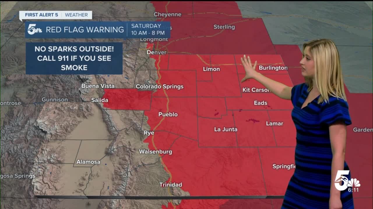
On Saturday a RED FLAG WARNING will go into effect at 10 am and last until 8 pm. Do not create any sparks outside and call 911 if you see smoke.

By 8 pm on Saturday a HIGH WIND WATCH is in effect until 8 pm Sunday. Wind gusts will be as high as 60-70 mph.

Colorado Springs forecast: Low: 34; High: 64;
RED FLAG WARNING from 10 am to 8 pm. Saturday will be warm with a few high clouds. Wind will be from the SSW at 15-25 mph gusting to 40 mph.
Pueblo forecast: Low: 31; High: 70;
RED FLAG WARNING from 10 am to 8 pm. A HIGH WIND WATCH will go into effect at 8 pm. Saturday will be warm and mostly sunny with SW wind at 10-25 mph gusting to 40 mph with increasing winds overnight.
Canon City forecast: Low: 37; High: 67;
RED FLAG WARNING from 10 am to 8 pm. Mostly sunny with W wind at 20-25 mph gusting to 45 mph.
Woodland Park forecast: Low: 28; High: 55;
Mostly sunny and windy on Saturday. Wind will be from the SW at 20-25 mph gusting to 45 mph. There is a chance of snow late on Saturday night into early Sunday morning.
Tri-Lakes forecast: Low: 30; High: 58;
RED FLAG WARNING from 10 am to 8 pm. Mostly sunny on Saturday with wind from the WSW at 15-25 mph gusting to 40 mph.
Plains forecast: Low: 30s; High: 70s;
RED FLAG WARNING from 10 am to 8 pm. It will be sunny and warm with highs in the low to mid-70s. Wind will be from the SW at 10-15 mph gusting 30-40 mph.
Walsenburg/Trinidad forecast: Low: 36/36; High: 65/65;
RED FLAG WARNING from 10 am to 8 pm. A HIGH WIND WATCH will go into effect at 8 pm. Wind will be from the WSW on Saturday afternoon from 15-25 mph gusting to 40 mph, with winds increasing on Saturday night.
Mountain valleys forecast: Low: 20s/30s; High: 50s;
A HIGH WIND WATCH will go into effect at 8 pm for the Wet mountains and Sangre De Cristo mountains, Huerfano, western Las Animas, and Custer County. The sky will be partly cloudy on Saturday with winds in the afternoon from the W at 10-20 mph gusting 35-45 mph. Winds will increase overnight on Saturday.
Extended outlook forecast:
The HIGH WIND WATCH will remain in effect on Sunday until 8 pm. There will be another round of fire danger, with a FIRE WEATHER WATCH in place for Sunday afternoon.

Winds will be the strongest on Sunday, with frequent gusts from 40-50 mph across the region, and gusts in excess of 60 mph for the high wind zone shown above.
____
Curious about the First Alert 5 Weather Storm Impact Scale? Check out our cheatsheet explainer.
Watch KOAA News5 on your time, anytime with our free streaming app available for your Roku, FireTV, AppleTV and Android TV. Just search KOAA News5, download and start watching.
