

Today’s Forecast:
With high pressure to our south and a strong area of low pressure moving into the West Coast this morning, a slightly better chance for showers and thunderstorms will be possible. Storms will be very hit or miss in nature, with rain not likely to reach the I-25 corridor until much later today or this evening. Storms on the eastern Plains will bring the potential for 1" hail and wind gusts to 60 mph.
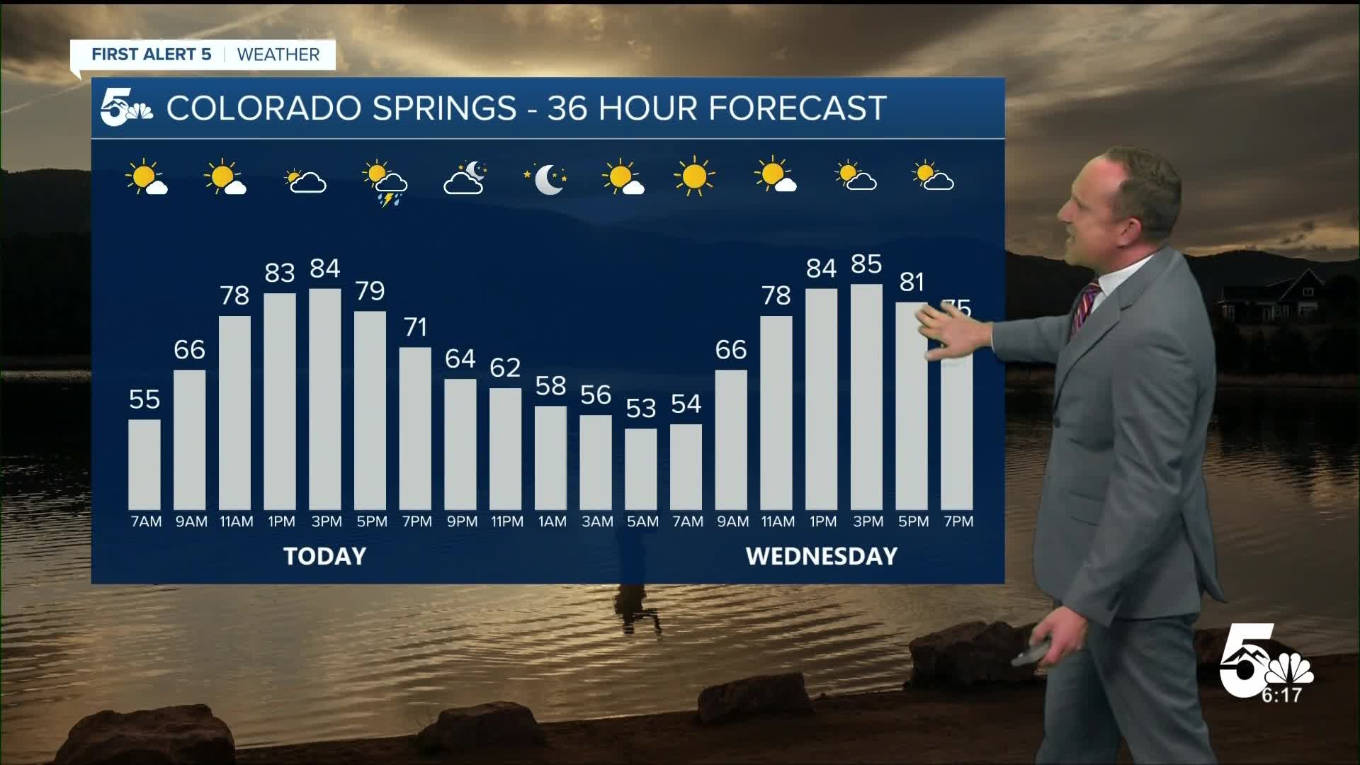
Tuesday's forecast will also feature more September warmth, with highs this afternoon about 5 degrees above seasonal averages.
Colorado Springs forecast: High: 84; Low: 53. Warmer than average highs on Tuesday, with increasing clouds this afternoon and the chance for isolated thunderstorms in the Pikes Peak Region. Our best shot at any rain today would be from 4 pm until 8 pm.
Pueblo forecast: High: 91; Low: 56. Temperatures have been climbing steadily upward since last Friday's high of 66 degrees. Today's high of 91 will be hot, and along with the heat, we'll see a chance for a rogue thunderstorm or two this evening.
Canon City forecast: High: 88; Low: 57. Sunshine early will give way to mostly cloudy skies this afternoon and the potential chance for showers and thunderstorms. Whatever rain we do see should come to an end around sunset.
Woodland Park forecast: High: 75; Low: 43. A clear and beautiful morning will turn mostly cloudy by the afternoon as another round of storms forms in the mountains and moves east into Teller County. Thunderstorms will be possible anytime after 2 pm.
Tri-Lakes forecast: High: 70s/80s; Low: 40s/50s. Warm, September weather will continue on Tuesday, along with a chance for scattered showers and thunderstorms this afternoon. If we see any rain today, it should hold off until after 3 pm.
Plains forecast: High: 80s/90s; Low: 50s. Increased instability and moisture will lead to a slight increase in storm coverage today and the potential for a few severe thunderstorms out towards the Colorado-Kansas border. Storms today will be capable of 1" hail and 60 mph wind gusts.
Walsenburg and Trinidad forecast: High: 80s; Low: 50s. Mostly dry skies can be expected on the southern I-25 corridor today. If we see any rain in our area, it will be short-lived as most of today's storms should remain up in the mountains or to our north.
Mountains forecast: High: 60s/70; Low: 30s/40s. Another wave of energy will combine with increasing moisture to deliver a good shot of rain and thunderstorms to the mountains. Timing wise, storms should hold off until after the lunch hour today.
Extended outlook forecast:
Drier and more stable air should keep most of the rain closer to the mountains and foothills from Wednesday to Thursday. Each afternoon, it's possible that a quick passing shower could move across the Pikes Peak Region and into the Plains. Impacts from any storms would be short lived.
Temperatures will remain in the 80s and 90s through Thursday before an incoming low-pressure system sends a cold front across the state. Highs will drop into the upper 70s in Colorado Springs from Friday into the weekend, with a chance of thunderstorms both Friday and Saturday afternoons ahead of mostly sunny skies on Sunday.
____
Curious about the First Alert 5 Weather Storm Impact Scale? Check out our cheatsheet explainer.
Watch KOAA News5 on your time, anytime with our free streaming app available for your Roku, FireTV, AppleTV and Android TV. Just search KOAA News5, download and start watching.
