

Today’s Forecast:
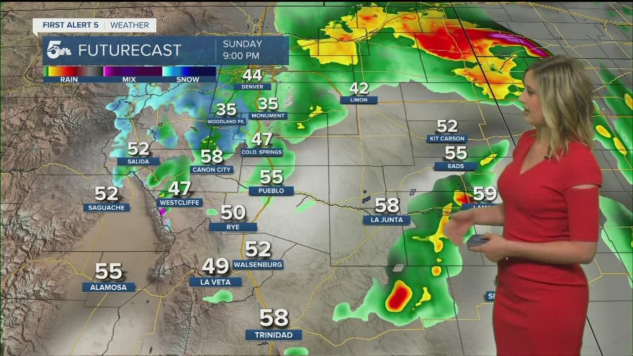
An active weather pattern is setting up for southern Colorado today. Temperatures will be cooler and humidity has increased. Thunderstorms are likely in the mountains and plains this afternoon, with severe storms possible.
If you see or hear lightning/thunder today while outdoors, find shelter immediately! Have a back up plan if you recreate outside today.
COLORADO SPRINGS: High: 67; Low: 41. Thunderstorms likely from 1 pm and through the evening. Hail is possible today.
PUEBLO: High: 73; Low: 46. Thunderstorms possible after 1 pm, and could have hail and frequent lightning.
CANON CITY: High: 68; Low: 45. Rain and thunderstorms likely after noon, with lightning possible.
WOODLAND PARK: High: 57; Low: 32. Cool today with showers after noon. Lightning is possible this afternoon. A mix of rain and snow possible tonight.
TRI-LAKES: High: 50s; Low: 30s. Early afternoon rain and thunderstorms, some of which will be strong. Hail is possible.
PLAINS: High: 70s; Low: 40s. Strong scattered thunderstorms with isolated severe thunderstorms possible this afternoon to evening.
WALSENBURG/TRINIDAD: High: 60s/70s; Low: 40s. Upper 60s and low 70s today with thunderstorms possible after 1 pm. Hail is possible.
Extended Outlook:
Lesser intensity rain is likely overnight into Monday morning. The sky will clear up through Memorial Day. The weather returns to seasonable and sunny for the rest of the week. Some late week thunderstorms are possible.
