

Today’s Forecast:
Our first snow of the season brought a couple of inches of accumulation to Southern Colorado last night. With frigid temperatures hanging around this morning, unplowed roads are going to be slick, icy and snow covered for today's return to work drives after the holiday weekend. You'll want to budget some extra time to get to work or school this morning, and please, slow down and give any working plows on the roads plenty of extra space as you're out and about.
Sunshine will return during the morning hours, allowing for temperatures to moderate into the 30s this afternoon. Another cold night will follow tonight, and as temperatures plummet down to the 10s and 20s, any unplowed streets could once again form ice in the overnight hours.
Colorado Springs forecast: High: 36; Low: 17. Even with the snow done falling, the roads are going to be snow covered and icy in some spots during the morning commute. Sunshine returning this morning will allow for highs to warm above the freezing mark today, allowing for a good amount of snow melt during the afternoon.
Pueblo forecast: High: 39; Low: 14. Slick and icy roads this morning have led to multiple accidents in Pueblo County. Give yourself plenty of extra time to get to your destination today. Highs will warm into the upper 30s this afternoon, with lows tonight back down to the 10s.
Canon City forecast: High: 38; Low: 20. Snowy roads this morning will give way to snowmelt sunshine this afternoon as daytime highs today warm above freezing, topping out in the upper 30s.
Woodland Park forecast: High: 33 Low: 14. While not a big storm, cold temperatures will keep snow on some roads on Monday, with our high today only warming to near the freezing mark. Lows tonight will drop back down to the 10s.
Tri-Lakes forecast: High: 30s; Low: 10s. Cold, with sunshine and afternoon highs in the 30s. Lows tonight will be very cold, dropping back down to the 10s.
Plains forecast: High: 30s; Low: 10s/20s. Snow will wrap up by 9 am on the eastern Plains, leaving us with a mostly sunny and chilly afternoon. Temperatures today will be around 10-15 degrees below average.
Walsenburg and Trinidad forecast: High: 30s; Low: 10s/20s. A few lingering snow showers will wrap up by 9 am, with a mostly sunny and cold afternoon to follow. Highs today will only warm into the 30s.
Mountains forecast: High: 20s; Low: 0s/10s. Lingering snow showers in the southeastern mountains will come to an end by the lunch hour, leaving us with a sunny and cold afternoon. Skies should remain dry Monday night, with temps tumbling back down to the single digits and teens.
Extended outlook forecast:
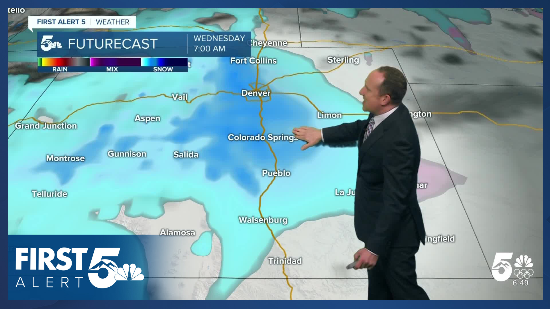
Nice weather will follow on Tuesday, with temperatures rebounding into the 40s and 50s on the Plains. Our next storm arrives Wednesday, with periods of snow throughout the day and another 1-3" of accumulation along the I-25 corridor. Highs on Wednesday will only warm into the 20s and 30s across Southern Colorado.
The storm will clear out pretty quickly by Wednesday night, but much like today, Thursday's commute could be impacted by icy and snow covered roads. Temperatures on Thursday will only warm into the upper 30s, with lower 40s by Friday in Colorado Springs.
Our weather on the Plains looks dry this weekend, with highs in the 40s. In the mountains, periods of snow will remain in the forecast.
____
Curious about the First Alert 5 Weather Storm Impact Scale? Check out our cheatsheet explainer.
Watch KOAA News5 on your time, anytime with our free streaming app available for your Roku, FireTV, AppleTV and Android TV. Just search KOAA News5, download and start watching.
