



COLORADO SPRINGS, Colo (KOAA) — Today’s Forecast:
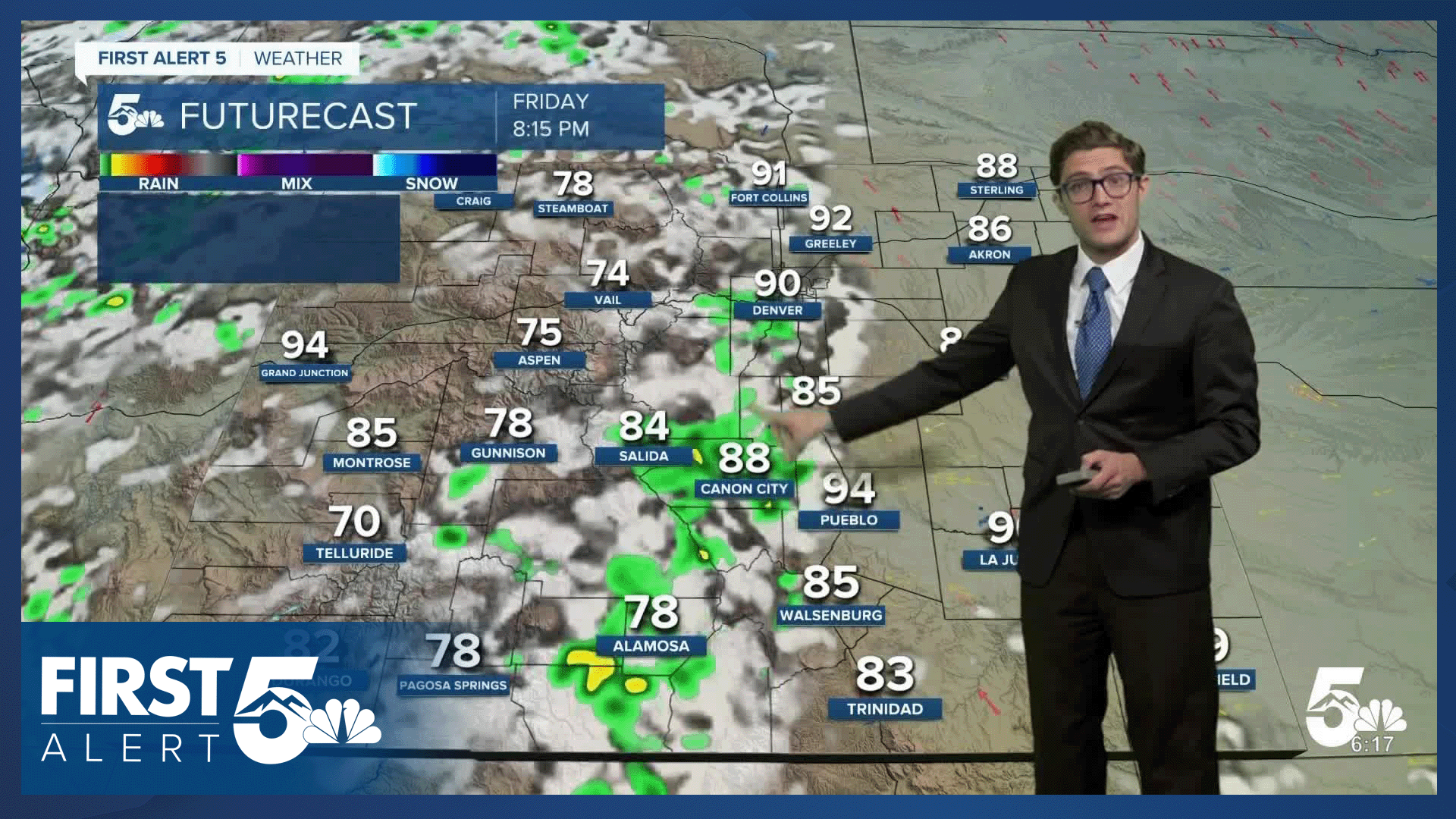
Storms today will be more isolated in much of southern Colorado as we begin to heat back up. High pressure begins to rebuild today, and that ridging helps to push the air down, reducing storm chances over the plains. Storms will still be possible up in the mountains, with an isolated storm possible today along I-25. Highs will roast into the 90s on I-25 with triple digits on the plains.
Colorado Springs forecast: High: 92; Low: 65.
Sunny this morning and partly cloudy this afternoon. Storm chances are significantly down today - only about 20%. The main thing you'll notice is the return of the heat. It will also still feel somewhat humid by Colorado standards with dew points still in the 50s.
Pueblo forecast: High: 98; Low: 67.
Sunny and roasting today with northeast winds at 10-15 mph with a few clouds rolling in during the afternoon.
Canon City forecast: High: 95; Low: 67.
Sunny and sizzling today with northwest winds this morning shifting east this afternoon. An isolated stray storm is still possible this afternoon but the chance is low.
Woodland Park forecast: High: 82; Low: 57.
Mostly sunny this morning with isolated afternoon thunderstorms. While the chance is certainly lower today than the last few days, you retain higher chances than other areas. Northwest winds at 10 mph shifting east this afternoon.
Tri-Lakes forecast: High: 80s; Low: 60s.
Sunny and hot with north winds at 5-10 mph. Partly cloudy skies this afternoon with a stray shower or storm close to the Ramparts.
Plains forecast: High: 90s/100s; Low: 60s.
The summer sizzle is back, and the rain chances are mostly gone today. Stay hydrated.
Walsenburg and Trinidad forecast: High: 91/92; Low: 65/64.
Sunny and hot with northwest winds at 5-10 mph shifting northeast this afternoon.
Mountains forecast: High: 70s/80s; Low: 50s/60s.
Mostly sunny this morning, with scattered afternoon thunderstorms. These storms will be most widespread along and west of the continental divide, with isolated action in the southern mountains driven mostly by terrain.
Extended outlook forecast:
Upper-level ridging remains widespread this weekend, and we'll be watching a chance for near record heat for some areas. Saturday will be hot and dry with highs in the mid-90s in Colorado springs, and triple digits in Pueblo. We really roast on Sunday and Monday. The record high in Colorado Springs on Sunday and Monday is 97 degrees both days. There is an isolated chance for a storm on Sunday, with that chance mostly west of I-25 and over the Palmer Divide.
The ridge begins to nose east on Monday, which means the monsoon tap will turn back on over eastern Colorado. It will still be very hot. The middle of next week will be more unsettled with daily afternoon chances for thunderstorms.
____
Curious about the First Alert 5 Weather Storm Impact Scale? Check out our cheatsheet explainer.
Watch KOAA News5 on your time, anytime with our free streaming app available for your Roku, FireTV, AppleTV and Android TV. Just search KOAA News5, download and start watching.
