

Tonight's Forecast:
There is a low chance of an isolated thunderstorm tonight in El Paso County. Otherwise, it will be partly cloudy and mild overnight in southern Colorado.
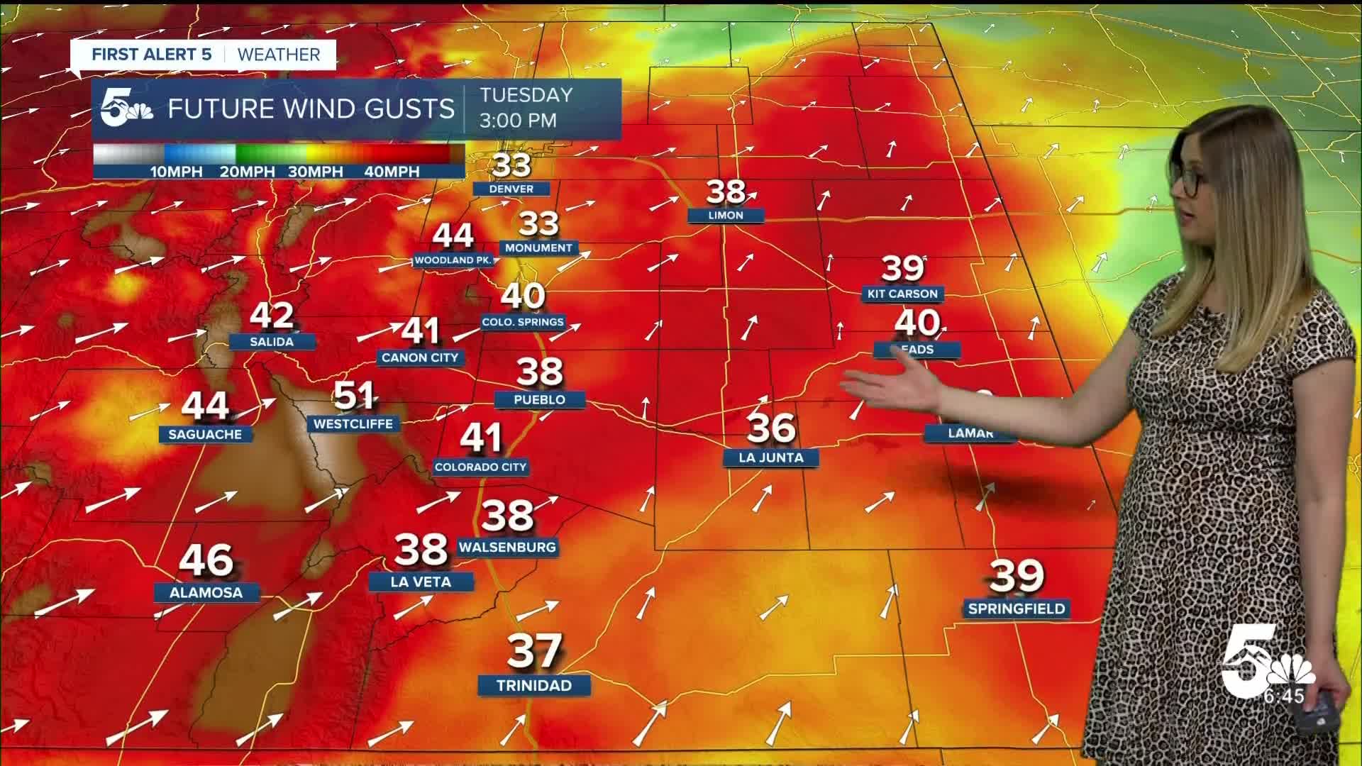
Tuesday Fire Danger:
A RED FLAG WARNING is in effect for the zones highlighted in red from noon until 7 pm on Tuesday.

Colorado Springs forecast: Low: 53; High: 91;
It will be hot and partly cloudy on Tuesday. There is a low chance of a spot shower in the afternoon. Otherwise, it will be dry and gusty, with SW wind at 10-20 mph gusting to 40 mph.
Pueblo forecast: Low: 57; High: 98;
RED FLAG WARNING from noon until 7 pm. It will be hot, dry, and gusty. Wind will be out of the SW at 10-20 mph, gusting to 40 mph. There is a low chance of a spot shower in the afternoon.
Canon City forecast: Low: 59; High: 94;
RED FLAG WARNING from noon until 7 pm. It will be hot and partly cloudy. Wind will be out of the WSW at 15-20 mph gusting to 40 mph. There is a low chance of a spot shower in the afternoon.
Woodland Park forecast: Low: 50; High: 79;
It will be mostly sunny and warm on Tuesday. Wind will be strong from the WSW at 15-20 mph, gusting to 45 mph. There is a low chance of a spot shower in the afternoon.
Tri-Lakes forecast: Low: 53; High: 86;
It will be partly cloudy and very warm on Tuesday with a low chance of a quick afternoon shower. Otherwise, it will be gusty with SW wind at 10-20 mph gusting to 35 mph.
Plains forecast: Low: 50s-60s; High: 90s-100s;
RED FLAG WARNING from noon until 7 pm for Bent County. It will be hot on Tuesday with gusty wind out of the SSW at 10-15 mph, gusting 35-40 mph. A few spotty showers or isolated thunderstorms are possible in the afternoon and evening.
Walsenburg and Trinidad forecast: Low: 61/58; High: 89/94;
RED FLAG WARNING from noon until 7 pm. It will be hot and partly cloudy, with a low chance of a brief afternoon thunderstorm. Wind will be out of the SW at 10-20 mph, gusting to 40 mph.
Mountains forecast: Low: 40s-50s; High: 70s-80s;
The mountain valleys will be windy and warm on Tuesday. Wind will be out of the WSW at 15-25 mph, gusting 40-50 mph. The sky will be partly cloudy, and a few dry thunderstorms are possible in the afternoon.
Extended outlook forecast:
Wednesday remains hot with high fire danger. A FIRE WEATHER WATCH is posted for the afternoon.

____
Curious about the First Alert 5 Weather Storm Impact Scale? Check out our cheatsheet explainer.
Watch KOAA News5 on your time, anytime with our free streaming app available for your Roku, FireTV, AppleTV and Android TV. Just search KOAA News5, download and start watching.
