

Today’s Forecast:
A strong and hot dome of high pressure will bring the heat to Southern Colorado on Thursday. This will be our hottest day of the week, with temperatures soaring into the 80s and 90s. It's even possible that a few spots on the eastern Plains and lower Arkansas River Valley could reach the triple digits. Along with the heat, it will be dry on the Plains today.
In the mountains, a few isolated showers and thunderstorms will be possible this afternoon. Storms in the mountains will be hit or miss in nature, but where they do form, they will be capable of lightning, rain and gusty outflow winds.
Colorado Springs forecast: High: 92; Low: 60. Hot and dry on Thursday as our high this afternoon looks to climb into the lower 90s for the first time this week. Not quite record territory, but close, with today's record high at 94 (2007).
Pueblo forecast: High: 97; Low: 61. Today's high in the upper 90s will be our hottest day of the week. Friday won't be much cooler before some bigger changes move into the area this weekend.
Canon City forecast: High: 94; Low: 63. Highs will be the hottest of the week on Thursday, with middle 90s today giving way to lower 90s and a chance of thunderstorms on Friday.
Woodland Park forecast: High: 85; Low: 51. Sunshine this morning will give way to partly cloudy and very warm afternoon. Highs today will warm into the middle 80s before cooling back down to the 70s on Friday.
Tri-Lakes forecast: High: 80s/90s; Low: 50s/60s. A sunny to mostly sunny morning will give way to hot highs this afternoon and a mix of sun and clouds. Rain is not expected on Thursday.
Plains forecast: High: 90s/100s; Low: 50s/60s. Thursday will be the hottest day of the week for the Plains and while 90s are likely in most areas, a few spots in the lower Arkansas River Valley could hit the 100s today.
Walsenburg and Trinidad forecast: High: 80s/90s; Low: 50s/60s. Hot temperatures can be expected for the end of the week, with highs each afternoon topping out in the 80s and 90s.
Mountains forecast: High: 70s/80s; Low: 40s/50s. Warm on Thursday, with a few hit or miss showers possible in the mountains this afternoon. Even if you don't see any rain today, these spotty storms will bring gusty outflow winds to some areas today.
Extended outlook forecast:
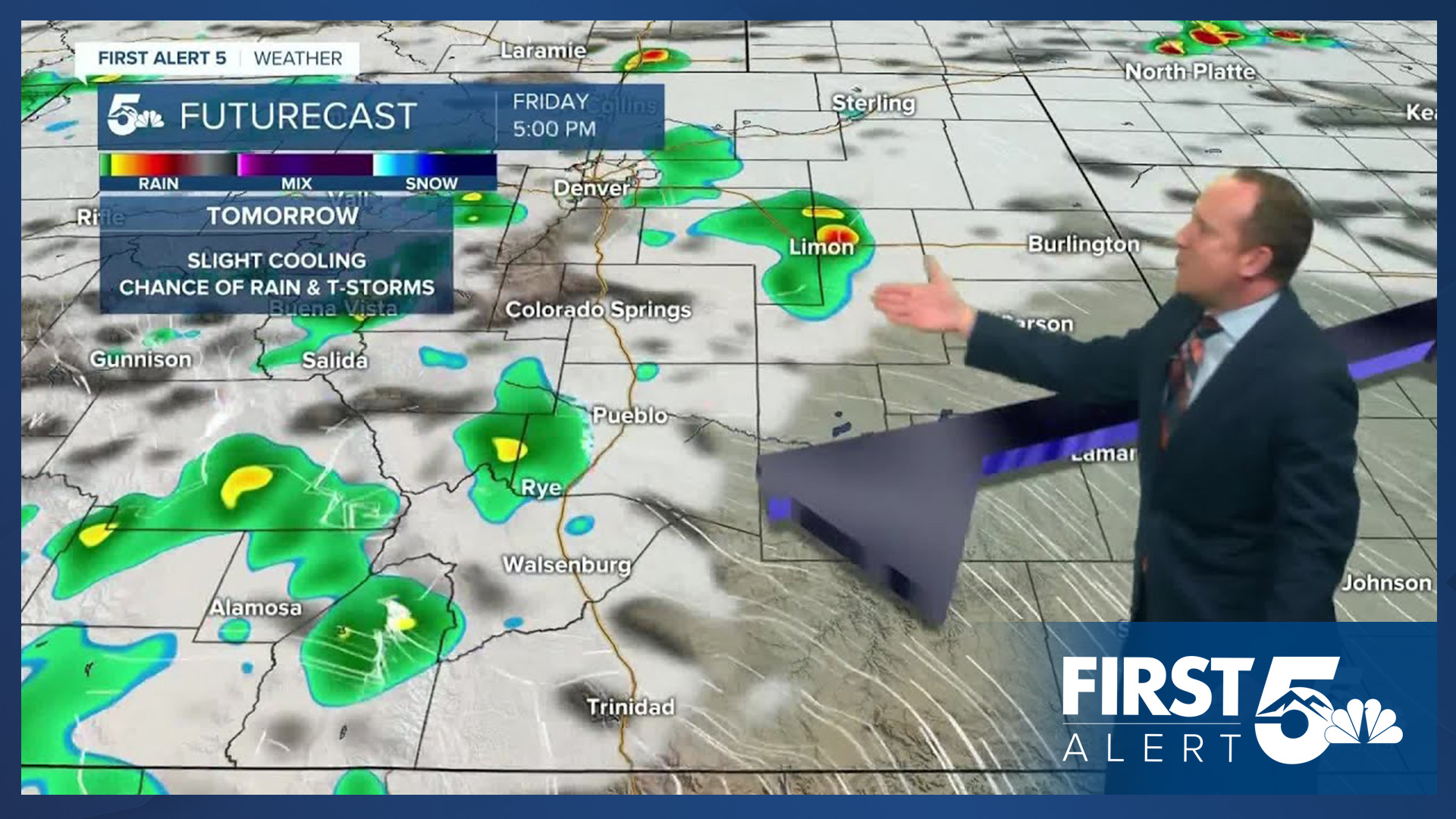
Beginning Friday, a well advertised pattern change will begin. Increasing moisture and an incoming cold front will bring back the potential for afternoon rain showers and thunderstorms to Southern Colorado. Storms in some areas could continue into the evening hours. Our high on Friday in Colorado Springs will warm into the middle to upper 80s, with our low Friday night cooling down to the upper 50s.
Below average highs can be expected this weekend, ranging from the upper 70s on Saturday to the lower 80s on Sunday in Colorado Springs. Highs in Pueblo and Canon City this weekend will warm into the 80s. Each afternoon, we'll continue to see a good chance of scattered showers and thunderstorms. The atmosphere will continue to cool next week, with highs fall-like, only warming into the 60s and 70s. With deeper sub-tropical moisture overhead, we'll also be watching closely for the potential for heavy rain each day, which looks to bring an increased threat of flooding to parts of Southern Colorado.
____
Curious about the First Alert 5 Weather Storm Impact Scale? Check out our cheatsheet explainer.
Watch KOAA News5 on your time, anytime with our free streaming app available for your Roku, FireTV, AppleTV and Android TV. Just search KOAA News5, download and start watching.
