

Today’s Forecast:
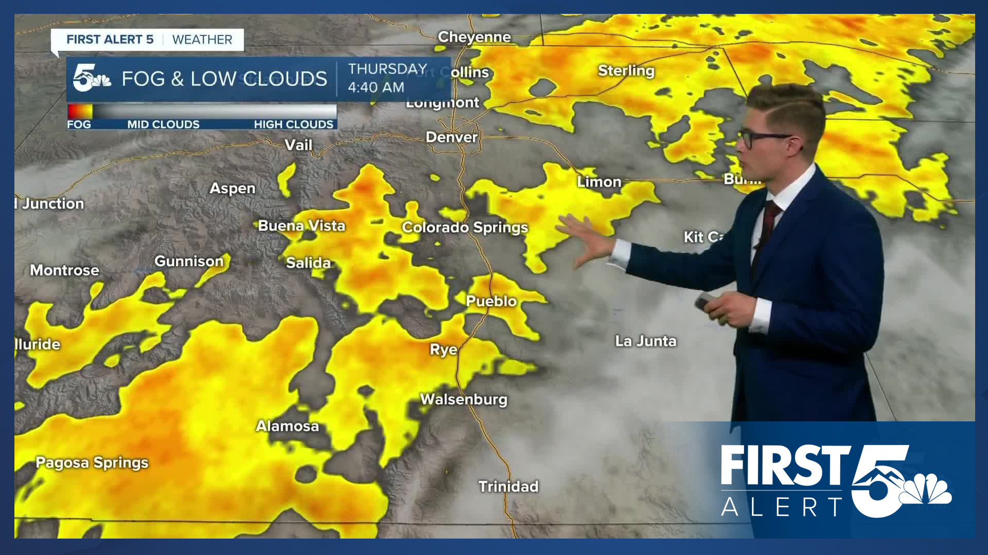
With continued moisture across southern Colorado, you can expect more active weather Thursday as storms again lead to various concerns. Starting the day, moisture from last night and upslope flow are leading to patchy light fog and low cloud cover. This is burning off and increasing in altitude as the morning gets underway.
I expect clouds to hang tough through the morning commute due to upslope flow along most of the I-25 corridor. Weak showers over the plains are on the way out - and you shouldn't expect more rain until much later today. Clouds break up in the late morning, though they won't fully leave the sky (no full sunshine). By the afternoon, we again end up with good thunderstorm energy, good wind shear (which helps to organize storms), and slow storm motion still looks lkely. Taken together, I see hit-or-miss afternoon storms: if you get a storm it's likely to be heavy with flooding possible, small hail (an isolated storm could dump out quarter to half dollar sized hail) and potentially strong wind gusts of 55-65 mph. Areas that saw flooding yesterday will not require as much rain today to see flooding return. The ground has already soaked up a lot of water.
The strongest severe potential today is south and east of highway 50 but I do expect some parts of the Pikes Peak Region to see strong storms too. The best flood potential is in the Raton Mesa, where the Weather Prediction Center has a 2-out-of-4 slight risk for Flash Flooding.
Today is another day to be heading down from hikes by 11 AM, and below the tree canopy by noon.
Highs will be below average following yesterday's front by about 10 degrees.
Colorado Springs forecast: High: 79; Low: 56.
Clouds early, partly to mostly sunny in late morning, scattered storms in the afternoon. Isolated strong storms possible, and isolated flooding is possible. Do not drive through flooded roadways - remember: turn around, don't drown. Even if you see other cars driving through flood zones. South winds at 10-15 mph.
Pueblo forecast: High: 84; Low: 60.
Partly cloudy this morning with fog dissipating quickly. Scattered afternoon thunderstorms, with a couple strong storms possible - 60 mph wind gusts, and quarter sized hail, the likeliest concern with the strongest and best organized storms. All storms today are capable of heavy rain and frequent lightning. Southeast winds at 5-15 mph.
Canon City forecast: High: 84; Low: 63.
Partly sunny this morning. Afternoon thunderstorms should be widespread, with a couple strong, and isolated flooding possible with slow storm motion. This will also lead to notable outdoor plan impacts if you get a storm, as it may last for awhile. Southeast winds at 5-10 mph.
Woodland Park forecast: High: 75; Low: 49.
Mostly sunny this morning becoming increasingly cloudy. Storm chances start by noon, and they continue the rest of the day. Good chances to see more than one thunderstorm (again) today. Isolated flooding is possible with slow moving storms. Wildfire smoke will also lead to haze in some areas. Look for storms to form in the pockets where that haze dissipates earliest - if you see a hole in the haze, that's where the clouds will build. South winds at 10-15 mph. Stay weather aware.
Tri-Lakes forecast: High: 70s; Low: 50s.
Patchy fog, dissipating quickly but with clouds hanging tough through much of the morning. Increasing sunshine by late morning, with storms arriving during early afternoon. Chances for storms increase throughout the afternoon. An isolated strong storm is possible with gusty wind and small hail. South winds at 10-15 mph.
Plains forecast: High: 70s/80s; Low: 50s/60s.
Mostly cloudy - with a few breaks late in the AM...but few and far between. Isolated afternoon thunderstorms, that chance increases later in the evening. Best strong storm potential in the southern counties, closer to the New Mexico border. Southeast winds at 10-15 mph.
Walsenburg and Trinidad forecast: High: 82/84; Low: 59/58.
Partly sunny with scattered afternoon thunderstorms. East winds at 5-10 mph, shifting southeast in the afternoon.
Mountains forecast: High: 70s; Low: 50s.
Hazy skies from wildfire smoke, mixed with clouds. Where you see the clouds and haze clear - expect storms to form in those pockets first, particularly if they're located near or over mountain summits. Storms are likely to contain heavy rain and frequent lightning. Not the - best- day for mountain plans, but if you're going, be headed down by 11:00 AM, and in the tree canopy by noon.
Extended outlook forecast:
Your finally Friday sees a return to seasonable temperatures across southern Colorado, with 80s and 90s on the board. Storm chances remain - it's our wettest or second month of the year (depending on location), after all - but they should be more isolated than storms today, with much lower impacts to your outdoor plans. We should also see less haze in the sky as wind directions shift and smoke from western fires moves out of the area.
All in all - tomorrow is a better outdoor plans day, but remember it does take trails time to dry out, and streams and rivers to drop, after significant rain. So I do expect muddy trails, particularly in lower elevations in the Ramparts and Pikes Peak Massif, and Wet Mountains, and streams will still be running high. Plan accordingly.
A monsoon pattern sets up Saturday and Sunday. This provides afternoon shower and storm chances and normal highs - 70s in the mountains, 80s and 90s on the lains. High pressure brings drier air in and a bit of a warm up early next week. By mid-week, storm chances increase again.
____
Curious about the First Alert 5 Weather Storm Impact Scale? Check out our cheatsheet explainer.
Watch KOAA News5 on your time, anytime with our free streaming app available for your Roku, FireTV, AppleTV and Android TV. Just search KOAA News5, download and start watching.
