



Today’s Forecast:
After a couple of cooler days in the 70s and 80s, hot weather comes roaring back late this week across Southern Colorado. In some areas, highs will be more than 10-20 degrees warmer than yesterday. Highs will warm into the 80s and 90s this afternoon, with a few of our hotter locations approaching triple digits.
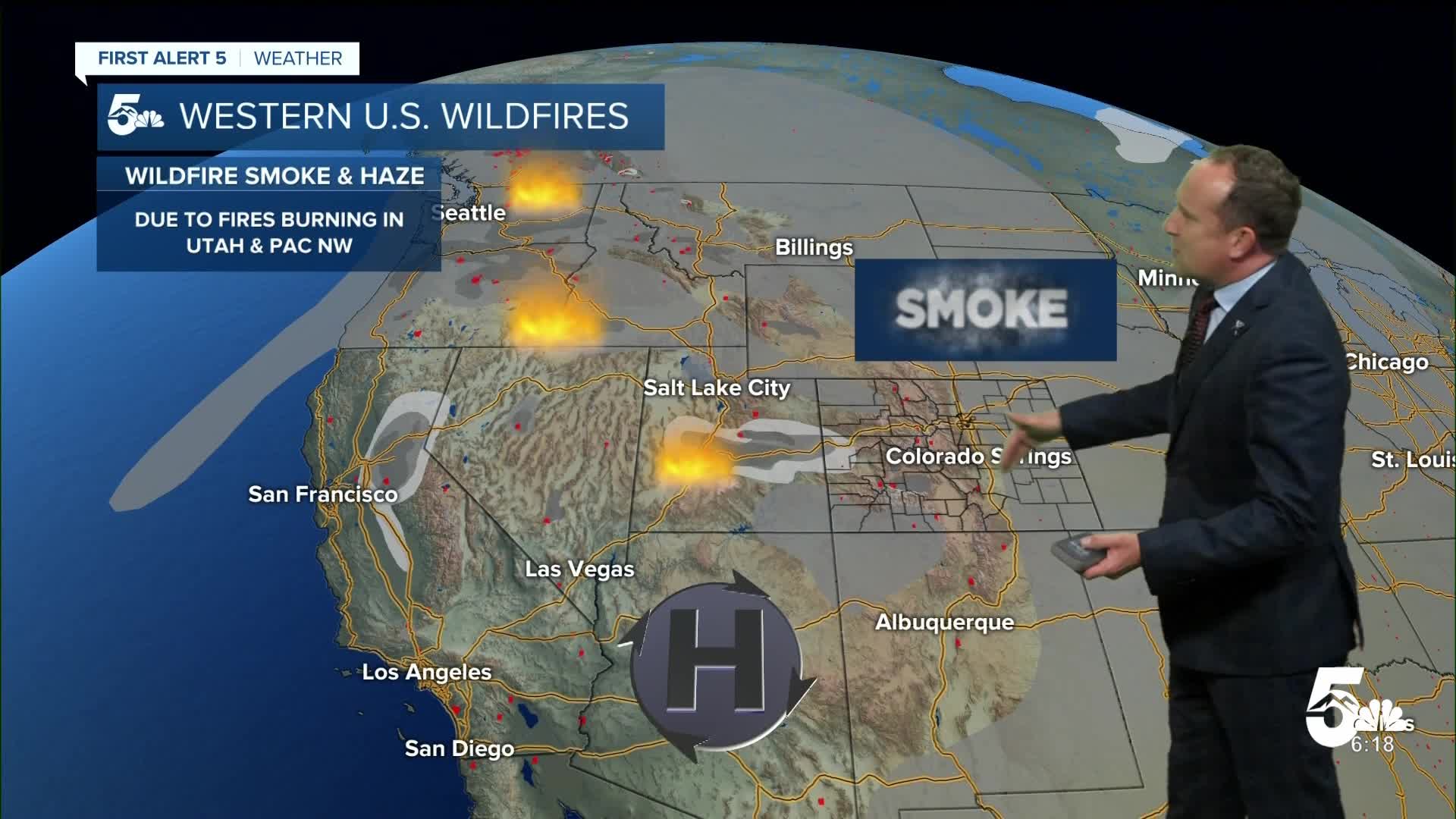
Areas of smoke and haze will continue to impact air quality on Thursday. An Air Quality Alert will remain in effect until at least 9 am for parts of Southern Colorado, with similar alerts in effect until at least 4 pm in the Denver metro. Until air quality improves, prioritize indoor workouts or shorter hikes over outdoor activities, especially if you suffer from asthma or have respiratory issues.
Colorado Springs forecast: High: 92; Low: 61. After two days with below average temperatures, we will see a return to the 90s this afternoon in Colorado Springs. Although records aren't expected today, they are likely from Friday into early next week.
Pueblo forecast: High: 97; Low: 63. Those 80s that we saw the past two days will give way to upper 90s this afternoon, with temperatures increasing by as much as 15-20 degrees from what we saw yesterday.
Canon City forecast: High: 95; Low: 63. This week's cool down won't continue today as temperatures this afternoon are set to return to the middle 90s. It only gets hotter from here, with triple digit temps on the way this weekend.
Woodland Park forecast: High: 85; Low: 52. Hazy skies will remain a factor in our forecast on Thursday, with a building ridge of high pressure bringing both the heat and dry skies to our forecast late this week.
Tri-Lakes forecast: High: 80s/90s; Low: 50s/60s. We'll see hazy sunshine and areas of smoke from wildfires burning across the western U.S. today. Highs will start to heat up today, topping out in the upper 80s and lower 90s.
Plains forecast: High: 90s; Low: 50s/60s. Hotter highs will return to the Plains starting this afternoon as temperatures soar into the middle to upper 90s. Areas of fog this morning will give way to hazy sunshine this afternoon, and just a small chance of a thunderstorm in Baca County.
Walsenburg and Trinidad forecast: High: 90s; Low: 50s/60s. Hazy sunshine this afternoon will give way to partly cloudy skies this evening. Highs will begin to heat up today, topping out in the 90s.
Mountains forecast: High: 60s/70s/80s; Low: 40s/50s. The mountains will also be heating up and drying out late this week as our typical rainy season takes a back seat to hazy sunshine and wildfire smoke.
Extended outlook forecast:
Hot and hazy weather will continue on Friday as temperatures soar into the middle to upper 90s in the Pikes Peak Region. I have forecasted a high of 96°F in Colorado Springs, which could threaten the record of 97°F, last set in 1980.
Our incoming heat wave will peak this weekend, with temperatures topping out in the upper 90s in Colorado Springs, and the triple digits in Pueblo and Canon City. Records are likely to fall once again across Southern Colorado.
Confidence in a weather pattern change is growing next week. As high pressure shifts to the east, monsoonal moisture will return to the state. Scattered showers and thunderstorms will be possible to likely starting next Tuesday.
____
Curious about the First Alert 5 Weather Storm Impact Scale? Check out our cheatsheet explainer.
Watch KOAA News5 on your time, anytime with our free streaming app available for your Roku, FireTV, AppleTV and Android TV. Just search KOAA News5, download and start watching.
