



Today’s Forecast:
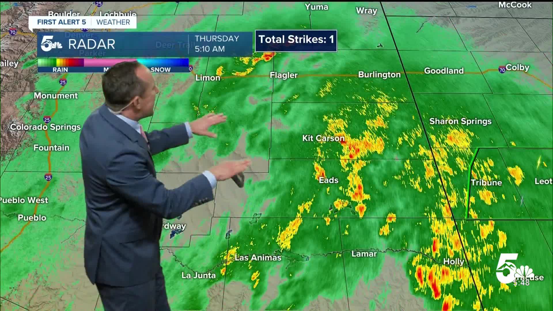
Tropical moisture will continue to stream into Colorado on Thursday, with the heaviest rain expected this morning over the far eastern Plains. A solid shield of precipitation will move off to the northeast and should be exiting the state by the lunch hour. For areas closer to I-25 and the Pikes Peak Region, I only expect to see a few lingering showers stick around this morning, with drying skies by 7-9 am.
With moisture remaining in place throughout the day, weak atmospheric energy will allow for additional showers and thunderstorms this afternoon and evening. Temperature wise...highs will be below average across Southern Colorado. Temperatures will warm into the 60s and 70s on the Plains, with 50s and lower 60s in the mountains and valleys.
Colorado Springs forecast: High: 68; Low: 50. Other than a spot shower or two this morning, skies should dry out while staying overcast and cool. Pacific moisture will remain in place this afternoon and with some weak instability, spotty showers will be possible across the Pikes Peak Region.
Pueblo forecast: High: 73; Low: 52. Skies will dry out this morning, with mostly cloudy skies and highs in the 70s this afternoon. Another flare up of showers will be possible this afternoon, mainly across the higher terrain.
Canon City forecast: High: 70; Low: 54. Skies will remain unsettled throughout the day on Thursday with rain chances once again increasing towards the afternoon and evening hours.
Woodland Park forecast: High: 57; Low: 42. Cool and unsettled weather will remain on Thursday as a second round of showers will be possible this afternoon and evening.
Tri-Lakes forecast: High: 60s; Low: 40s. Cool and cloudy conditions will persist on Thursday, with some additional rain showers this afternoon and evening.
Plains forecast: High: 60s/70s; Low: 50s. The heaviest rain this morning will continue to lift north of the Arkansas River Valley, and should exit the state by the lunch hour. This afternoon, showers and storms will blossom over the mountains, with additional showers and thunderstorms this weekend.
Walsenburg and Trinidad forecast: High: 60s/70s; Low: 40s/50s. Showers should wrap up shortly after sunrise this morning, with dry skies for a few hours before additional chances for rain return this afternoon and evening.
Mountains forecast: High: 50s; Low: 30s/40s. Chilly and unsettled weather will continue on Thursday, with additional rain and snow showers in the high country this afternoon and evening. Snow levels through late tonight look to stay at or above 12,000 to 13,000 feet.
Extended outlook forecast:
After another round of spotty to scattered showers and thunderstorms Friday afternoon, we'll see a brief pattern change heading into the weekend. Highs will warm into the lower 70s on Friday before rebounding into the lower 80s this weekend.
Monday will remain mild, with highs in the upper 70s and a chance of thunderstorms by the afternoon as our next trough approaches from the west. This disturbance will bring in cooler and unsettled conditions towards the middle of next week, with rain on the Plains and snow above 9,000-10,000. This far out, there's still a lot of uncertainty on the track of the storm and associated cold air, along with moisture from a few Pacific storms. Stay tuned this late this week and weekend as we continue to iron out those details.
____
Curious about the First Alert 5 Weather Storm Impact Scale? Check out our cheatsheet explainer.
Watch KOAA News5 on your time, anytime with our free streaming app available for your Roku, FireTV, AppleTV and Android TV. Just search KOAA News5, download and start watching.
