


Tonight's Forecast:
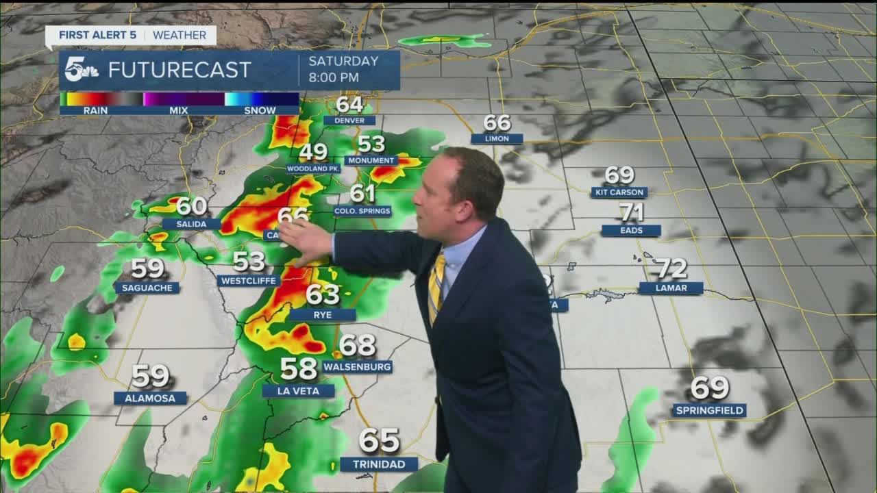
Rain will continue to expand over the mountains early this evening while spreading east towards the interstate between 6-8 pm. As the rain fills in, we're expecting moderate to heavy rainfall, and some thunderstorms across the region through the overnight hours. The potential for urban flooding, as well as flash flooding in recent burn scars, will need to be watched closely across parts of Southern Colorado.
With colder air a factor in tonight's forecast, areas above 12,000 feet could see SNOW, with as much as 1-4" possible by Sunday morning across the higher summit of Pikes Peak. This could lead to some issues for the Pikes Peak International Hill Climb, with a potential delayed start looming due to inclement weather conditions, or possible changes to the course.
Colorado Springs forecast: Low: 52; High: 57; We're looking at a chilly and unsettled end to the weekend across all of Southern Colorado, including the Pikes Peak Region. It will be a gray and damp Sunday, with the potential for some occasional rain showers and drizzle.
Pueblo forecast: Low: 57; High: 61; Sunday will be a bit chilly for late June standards as our forecast will feature lots of clouds, drizzle, and some occasional rain showers. Tomorrow's high of 61° will be more than 30 degrees below average.
Canon City forecast: Low: 55; High: 60; Sunday's cool and rainy forecast will have us feeling us more like early April than late June. Grab your rain jacket and umbrella if you're going to be outside on Sunday.
Woodland Park forecast: Low: 44; High: 53; Summer will seemingly hit pause on Sunday as unseasonably cool temperatures and periods of rain will continue to impact Woodland Park and Teller County most of the day.
Tri-Lakes forecast: Low: 40s/50s; High: 50s; Saturday night's soaking showers will give way to a cool and damp day on Sunday, with more rain and drizzle at times across the region.
Plains forecast: Low: 50s; High: 50s/60s; Sunday will by far be the coolest day of the month and a big time departure from the 90s and 100s that we're used to seeing this time of the year. Instead of sizzling heat, we'll see a cool and unsettled day of weather across the Plains, with rain at times, especially for areas south of Highway 50.
Walsenburg and Trinidad forecast: Low: 40s/50s; High: 50s/60s; Periods of heavy rain tonight along with the potential for more heavy rain at times on Sunday. Estimated rainfall of 1-2" for the southern I-25 corridor through Sunday evening.
Mountains forecast: Low: 30s; High: 40s; A wintry like day for the mountains of Southern Colorado on Sunday. With cold air in place early Sunday morning, several inches of snow could fall above 12,000 feet. In lower mountain regions, showers and thunderstorms will remain possible through Sunday evening.
Extended outlook forecast:
Lingering monsoon moisture on Monday will help to generate scattered afternoon showers and thunderstorms across Southern Colorado, with highs expected to rebound by as much as 10-20 degrees. Drier air will fill into the forecast by the middle of the week as the best potential for daily thunderstorms stays up across the mountains.
A daily uptick in thunderstorms is expected late next week and weekend as the plume of monsoon moisture looks to return to our forecast.
____
Curious about the First Alert 5 Weather Storm Impact Scale? Check out our cheatsheet explainer.
Watch KOAA News5 on your time, anytime with our free streaming app available for your Roku, FireTV, AppleTV and Android TV. Just search KOAA News5, download and start watching.
