

Today’s Forecast:
Warm temperatures will greet many of us as we start out the day in the 60s, a sign of things to come this afternoon. That's right! More heat can be expected this afternoon across Southern Colorado. Highs will warm into the 80s and 90s on the Plains, with 70s in Teller County and our mountain valleys.
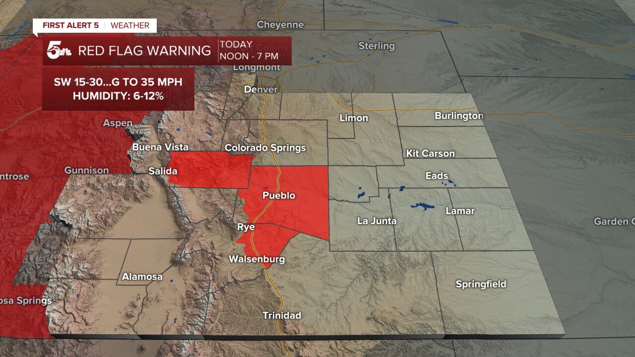
Weather wise, it will be a mixed bag of weather, with high fire danger and Red Flag Warnings for Pueblo, Fremont and Huerfano counties today.
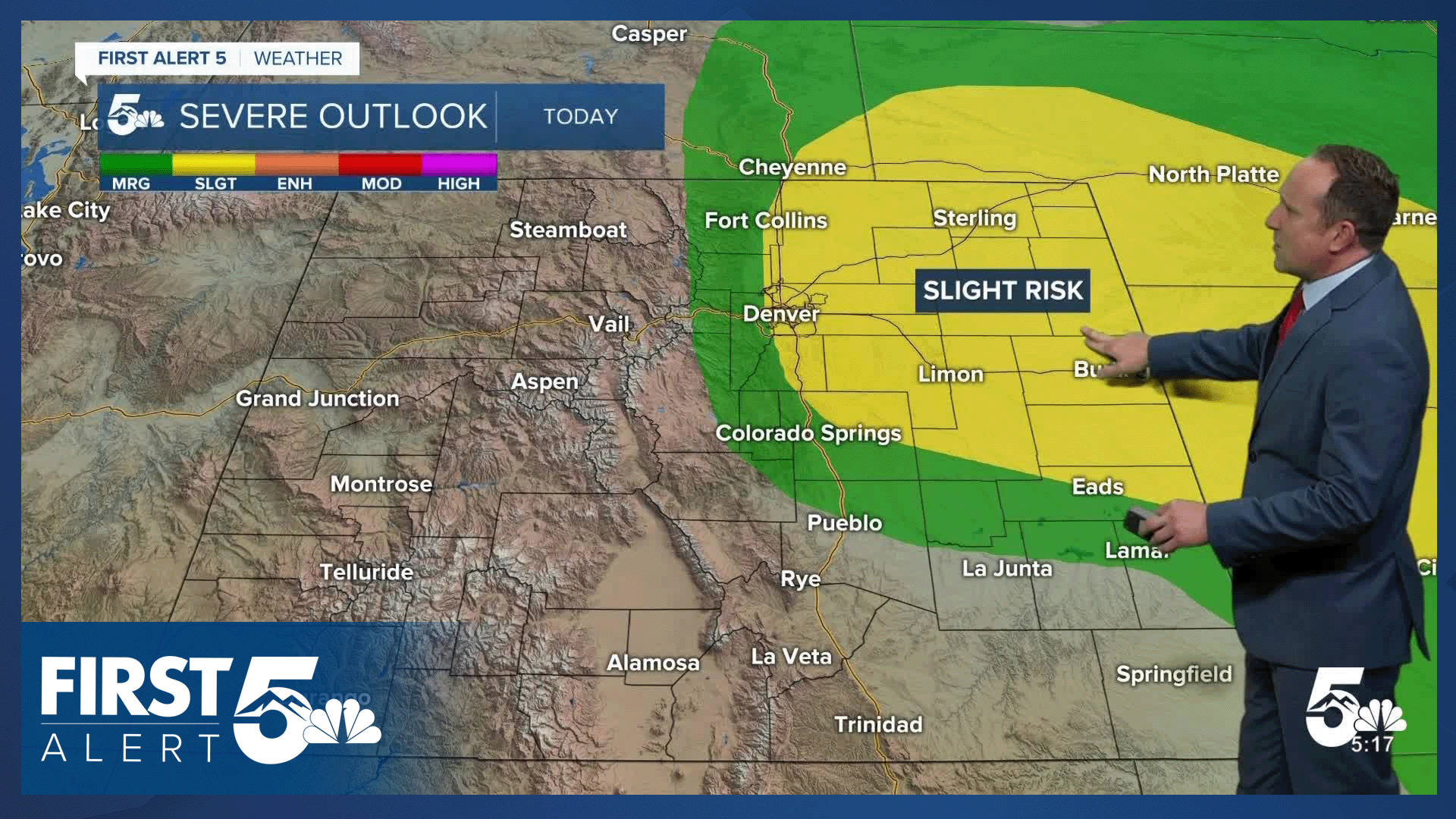
Severe weather will also be possible today in El Paso County and over the Plains. Storms will initiate towards mid to late afternoon on the Palmer Divide, and as they move east, they will be capable of hail as big as 1-2", very strong wind, and tornado development. We'll also be watching skies over the southeastern Plains. Storms look less likely here, but those that develop could also turn severe.
Colorado Springs forecast: High: 87; Low: 56. After hitting the 90s for the first time this year on Sunday, temperatures will be "slightly cooler" today, only warming into the upper 80s. In the Pikes Peak Region, we'll find ourselves in between high fire danger to our south and the threat of severe weather to the north and east. We should stay mainly dry in town today.
Pueblo forecast: High: 95; Low: 59. It will be hot, dry and gusty on Monday, with a Red Flag Warning in effect from noon to 7 pm. Peak gusts today will be around 30-35 mph.
Canon City forecast: High: 92; Low: 58. Rain is not likely early this week in Fremont County, with our forecast on the hot, dry and windy side. A Red Warning will remain in effect today from noon to 7 pm.
Woodland Park forecast: High: 76; Low: 51. We should stay mainly dry in Teller County on Monday, with only around a 10-20% chance of an afternoon shower. Overall, it will be a dry, gusty and warm start to the week.
Tri-Lakes forecast: High: 70s/80s; Low: 50s. The latest forecast trends are in favor of storms forming on the north side of the Palmer Divide this afternoon before racing off to the east/northeast, where they are likely to reach severe criteria. Chances for rain today in Monument will be low, around 20%.
Plains forecast: High: 90s; Low: 50s/60s. It will be a hot and mainly dry start to the week on the Plains, where a few thunderstorms will be possible towards late afternoon and evening. In these areas, although storms will be few and far between, it's possible that a few could reach severe strength.
Walsenburg and Trinidad forecast: High: 80s/90s; Low: 50s/60s. It will be a warm and breezy start to the week on the southern I-25 corridor, with a Red Flag Warning in effect in Huerfano County from noon to 7 pm.
Mountains forecast: High: 60s/70s; Low: 40s/50s. Warm and mainly dry weather for the southeastern Plains on Monday, with high fire danger on the eastern slopes of the southeastern mountains, and adjacent Plains. Gusts today will be up around 40-45 mph.
Extended outlook forecast:
Dry weather is likely to continue on Tuesday for the Pikes Peak Region, although some modeling is coming in with increasing moisture compared to earlier model runs. We'll continue to watch it for you and will of course keep you updated.
If we don't see any rain on Tuesday, then we won't likely see any until the weekend. That's for all of Southern Colorado.
Temperatures this week will remain hot. We'll see highs in the lower 90s Tuesday and Wednesday, 80s on Thursday, and near 90-degree heat on Friday. Highs in Pueblo and Canon City will warm into the 90s each day.
____
Curious about the First Alert 5 Weather Storm Impact Scale? Check out our cheatsheet explainer.
Watch KOAA News5 on your time, anytime with our free streaming app available for your Roku, FireTV, AppleTV and Android TV. Just search KOAA News5, download and start watching.
