



Today’s Forecast:
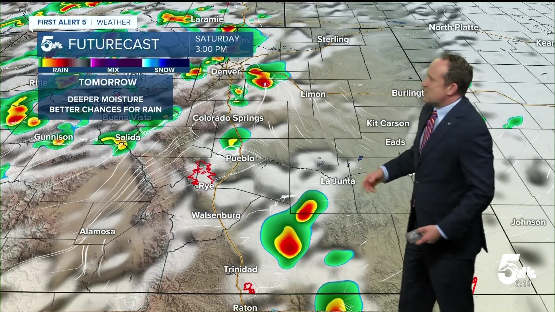
Low pressure will move into Idaho over the next 12-24 hours, and this will impact our weather locally by shifting the monsoon moisture plume farther to the east as we head towards Friday afternoon. This should allow for a slightly better chance for thunderstorms this afternoon around the Pikes Peak Region and I-25 corridor. As storms move into the northeastern Plains, a few storms could be on the stronger side.
Highs today will be warming across the region, topping out in the 80s and 90s on the Plains. Afternoon highs will be around 5-8 degrees above seasonal averages.
Colorado Springs forecast: High: 83; Low: 55. Mild temperatures this morning will give way to a warmer afternoon in the lower 80s, with a chance of thunderstorms mainly between 1-5 pm.
Pueblo forecast: High: 89; Low: 58. Drier skies on Thursday will give way to a chance for afternoon showers and thunderstorms in the Pueblo area on Friday. Highs today will be hot as we approach the 90 degree mark this afternoon.
Canon City forecast: High: 85; Low: 57. A mild and dry morning will give way to a warm afternoon, with a chance for showers and thunderstorms by early to mid afternoon.
Woodland Park forecast: High: 71; Low: 44. Our chances for rain in Teller County will increase starting today, and continuing this weekend. While severe weather is not expected this afternoon, lightning and gusty winds will be possible from any passing storms.
Tri-Lakes forecast: High: 70s/80s; Low: 40s/50s. The Palmer Divide could see several round of rain today. Keep an eye on the skies anytime after 1 pm as round #1 arrives. Round #2 looks possible this evening as a cold front drops in from the north.
Plains forecast: High: 80s/90s; Low: 50s. Rain chances look to stay fairly low on the southeastern Plains on Friday, but will be increasing this weekend. Highs today will be hot, topping out in the upper 80s and lower 90s.
Walsenburg and Trinidad forecast: High: 80s; Low: 50s. Friday's forecast will be warm, with the potential for a few isolated showers or thunderstorms this afternoon. Rain chances will increase this weekend on the southern I-25 corridor.
Mountains forecast: High: 60s/70s; Low: 40s. After a stormy day on Thursday, rain chances will remain elevated each afternoon in the southeastern mountains from today and Saturday before drier air moves in on Sunday.
Extended outlook forecast:
Saturday's high in Colorado Springs of 81 degrees will still be above the average high for this time of the year of 76 degrees. The first half of the day will be dry before thunderstorm chances increase region-wide by Saturday afternoon.
A cold front that moves into the state late Saturday will drop highs down to the middle 70s on Sunday and the lower 70s on Monday, the last day of summer. Scattered thunderstorms will be possible each afternoon, with thunderstorm chances lower towards the middle of next week.
____
Curious about the First Alert 5 Weather Storm Impact Scale? Check out our cheatsheet explainer.
Watch KOAA News5 on your time, anytime with our free streaming app available for your Roku, FireTV, AppleTV and Android TV. Just search KOAA News5, download and start watching.
