



Today’s Forecast:
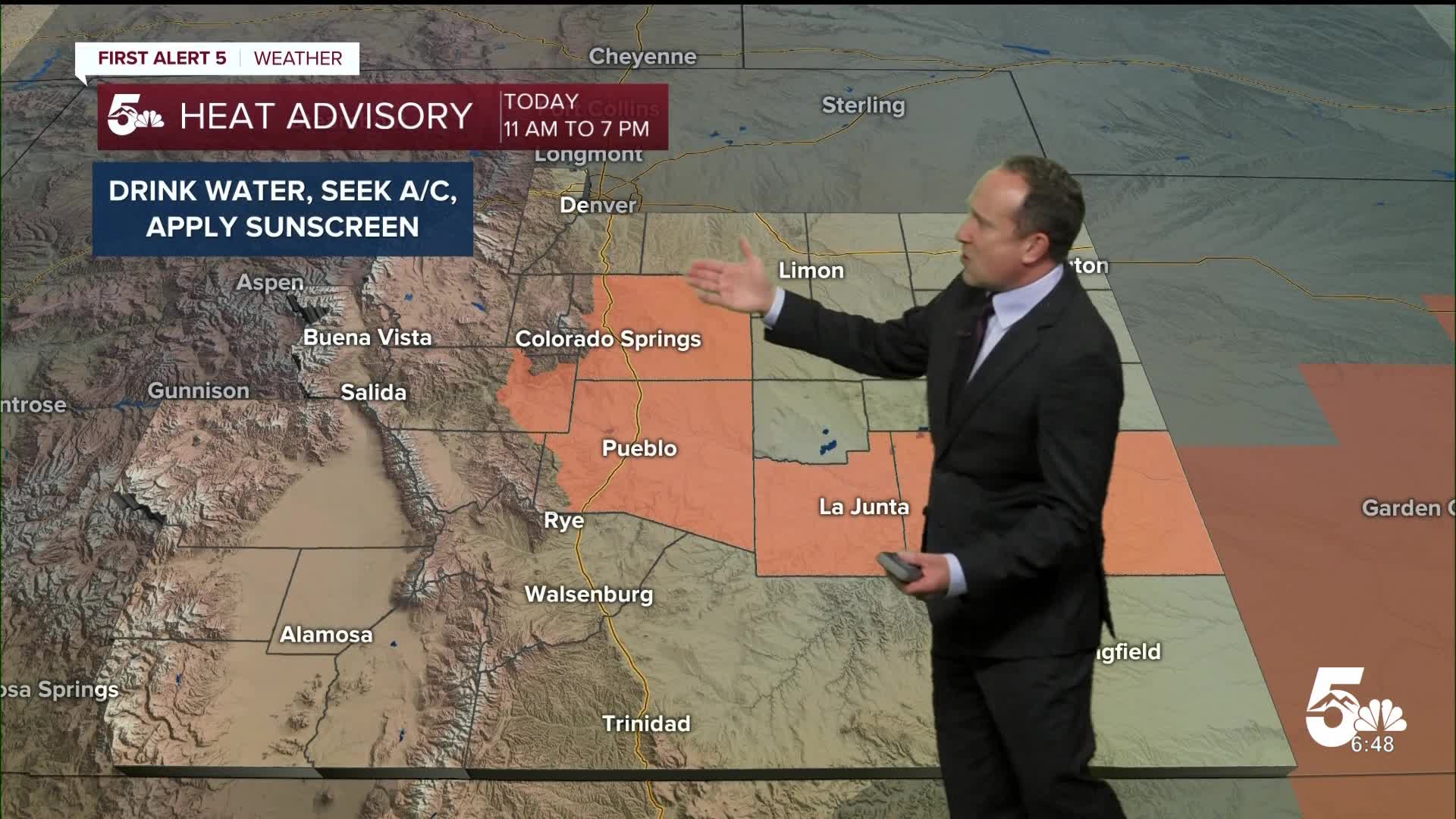
On Monday, we'll continue to see hotter than average temperatures and the potential for more record-breaking heat across Southern Colorado. Highs on the Plains will return to the 90s and 100s, with a few areas above 105 degrees today in the lower Arkansas River Valley.
A HEAT ADVISORY will remain in effect from 11 am to 7 pm, and includes Colorado Springs, Pueblo and Canon City, as well as the lower Arkansas River Valley.
The heat dome will continue to limit storm chances early this week, with very few showers and storms in our forecast. Storms today will remain high-based in nature, which means gusty winds and little if any rain.
Colorado Springs forecast: High: 94; Low: 62. A HEAT ADVISORY will be in effect today from 11 am to 7 pm. Count yourself lucky if you see a storm today, as rain cooled air will be nice, but storms are not expected to be widespread for the Pikes Peak Region.
Pueblo forecast: High: 103; Low: 64. Triple digit heat this afternoon has prompted another HEAT ADVISORY for Pueblo County. Skies will stay mainly dry today, with rain chances only around 10%.
Canon City forecast: High: 100; Low: 65. A HEAT ADVISORY will remain in effect today from 11 am to 7 pm, with highs in the upper 90s and lower 100s. By this afternoon, increasing clouds may give way to a few gusty showers.
Woodland Park forecast: High: 85; Low: 55. Hot and hazy, with increasing clouds and the potential for a few widely scattered showers and thunderstorms.
Tri-Lakes forecast: High: 80s/90s; Low: 50s/60s. The heat will remain the big story today, with only a slight chance of showers and thunderstorms this afternoon to help cool us down.
Plains forecast: High: 100s; Low: 60s/70s. Another HEAT ADVISORY has been issued today for the lower Arkansas River Valley. Some areas could see highs surpass 105 degrees. Although storms will be spotty in coverage, any that do form could be on the strong to severe side.
Walsenburg and Trinidad forecast: High: 90s; Low: 50s/60s. The heat will be widespread today, much more than any showers and storms that form this afternoon. These are expected to be limited today, but will increase towards the end of the week.
Mountains forecast: High: 70s/80s; Low: 40s/50s. Hazy sunshine early will give way to increasing clouds this afternoon and the potential for spotty to scattered showers and thunderstorms Overall impacts from rain today will be minimal.
Extended outlook forecast:
Tuesday looks to be just as hot as today, with a return to the mid 90s in Colorado Springs and triple digits in Pueblo.
By Wednesday, high pressure moves towards west Texas, allowing for a notable uptick in moisture. With better chances for rain, highs will cool a few degrees into the lower 90s in the Pikes Peak Region.
A potent cold front will sweep through the Plains early Thursday, dropping highs to around 80 degrees in Colorado Springs. Behind the front, we can also expect rainier conditions, with widespread storms both Thursday and Friday, and the potential for flooding.
____
Curious about the First Alert 5 Weather Storm Impact Scale? Check out our cheatsheet explainer.
Watch KOAA News5 on your time, anytime with our free streaming app available for your Roku, FireTV, AppleTV and Android TV. Just search KOAA News5, download and start watching.
