


COLORADO SPRINGS, Colo. (KOAA) — Today’s Forecast:
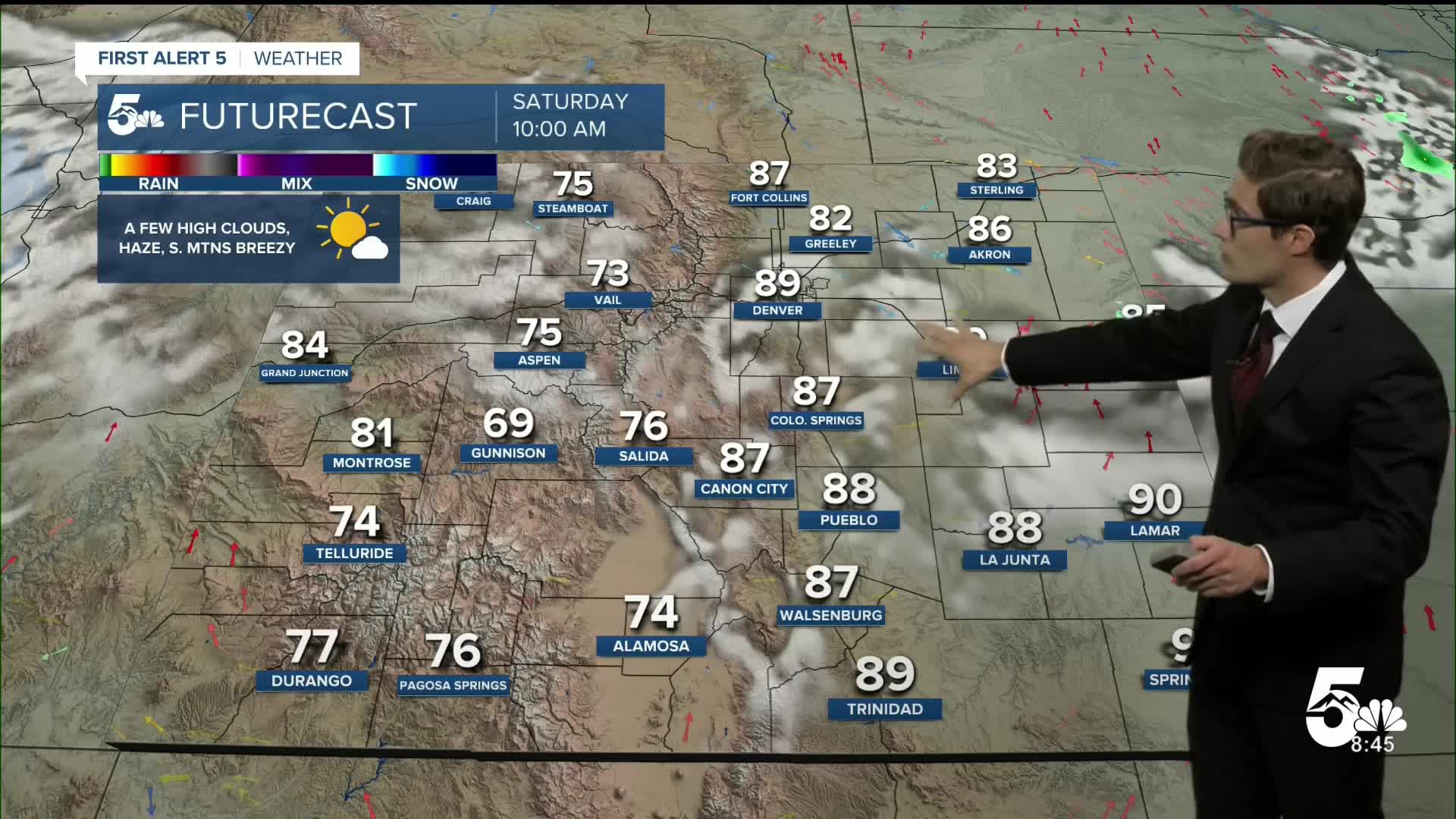
Heat, smoke, and gusty evaporating rain showers are your forecast this weekend in southern Colorado. With two remaining 8 PM or later sunsets of the year in Colorado Springs, the sun is doing plenty of work making it feel like a furnace outside over the next three days.
A Heat Advisory is in effect today, and tomorrow, from 12 PM - 8 PM. Stay hydrated, seek shade, and consider avoiding strenuous activities mid-day - especially if you're sensitive to the heat.
Expect light elevated haze from Pacific Northwest wildfires once again today. Smoke impacts will be more of an issue for you if you're spending the day in the high country, with most of our smoke today being elevated. In addition, ground ozone levels will be relatively high this afternoon in southern Colorado due to the heat and sunshine which can also cause respiratory issues for sensitive groups.
We'll also see a few mid and high level clouds develop over the mountains late this morning. These should move off across the plains this afternoon producing partly cloudy skies, and a couple of isolated evaporating sprinkles. Due to dry air near the ground, these wisps of rain will produce patches of gusty and erratic wind where they pop up.
Expect a nice rapid, and classic, Colorado cooldown tonight after sunset - so if you haven't gotten the dog walk in yet, that's your best time for it.
Colorado Springs forecast: High: 97; Low: 65.
HEAT ADVISORY in effect from 12:00 PM - 8:00 PM
Yesterday we reached 96 degrees in Colorado Springs, which is 1 degree shy of the record. Today, we should be a degree or two warmer which could tie the current record of 97 degrees, which was set only last year. You'll see a bit of haze today from a mixture of wildfire smoke and smog (which is a mixture of visible and invisible chemicals typically released by fuel combustion), and this will impact air quality a bit this afternoon. Skies will otherwise be sunny this morning and partly cloudy this afternoon. Seek shade, and stay hydrated.
Pueblo forecast: High: 104; Low: 66.
HEAT ADVISORY in effect from 12:00 PM - 8:00 PM
The record high today in Pueblo is 104, set in 1969. It'll be a close call today, and very possible we'll break the record. Expect hazy sunshine through the AM with some passing PM clouds. Air quality will be moderate mainly due to smoke.
Canon City forecast: High: 101; Low: 67.
HEAT ADVISORY in effect from 12:00 PM - 8:00 PM
Perhaps a day to skip the shelf road rock climb...those rocks are going to be HOT this afternoon! Expect hazy sunshine today mainly due to wildfire smoke. It won't be as thick as it was in the first half of the past week, but it will still be visible.
Woodland Park forecast: High: 88; Low: 57.
Patchy smoke, and hot. Mostly sunny this morning with a significant increase in PM cloud cover, with evaporating rain in the afternoon producing isolated pockets of gusty and erratic wind.
Tri-Lakes forecast: High: 90s; Low: 60s.
HEAT ADVISORY in effect from 12:00 PM - 8:00 PM
Hazy, sunny, and very hot. Due to the dry air in the low levels of the sky, temperatures will fall quickly with increasing height. So, perhaps a day to spend at the top of the Ramparts....or by the pool. Increasing afternoon clouds.
Plains forecast: High: 100s; Low: 60s.
HEAT ADVISORY in effect from 12:00 PM - 8:00 PM
Sunny, hazy, very hot, and breezy. Southwest winds at 10-20 mph gusting at times to 25 mph this afternoon. Patchy PM clouds.
Walsenburg and Trinidad forecast: High: 95/97; Low: 65/64.
Mostly sunny, hot, and hazy. Patchy PM clouds. Modest west southwest winds.
Mountains forecast: High: 80s; Low: 50s/60s.
Hazy with wildfire smoke reducing air quality at higher elevations - particularly above about 10,000 feet. That said, air quality will remain much better than early last week. Breezy with southwest winds at 10-20 mph and increasing PM clouds.
Extended outlook forecast:
High pressure anchored over the Four Corners region will slowly weaken and drift southeast over the next few days. Sunday brings another round of sizzling summer heat and more highs in the upper 90s and 100s. Additional mid-level moisture will work around the drifting high, leading to some more robust afternoon storm activity. Unfortunately we remain very dry near the ground, leading to more evaporating rain - and the potential for dry lightning across the eastern plains which we will monitor.
In the high country, a few isolated showers and rumbles are possible.
We remain hot on Monday with an isolated storm chance in the afternoon - with the best chance in the mountains and more patchy activity on the plains, and highs still above average. We'll then see a significant monsoon moisture surge in the second half of next week. My focus is on Thursday and Friday for the heaviest rain chances as the monsoon moisture interacts with some approaching northern stream energy.
____
Curious about the First Alert 5 Weather Storm Impact Scale? Check out our cheatsheet explainer.
Watch KOAA News5 on your time, anytime with our free streaming app available for your Roku, FireTV, AppleTV and Android TV. Just search KOAA News5, download and start watching.
