

Today’s Forecast:
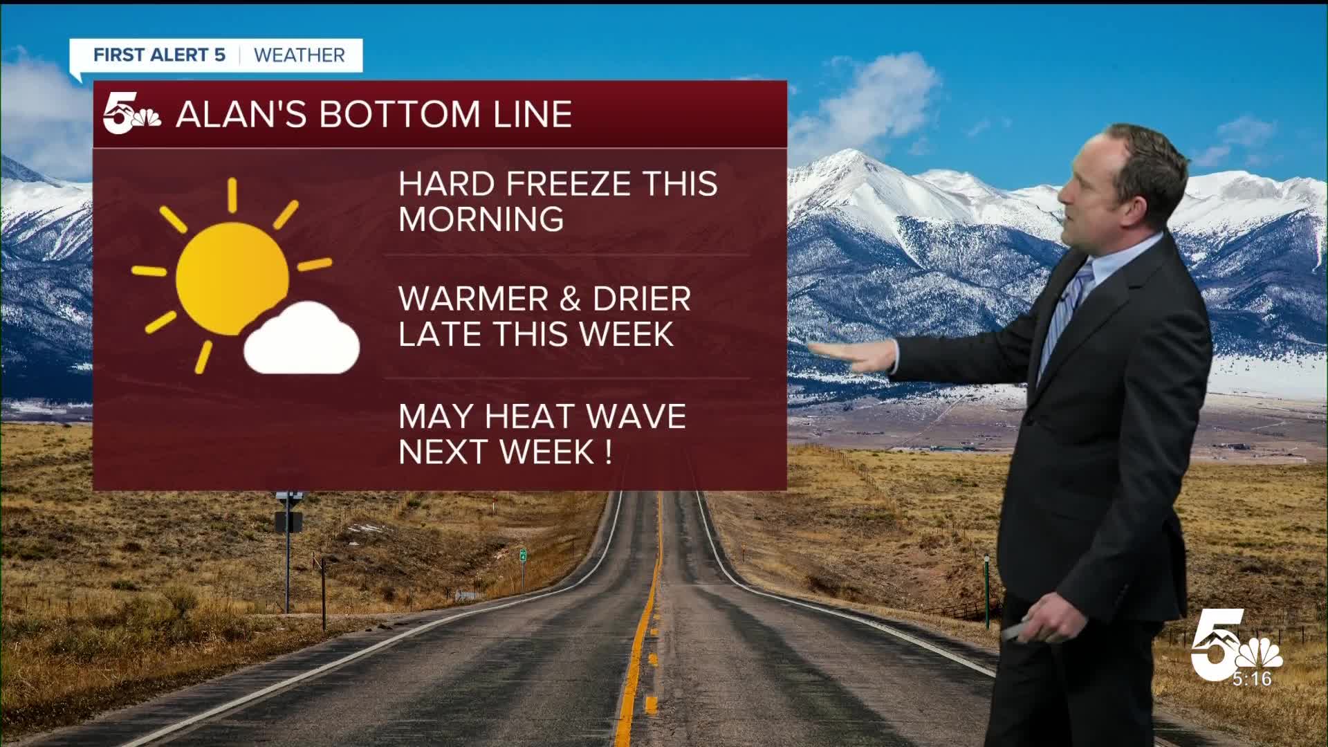
The Colorado Springs Airport officially recorded 1.6" of snow with yesterday's storm while the Pueblo Memorial Airport recorded 0.5" of snow. This morning, clear skies, light winds, and dry air have allowed for efficient radiational cooling, with Freeze Warning in effect until 8 am. Temperatures as you head out the door will be in the 20s and 30s in most areas. With a very high May sun angle, temperatures will rocket up today into the mid-60s and 70s on the Plains.
Clouds will increase this afternoon ahead of a weak passing upper disturbance. This will lead to some virga showers across the area, which means that rain would evaporate as it encounters drier air near the surface.
Colorado Springs forecast: High: 66; Low: 40. Morning temperatures in the upper 20s and lower 30s will give way to highs today in the middle 60s. A weak disturbance moving across northern Colorado will lead to increasing clouds here locally, with only around a 10% chance of an afternoon rain shower.
Pueblo forecast: High: 73; Low: 40. A brisk start to our Thursday will give way to a mostly sunny and warm afternoon. Today's high of 73°F will be around 30° warmer than yesterday's high of just 43°F.
Canon City forecast: High: 70; Low: 42. A cold morning on Thursday will give way to a mild and partly cloudy afternoon. Clouds will increase and skies may look unsettled, but chances for rain should remain low, only at around 10%.
Woodland Park forecast: High: 56; Low: 33. A frigid, spring morning will give way to near average highs this afternoon as Thursday's temperatures top out in the middle 50s. A distubance
Tri-Lakes forecast: High: 50s/60s; Low: 30s/40s. Below freezing temperatures this morning will give way to a partly cloudy and mild afternoon. Other than a virga shower this afternoon, skies should remain dry across northern El Paso County.
Plains forecast: High: 70s; Low: 30s/40s. After a cold looking start to our Thursday, highs today will be mild, with light southwest breezes and plenty of sunshine.
Walsenburg and Trinidad forecast: High: 60s; Low: 30s. Skies will be nice and clear Thursday morning, and after a cold start to your day, highs will rebound nicely into the middle to upper 60s this afternoon.
Mountains forecast: High: 40s/50s; Low: 30s. After fresh snow in the mountains this week, skies will turn bright and sunny on Thursday, with only a few spot showers possible this afternoon around Pikes Peak.
Extended outlook forecast:
Temperatures continue to warm Friday as upper-level high pressure begins to build across the west. Highs will warm into the 70s and 80s, warmest from the Arkansas River Valley into the southeastern Plains.
This weekend, Saturday will be the warmer day with increasing PM clouds and an isolated shower possible, mainly up in the mountain zones. A weak front will cool highs region-wide on Sunday by as much as 4-8 degrees.
Strong upper ridging builds early next week, with temperatures warming to the middle 80s in Colorado Springs, and lower 90s in Pueblo and Canon City.
____
Curious about the First Alert 5 Weather Storm Impact Scale? Check out our cheatsheet explainer.
Watch KOAA News5 on your time, anytime with our free streaming app available for your Roku, FireTV, AppleTV and Android TV. Just search KOAA News5, download and start watching.
