



COLORADO SPRINGS, Colo. (KOAA) — Today’s Forecast:
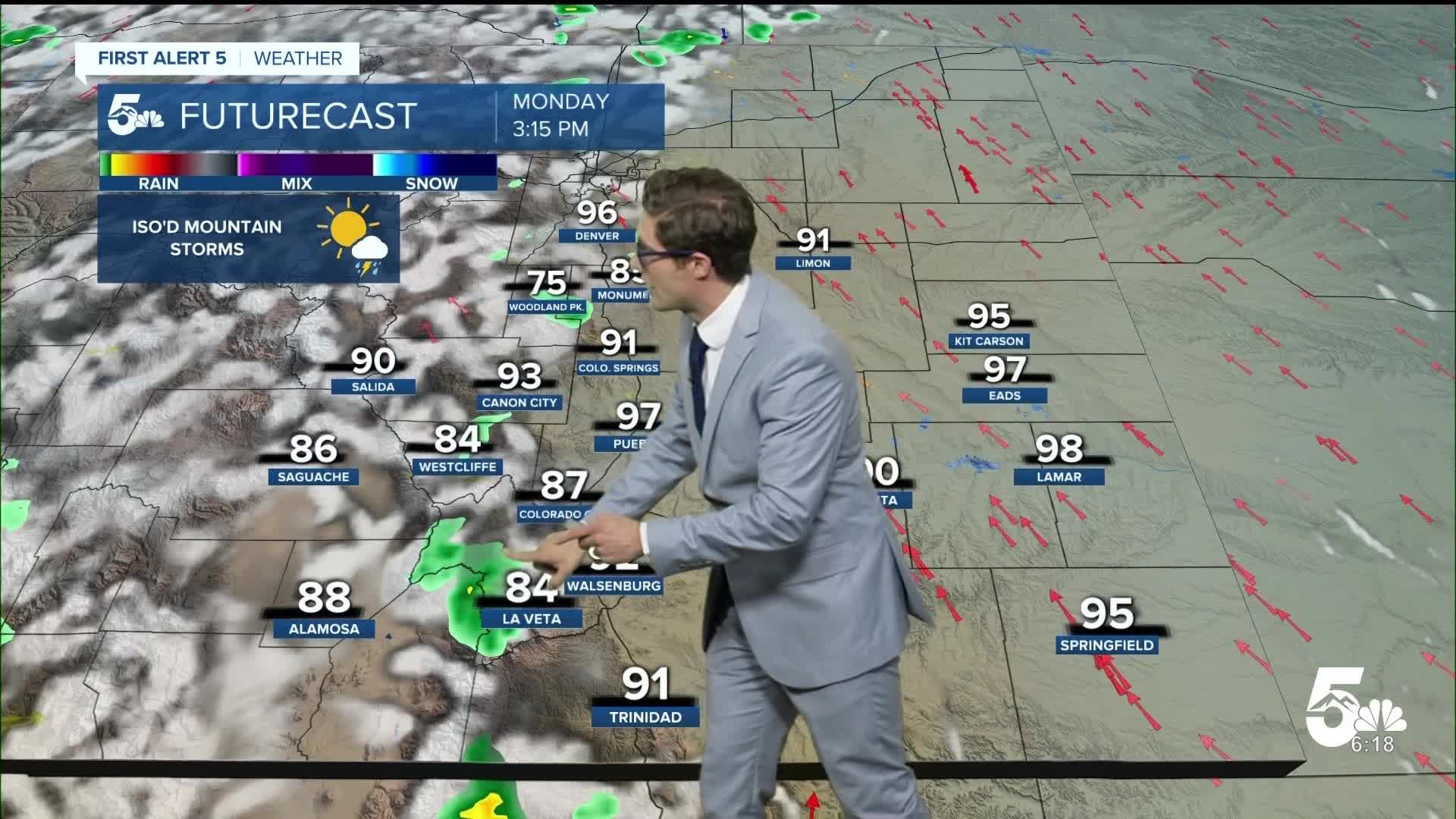
Patchy smoke will continue to filter through the skies of southern Colorado today, but it won't be as thick as in past days. A large region of high pressure across the west will lead to mainly sunny skies, heat, and relatively modest winds. It will be very hot today, with highs 5-10 degrees above their already warm July averages.
Isolated thunderstorms are possible in the high country this afternoon, but will largely skip I-25 outside of the Palmer Divide. These storms will produce more wind than wetting rains today, which could increase fire intensity if they directly impact the Aspen Acres fire. There is a better chance for helpful mountain rainfall on Tuesday.
Colorado Springs forecast: High: 92; Low: 60.
Mainly clear skies today, with pockets of haze. Winds will be light this morning from the east. They'll shift southeast this afternoon, at 5-10 mph. This upslope flow is part of why wildfire smoke won't be as bad today as it was last week. This will also keep more moisture in the region, and while storms today should stay mainly in the mountains - fire danger will remain sub-critical as a result of the higher humidity.
Pueblo forecast: High: 99; Low: 64.
AIR QUALITY ADVISORY in effect until 9:00 AM
Patchy smoke throughout the day, and very hot. An overnight inversion, which is very typical, means the smoke is concentrated close to the ground early today. Light north wind this morning shifting southeast at 5-10 mph this afternoon.
Canon City forecast: High: 95; Low: 64.
AIR QUALITY ADVISORY in effect until 9:00 AM
Sunny with moderate smoke throughout the day. Light winds out of the west southwest this morning, shifting southeast at 5-10 mph this afternoon.
Woodland Park forecast: High: 85; Low: 53.
Mostly sunny this morning with an isolated thunderstorm possible this afternoon. Periodic wildfire smoke, though it will start off below you due to a morning inversion, and then be largely above you this afternoon. Southeast winds this afternoon, generally light.
Tri-Lakes forecast: High: 80s; Low: 50s.
Mostly sunny this morning and partly cloudy this afternoon with a few sprinkles in the Ramparts. Light to moderate smoke, and winds from the south increasing to 10-15 mph this afternoon.
Plains forecast: High: 90s/100s; Low: 60s.
Sunny this morning becoming partly cloudy in the mid-afternoon. Southeast winds at 10-15 mph this afternoon.
Walsenburg and Trinidad forecast: High: 92; Low: 61/62.
Sunny this morning, partly cloudy this afternoon. An isolated storm or two is possible this afternoon but it is unlikely to bring good rainfall unfortunately. If you get a storm, it'd most likely bring gusty and erratic wind. Speaking of wind, it's pretty weak today, southeast at 5-10 mph this afternoon.
Mountains forecast: High: 80s; Low: 50s.
Mostly sunny with patchy smoke this morning, and isolated afternoon thunderstorms driven by terrain. In other words, most likely on top of the mountain summits and particularly the higher summits. Southeast winds at 10-20 mph, which pushes smoke toward the Wet Mountain Valley and toward the Central Mountains.
Extended outlook forecast:
Significantly better moisture - a monsoon-like pattern - arrives on Tuesday. Tropical moisture surges north under the upper level ridge, with scattered thunderstorms developing over most mountain areas by noon. These storms will move off the mountains and through the plains during the mid-afternoon. Storm coverage should be about 40%.
Temperatures remain hot all week, with the best PM thunderstorm chances coming Tuesday through Thursday. Flash flooding is possible over new burn scars - but the moisture is certainly better than last week's gusty wind. Storms still have the potential though to produce gusty, erratic wind too so the exact track of storms and the amount of moisture in the air will be very important. The hotter the temperature, and the lower the dew point, the higher the cloud bases will be. Higher cloud bases tend to equal lower chances for rain reaching the ground, and increase the chance of gusty erratic winds.
It will get even hotter this weekend. Some parts of Colorado are likely to see record-breaking heat. Stay tuned.
____
Curious about the First Alert 5 Weather Storm Impact Scale? Check out our cheatsheet explainer.
Watch KOAA News5 on your time, anytime with our free streaming app available for your Roku, FireTV, AppleTV and Android TV. Just search KOAA News5, download and start watching.
