

Today’s Forecast:
Mother Nature will bring an encore performance of Tuesday's great weather to Southern Colorado on Wednesday. What this will mean for today is plentiful sunshine, light breezes and mild temperatures. Highs today will be around 5 degrees above average, warming into the 60s and 70s.
Colorado Springs forecast: High: 67; Low: 38. Get ready for another stunning day in the Pikes Peak Region, with mild highs and plenty of sunshine on tap for our Wednesday.
Pueblo forecast: High: 71; Low: 35. Wednesday's forecast will be just as nice as what we saw yesterday, with the potential for an additional degree or two of warming this afternoon.
Canon City forecast: High: 70; Low: 43. Goldilocks weather will return on Wednesday, with today's weather not too hot, not too cold, but just about right.
Woodland Park forecast: High: 63; Low: 34. Mild and sunny weather on Wednesday will give way to an incoming storm late this week, and chances for rain and snow showers in Teller County.
Tri-Lakes forecast: High: 60s; Low: 30s/40s. Sunny to mostly sunny skies, light breezes and mild highs will make for another gorgeous day! Highs this afternoon will be around 5 degrees above average.
Plains forecast: High: 60s/70s; Low: 30s/40s. Today's forecast will be a near carbon copy of what we saw on Tuesday, with sunshine, light breezes and mild highs.
Walsenburg and Trinidad forecast: High: 60s/70s; Low: 40s. Light winds, sunshine and mild highs will add up to what will be another gorgeous late October day on the southern I-25 corridor.
Mountains forecast: High: 50s/60s; Low: 30s. An incoming storm will bring snow to the high country late this week, but before the storm arrives, plan time outside today to take advantage of the gorgeous afternoon in the mountains.
Extended outlook forecast:
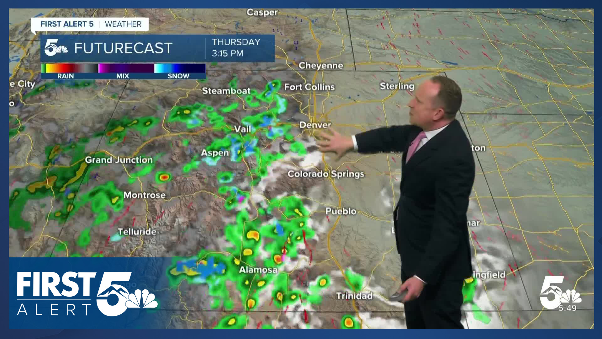
An incoming Pacific storm will spread rain and snow into the state on Thursday. Snow levels in the mountains will start out in the 10,000 to 11,000 foot range before lowering down to around 9,000 feet late Thursday night. With highs in the 60s on the Plains, we won't see snow from this storm, but instead a chance for showers from Thursday evening into Friday.
As the system drops to our south on Friday, highs will be cooler, only warming into the upper 50s to close out the week in Colorado Springs. Temperatures will rebound back into the 60s and lower 70s this weekend from Colorado Springs to Pueblo, with increasing wind on Sunday ahead of our next storm. The latest trends for early next week are in favor of cooling highs and gusty wind, with little moisture outside of the mountains.
____
Curious about the First Alert 5 Weather Storm Impact Scale? Check out our cheatsheet explainer.
Watch KOAA News5 on your time, anytime with our free streaming app available for your Roku, FireTV, AppleTV and Android TV. Just search KOAA News5, download and start watching.
