


Tonight's Forecast:
A cold, but calm night of weather is expected throughout Southern Colorado. Overnight lows across the I-25 corridor will drop down to the 10s and 20s tonight, with a similar forecast for the Plains and Arkansas River Valley. There's another chance for negative lows in the San Luis Valley tonight, where Alamosa has already seen negative overnight temperatures for the past six nights in a row.
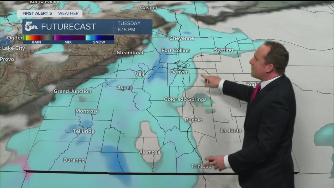
COLORADO SPRINGS: Low: 21; High: 33. After warming into the 60s today, we're expecting to be around 30 degrees colder on Tuesday. Behind an overnight cold front, the potential for snow will increase by tomorrow evening between 5-8 pm across the Pikes Peak Region.
PUEBLO: Low: 22; High: 37. Under mostly cloudy skies, we'll be around 25-30 degrees colder on Tuesday. Snow isn't expected during the day, but should pick up between 6-9 pm.
CANON CITY: Low: 25; High: 35. A dry and much colder day for Fremont County before snow picks up between 4-7 pm. Snow will become heavy at times after midnight, with the potential for quite a bit of snowfall through Wednesday evening.
WOODLAND PARK: Low: 15; High: 26. Wintry weather will push into Teller County by the late afternoon hours, with some slick and icy roads already possible for the evening commute. The snow will keep on coming into the overnight hours and throughout the day on Wednesday.
TRI-LAKES: Low: 10s/20s; High: 20s/30s. Tuesday will be a transition day as a big blast of winter pushes into the Palmer Divide by Tuesday evening. I'm not too worried about the evening commute Tuesday, but anytime after that, conditions will worsen with moderate to heavy snow continuing into Wednesday.
PLAINS: Low: 10s/20s; High: 30s/40s. Tuesday will be much colder, with increasing clouds out ahead of our next storm. That storm will spread snow into the Plains from north to south during the evening hours, with the potential for periods of heavy snow into Wednesday.
WALSENBURG/TRINIDAD: Low: 10s/20s; High: 30s/40s. Much colder air will push into the southern I-25 corridor out ahead of our next winter storm. Snow flakes will begin to push off of the mountains by late afternoon, with the potential for heavy snow overnight and Wednesday.
MOUNTAINS: Low: 10s; High: 20s. Dry skies early Tuesday morning will quickly turn snowy by the afternoon. This mid-week storm will heavily favor the San Juans, Sangres and Wet Mountains with the biggest snow totals. All of these mountain ranges will be under Winter Storm Warnings from 2 pm Tuesday to midnight Wednesday night. Snowfall totals in the mountains could top 15-20" in some areas.
Extended Outlook:
This is going to be a long duration event, with significant impacts at times in Southern Colorado. I think that the bulk of the snow will fall from around midnight Tuesday night through midday Wednesday. Snow should taper off by Wednesday evening from north to south, but could linger into Thursday morning for the southeast Plains.
The other big story will be the cold. Highs Wednesday and Thursday will only warm into the 10s and 20s, with negative lows at night for some areas. With the frigid air in the forecast, it's possible that we could stay below freezing in Colorado Springs from Tuesday afternoon through at least Friday morning.
____
Watch KOAA News5 on your time, anytime with our free streaming app available for your Roku, FireTV, AppleTV and Android TV. Just search KOAA News5, download and start watching.
