



Today’s Forecast:
A few early morning showers will linger at times into early this afternoon, but today should provide a brief break in the action before the main event arrives later tonight and into Wednesday morning. Temperatures this afternoon will stay cool, only warming into the 50s, 60s and very low 70s. Daytime highs on Tuesday will be around 8-10 degrees below average.
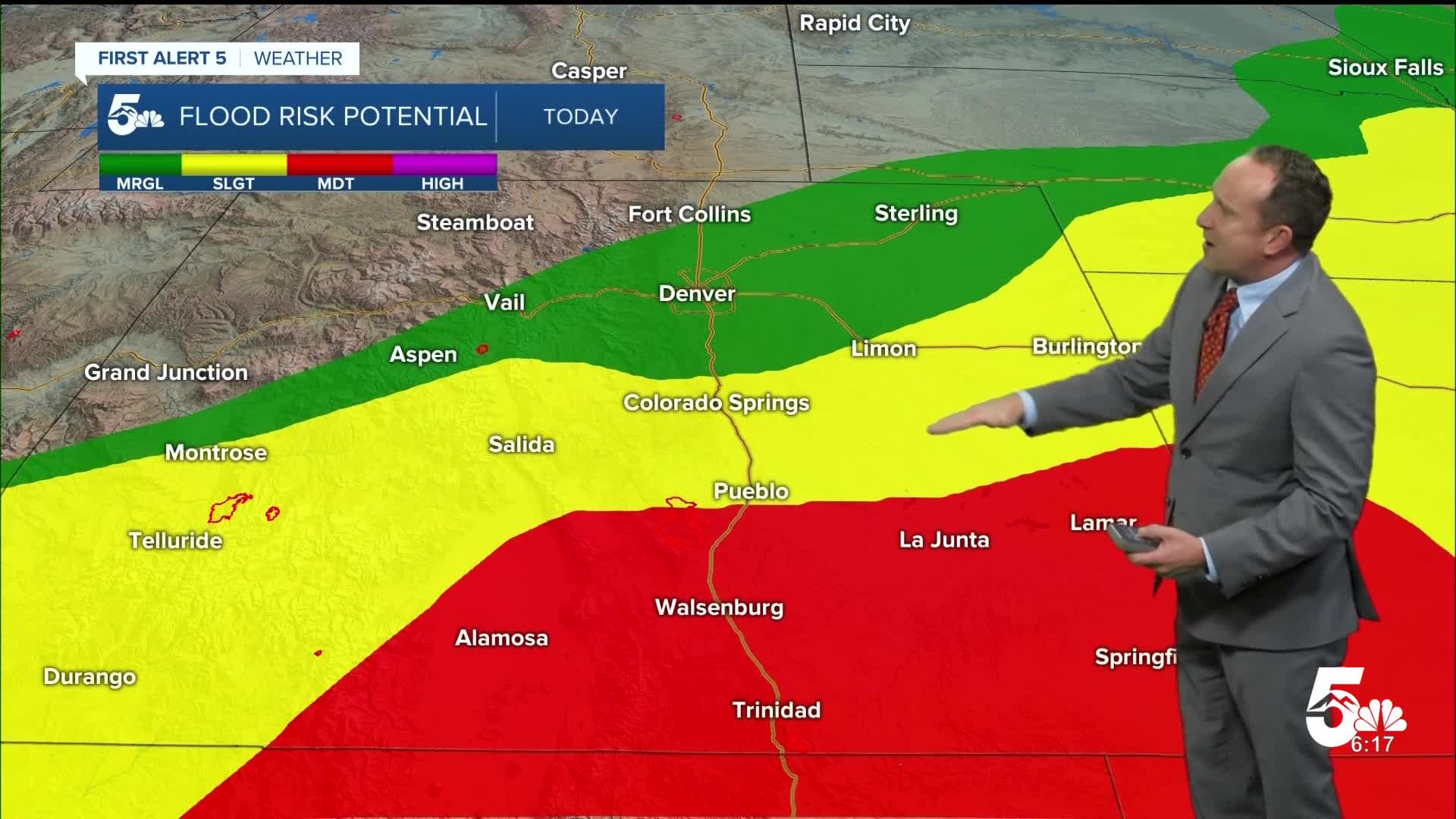
FLOOD WATCHES will go into effect starting at noon for the Pikes Peak Region. These watches are already in effect for the San Luis Valley, Pueblo County and the southeastern Plains.

Colorado Springs forecast: High: 64; Low: 52. Tuesday's forecast will be cool and cloudy, with some occasional showers possible throughout the day in the Pikes Peak Region. Heavier rain will arrive later tonight.
Pueblo forecast: High: 68; Low: 55. Highs today will be around 10 degrees below average, due to cloudy skies and occasional showers. By late this evening, heavier showers will expand north into Pueblo County.
Canon City forecast: High: 67; Low: 53. It will be a cool and overcast Tuesday, with intermittent showers this afternoon giving way to moderate to heavy rain later tonight and Wednesday.
Woodland Park forecast: High: 55; Low: 43. Cool and cloudy fall-like weather on Tuesday will give way to increasing rain Tuesday night and Wednesday, with a FLOOD WATCH in effect through midday Thursday for Teller County.
Tri-Lakes forecast: High: 50s/60s; Low: 40s/50s. Tuesday's fall-like weather will feature a chance for showers during the day, followed by an increasing chance for heavy rain and thunderstorms late tonight and Wednesday.
Plains forecast: High: 60s/70s; Low: 50s. Occasional showers will rotate in from the south throughout the day on Tuesday, with the rain becoming more widespread and heavier by late this afternoon and evening.
Walsenburg and Trinidad forecast: High: 60s; Low: 40s/50s. Scattered showers and isolated thunderstorms will increase in coverage this afternoon and evening before heavy rain and wind push in later tonight from south to north.
Mountains forecast: High: 40s/50s; Low: 30s/40s. An unsettled weather pattern will come to fruition today and tonight, with rain becoming heavier and more widespread through the overnight hours. Snow levels may drop down to around 10,000-11,000 feet by Wednesday night, with as much as a foot of snow from this storm on Pikes Peak.
Extended outlook forecast:
The heaviest rain will arrive late tonight into Wednesday morning, and isn't likely to taper off until early Thursday. A storm total range in the Pikes Peak Region of 1.5-3" looks likely, but there's still some uncertainty with the exact track of the storm and the heaviest rainfall associated with the remnants of Hurricane Polo. If these two things line up farther to the east, we could end up with lower totals.
Temperatures today will warm into the mid 60s, with upper 50s to lower 60s on both Wednesday and Thursday.
This storm also looks to bring quite a bit of wind with it. 30-45 wind gusts will be possible from Wednesday morning to Thursday morning for the Pikes Peak Region. Nice weather will return Friday, with highs in the 60s. 70s will follow this weekend.
____
Curious about the First Alert 5 Weather Storm Impact Scale? Check out our cheatsheet explainer.
Watch KOAA News5 on your time, anytime with our free streaming app available for your Roku, FireTV, AppleTV and Android TV. Just search KOAA News5, download and start watching.
