

Today’s Forecast:
A series of cold fronts this week has brought much cooler air into Southern Colorado this morning. A Frost Advisory has been issued for northern El Paso County until 9 am, and includes the cities of Monument, Palmer Lake and Black Forest.
Sunshine and lighter breezes will follow this afternoon as highs climb into the 50s in the mountain areas, with a mix of 60s and lower 70s for areas along and east of I-25.
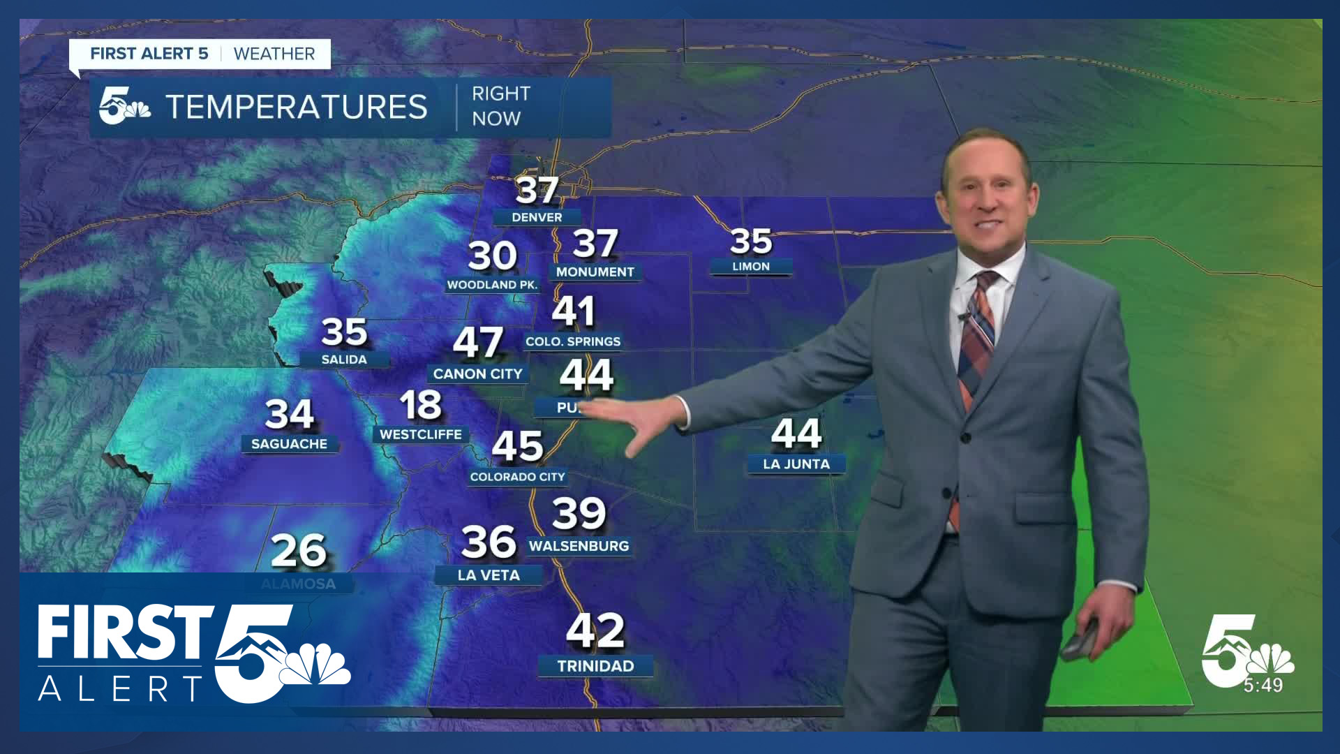
Colorado Springs forecast: High: 65; Low: 37. Jacket weather this morning will give way to sunshine and near average highs this afternoon. Lows tonight will be colder than last night, dropping down to the middle to upper 30s.
Pueblo forecast: High: 71; Low: 36. As cooler air settles into Colorado on Friday, we'll see some pretty big differences these next few days between morning lows and afternoon highs. Today's highs will warm into the lower 70s, with middle 30s expected tonight.
Canon City forecast: High: 68; Low: 41. Near perfect and pleasant weather can be expected this afternoon, with sunshine, light breezes and a high in the upper 60s.
Woodland Park forecast: High: 57; Low: 29. Fall will be in the air on Friday, with highs this afternoon expected to top out in the upper 50s and lows tonight cooling down to the upper 20s.
Tri-Lakes forecast: High: 60s; Low: 30s. This morning's Frost Advisory should be allowed to expire by 9 am and as temperatures warm this afternoon, we should see highs in the lower 60s.
Plains forecast: High: 60s/70s; Low: 30s/40s. After a windy and warm day on Thursday, Friday's forecast will be both cooler and calmer, with highs this afternoon on the Plains warming into the 60s and 70s.
Walsenburg and Trinidad forecast: High: 60s; Low: 30s/40s. Clear skies, light breezes and comfortable fall-like temperatures will make for a gorgeous October day. Get outside and enjoy!
Mountains forecast: High: 40s/50s; Low: 20s. Bright and dry skies will make for a perfect end to the week in Colorado's high country. Highs today will warm into the 40s and 50s, with lows tonight in the 20s, with increasing westerly wind gusts to 40 mph.
Extended outlook forecast:
Temperatures on Saturday will start out in the 30s before climbing into the 60s and lower 70s on the Plains. A cold front on Saturday will increase the northerly wind in the afternoon, with gusts in the Springs up to 25 mph. Stronger gusts can be expected for areas east of I-25.
Brief ridging will allow for an adequate warm-up late this week, with highs rebounding into the lower to middle 70s on Sunday in Colorado Springs. Lower 70s will follow on Monday ahead of our next cold front that will drop highs into 60s on Tuesday and Wednesday.
____
Curious about the First Alert 5 Weather Storm Impact Scale? Check out our cheatsheet explainer.
Watch KOAA News5 on your time, anytime with our free streaming app available for your Roku, FireTV, AppleTV and Android TV. Just search KOAA News5, download and start watching.
