


Today’s Forecast:
While it might sound like a broken record by now - fire danger is still high, again, today. This is the 75th day of the year with Red Flag Warnings somewhere in southern Colorado. The 20-year average is 43 days per year.
Today, it will not be as windy today as in the last few days as upper-level winds weaken slightly. At the same time, a building ridge to the east will push the burner up another couple of notches today and temperatures will climb today - most of the plains hits the 90s, with some triple digit heat too! Humidity will be lower today than it was yesterday - down to 4% or even lower by the afternoon. Red Flag Warnings will be in effect from 10:00 AM - Midnight.
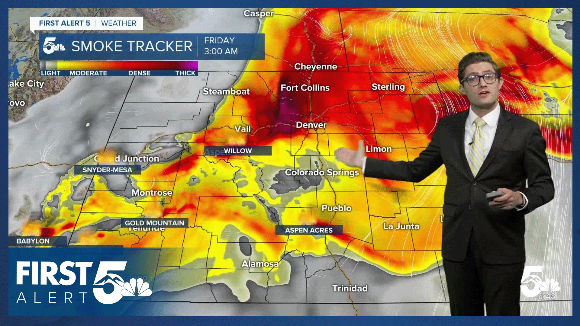
An Air Quality Alert is in place through 9:00 AM, but this may be extended...either immediately or this afternoon, as fire activity ramps up again at Aspen Acres. Today's winds will be southwesterly at 10-20 mph, gusting to 30 mph mainly during the afternoon. Conditions at the fire will be locally worse. Temperature contrasts drive wind. The hot, large fire, will enhance wind speeds within its local vicinity. This is part of what makes firefighting so difficult with these types of fires.
Weak upslope flow this evening across the plains will push smoke back toward the I-25 corridor, meaning smoke will thicken up close to sunset wherever it isn't thick during the afternoon. Meanwhile, some of the stronger mountain wind gusts of the day will likely occur closer to sunset into the evening hours.
A few strong storms are also possible today over the far eastern counties, primarily in Prowers and Baca. These are most likely in the 1-2 PM time frame, before moving east into Kansas by mid-afternoon.
Colorado Springs forecast: High: 92; Low: 57.
Pueblo forecast: High: 97; Low: 58.
Canon City forecast: High: 95; Low: 59.
Woodland Park forecast: High: 81; Low: 47.
Tri-Lakes forecast: High: 80s; Low: 50s.
Plains forecast: High: 90s/100s; Low: 60s.
Walsenburg and Trinidad forecast: High: 91/95; Low: 57.
Mountains forecast: High: 80s; Low: 50s.
Extended outlook forecast:
Red Flag Warnings return again Friday, once again from 10:00 AM - Midnight. Winds will be even less consistent than today as a heat dome continues to slowly drift east and low pressure pulls further north - weakening upper level winds. But, a secondary mid-level high will develop over northern Mexico, keeping the winds just strong enough to keep the threat for quick fire growth high. Highs get even toastier - Friday will be hottest day of the week! Afternoon winds remain out of the southwest, at 10-20 mph, gusting 25-35 mph.
We see a slight cooldown on July 4th but only by a few degrees, with an isolated shower or thunderstorm possible during the afternoon. This sounds good, but it remains to be seen if we have enough low-level moisture for much rain to reach the ground.
Moisture will increase beginning on Sunday, leading to low but daily afternoon chances for thunderstorms next week and slightly better firefighting conditions. It will still be hot though with highs in the 90s in Colorado Springs.
____
Curious about the First Alert 5 Weather Storm Impact Scale? Check out our cheatsheet explainer.
Watch KOAA News5 on your time, anytime with our free streaming app available for your Roku, FireTV, AppleTV and Android TV. Just search KOAA News5, download and start watching.
