

Tonight's Forecast:
The wind will ease up overnight. Wildfire smoke will settle near the surface across southern Colorado tonight, so it is best to keep windows closed.
AIR QUALITY ALERTS have been posted until at least Tuesday at 9 am for the counties highlighted in grey.

Fire Danger Tuesday:
RED FLAG WARNINGS are in effect from 10 am until 10 pm for the counties highlighted in red. Do not create sparks or flames outside, and call 911 if you see a new wildfire.

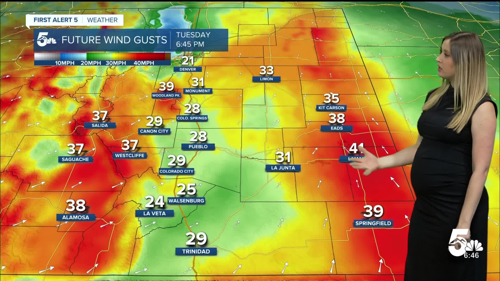
Colorado Springs forecast: Low: 56; High: 89;
AIR QUALITY ALERT until at least 9 am. RED FLAG WARNING from 10 am until 10 pm. It will be hot, dry, and windy on Tuesday. Wind will be out of the SSW at 15 mph, gusting to 30 mph.
Pueblo forecast: Low: 59; High: 96;
AIR QUALITY ALERT until at least 9 am. RED FLAG WARNING from 10 am until 10 pm. Tuesday will be hot, dry, and gusty. Wind will be out of the SSW at 10-15 mph gusting to 30 mph.
Canon City forecast: Low: 59; High: 94;
RED FLAG WARNING from 10 am until 10 pm. Tuesday will be hot and dry! Wind will be out of the WSW at 10 mph gusting to 30 mph.
Woodland Park forecast: Low: 48; High: 78;
RED FLAG WARNING from 10 am until 10 pm. It will be dry and gusty again on Tuesday. Wind will be out of the WSW at 10 mph gusting to 40 mph.
Tri-Lakes forecast: Low: 50; High: 85;
AIR QUALITY ALERT until at least 9 am. RED FLAG WARNING from 10 am until 10 pm. It will be very warm on Tuesday with gusty wind. Wind will be out of the SSW at 10 mph gusting to 30 mph.
Plains forecast: Low: 50s-60s; High: 90s;
RED FLAG WARNING from 10 am until 10 pm for Crowley and Otero Counties. It will be hot and gusty on Tuesday with SSW to SSE wind at 10-15 mph gusting 30-40 mph. A few isolated thunderstorms are possible in the afternoon, leading to even stronger wind gusts.
Walsenburg and Trinidad forecast: Low: 57/56; High: 91/91;
RED FLAG WARNING from 10 am until 10 pm. It will be mostly sunny, hot, and breezy on Tuesday. Wind will be out of the SSW at 10 mph gusting to 30 mph.
Mountains forecast: Low: 40s-50s; High: 70s-80s;
RED FLAG WARNING from 10 am until 10 pm. AIR QUALITY ALERT until at least 9 am for Custer County. It will be gusty and dry again in the mountain valleys on Tuesday. Wind generally out of the SSW at 15-20 mph, gusting 35-45 mph.
Extended outlook forecast:
Fire danger continues on Wednesday with FIRE WEATHER WATCHES in place for the afternoon, in the same zones under the red flag warning on Tuesday.
The weather this week remains hot and dry; in fact, temperatures rise each day and peak on Friday in the 80s to 100s. But the wind will gradually decrease through the week. This will slightly lower fire danger by the end of the week, ONLY in terms of wind.
____
Curious about the First Alert 5 Weather Storm Impact Scale? Check out our cheatsheet explainer.
Watch KOAA News5 on your time, anytime with our free streaming app available for your Roku, FireTV, AppleTV and Android TV. Just search KOAA News5, download and start watching.
