

Tonight's Forecast:
It will be mild tonight with a light breeze from the west. Temperatures will be around 10 to 15 degrees above average, with some spots remaining above freezing.
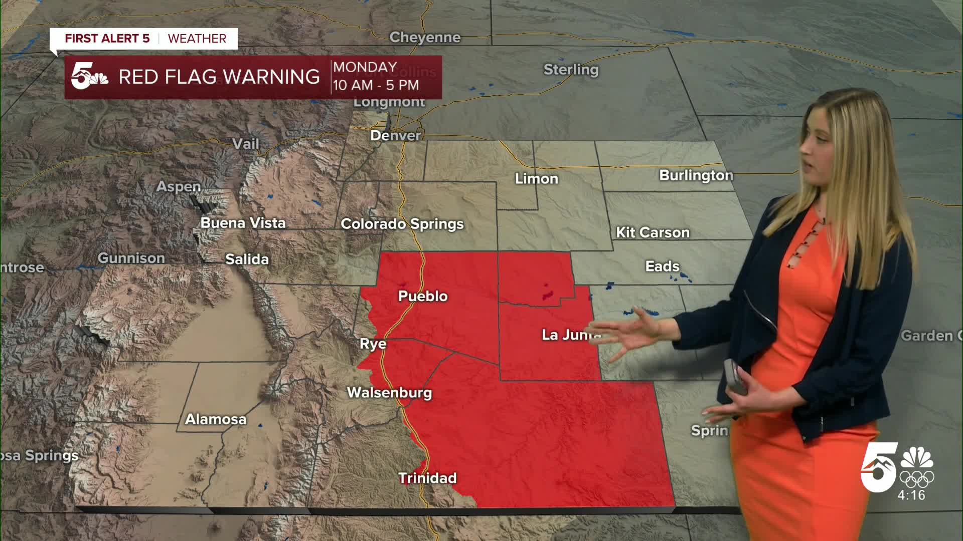
Red Flag Warning Monday:
Fire danger will be high on Monday, especially in the zones highlighted in red where a Red Flag Warning is in effect from 10 am until 5 pm.

Colorado Springs forecast: Low: 31; High: 60;
The forecast high on Monday is 15 degrees above average. The sky will be mostly sunny, and winds will be gusty out of the W at 10 mph gusting to 35 mph.
Pueblo forecast: Low: 31; High: 65;
RED FLAG WARNING 10 am until 5 pm. Wind will be out of the W at 10-15 mph, gusting to 35 mph. It will be mostly sunny and warm.
Canon City forecast: Low: 37; High: 59;
It will be mostly sunny and mild on Monday. Wind will be out of the W at 15 mph gusting to 40 mph.
Woodland Park forecast: Low: 31; High: 50;
Monday will be mild and mostly sunny. Wind will be out of the WSW at 15 mph gusting to 40 mph.
Tri-Lakes forecast: Low: 34; High: 56;
It will be mostly sunny with mild temperatures on Monday. Wind will be out of the WNW at 10 mph gusting to 35 mph.
Plains forecast: Low: 20s-30s; High: 60s;
RED FLAG WARNING 10 am until 5 pm for Crowley, Otero, Las Animas, and Bent Counties. Winds will be breezy in the plains, coming from the WSW at 5-15 mph, gusting 20-35 mph.
Walsenburg and Trinidad forecast: Low: 37/34; High: 59/63;
RED FLAG WARNING 10 am until 5 pm. It will be a warm and gusty day with W wind sustained at 15-20 mph, gusting 30-40 mph.
Mountains forecast: Low: teens-30s; High: 40s-50s;
It will be a partly cloudy day with snow west of the Continental Divide on Monday, and downsloping dry weather on the east side of the divide. Wind will be out of the W at 10-15 mph, gusting 20-40 mph.
Extended outlook forecast:
Temperatures will fall throughout the week. We remain above average through Wednesday. Then we fall to average or below average on Thursday and Friday.
A weather pattern change that brings the colder temperatures will also bring some snow into Colorado. With the current data, it looks like snow moves into our region on Thursday, increasing in coverage throughout the afternoon and evening, then coming to an end on Friday morning. This storm looks to bring a couple of inches of snow to southern Colorado. We will monitor this storm and bring you the expected forecast snow totals in the coming days.
____
Curious about the First Alert 5 Weather Storm Impact Scale? Check out our cheatsheet explainer.
Watch KOAA News5 on your time, anytime with our free streaming app available for your Roku, FireTV, AppleTV and Android TV. Just search KOAA News5, download and start watching.
