


Today’s Forecast:
Today will be very dry and gusty, which will elevate fire danger.
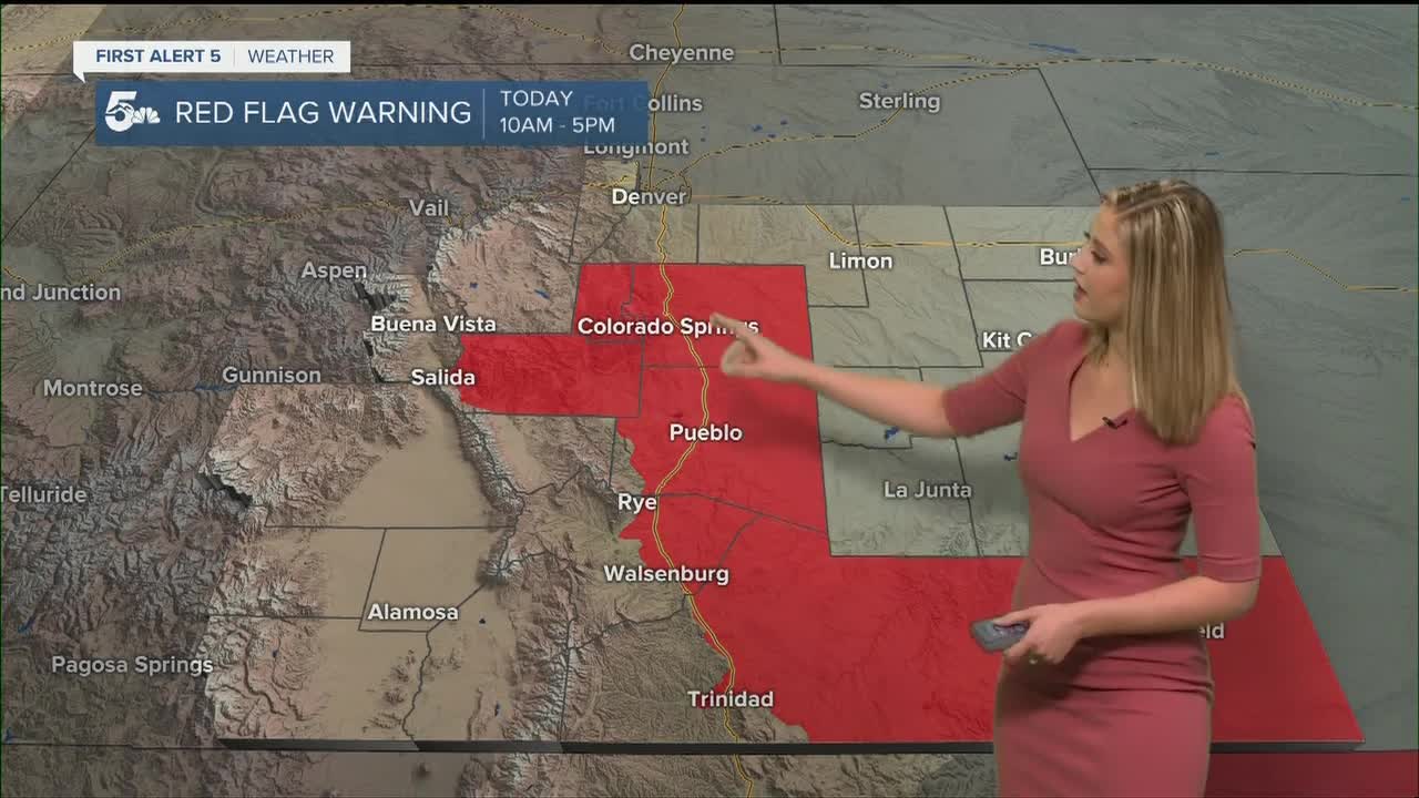
RED FLAG WARNING is in effect from 10 am to 5 pm for EL PASO, TELLER, FREMONT, PUEBLO, EASTERN HUERFANO, EASTERN LAS ANIMAS, AND BACA COUNTIES.
Do not cause a spark or flame outdoors today.
COLORADO SPRINGS: High: 60; Low: 32. Partly cloudy and breezy today with wind gusts up to 25 mph.
PUEBLO: High: 61; Low: 28. Mild and dry today with wind gusts up to 25 mph.
CANON CITY: High: 59; Low: 36. Gusty and dry today with gusts up to 35 mph.
WOODLAND PARK: High: 53; Low: 29. Mild and gusty today with winds up to 35 mph.
TRI-LAKES: High: 50s; Low: 30s. Mid to upper 50s with winds gusting to 30 mph.
PLAINS: High: 60s; Low: teens/20s. A breezy day with mild temperatures in the low 60s.
WALSENBURG/TRINIDAD: High: 50s/60s; Low: 30s. A windy day with partly cloudy conditions. Temperatures will reach the upper 50s in Walsenburg and low 60 in Trinidad.
MOUNTAINS: High: 40s/50s; Low: teens/20s. A windy day with gusts 30-35 mph but slightly higher humidity than the plains which is why Red Flag Warnings are not in place.
Extended Outlook:
Monday and Tuesday will be warm and breezy, very similar to today. On Wednesday expect a storm to bring snow to the mountains, favoring the San Juans, and very windy conditions to the plains. In southern Colorado on Wednesday, wind gusts in excess of 60 mph are possible. Be on the lookout for a possible high wind watch for Wednesday.
KOAA News5 on your time, streaming on your Roku, FireTV, AppleTV and AndroidTV.
