

Today’s Forecast:
The big story today will be a storm crossing the northern Rockies, and its expected impacts on Southern Colorado. While light snow showers will fall across our state's northern and central mountain ranges on Thursday, we'll be on the dry side of the storm here locally. Wind will be our main mode of weather today, with gusts around 20-30 mph for the I-25 corridor. Gusts to 40 mph will be possible in the mountains.
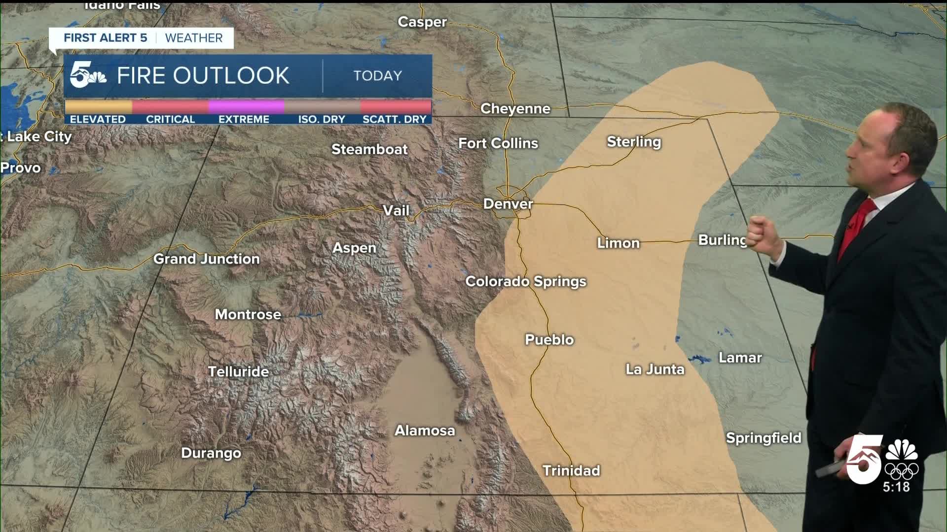
Driven by gusty downslope breezes, Thursday will be a warm one for Southern Colorado. Highs will rebound back into the 70s today on the Plains, with 50s and 60s for the mountain valleys. Temperatures this afternoon will be around 15 degrees above average.
Colorado Springs forecast: High: 71; Low: 33. The dramatic daily temperature swings that we've seen since the weekend will continue on Thursday, with our high this afternoon warming back into the lower 70s. Fire danger levels will be elevated due to relative humidity in the teens and wind gusts to 30 mph.
Pueblo forecast: High: 77; Low: 30. The 60s that we saw on Wednesday will be replaced with 70s today. It will be gusty this afternoon as well, with peak wind gusts to 30 mph, and elevated fire danger.
Canon City forecast: High: 73; Low: 37. Dry and windy on Thursday, with afternoon highs rebounding back into the lower to middle 70s.
Woodland Park forecast: High: 59; Low: 28. Unseasonably mild weather can be expected on Thursday, with westerly wind gusts this afternoon up around 40 mph.
Tri-Lakes forecast: High: 60s; Low: 30s. Mild and windy on Thursday, with peak gusts to 30 mph. Highs today will be as much as 10-15 degrees above average.
Plains forecast: High: 70s; Low: 30s. Warmer, with breezy to gusty west and northwest winds this afternoon. Peak gusts could top 35 mph in some areas, with fire danger risk elevated through early this evening.
Walsenburg and Trinidad forecast: High: 60s/70s; Low: 30s. Windy and warm on Thursday, with afternoon wind gusts expected to range between 30-35 mph.
Mountains forecast: High: 40s/50s; Low: 20s. The strongest gusts on Thursday will impact the mountains, with some areas gusting up to 45 mph. A storm crossing the northern Rockies will bring the potential for a few inches of snow to the northern and central mountains today, with snow not expected for the Wet Mountains and Sangres.
Extended outlook forecast:
A series of cold fronts will cool temperatures as head towards the weekend. Friday's high near 60 degrees in Colorado Springs will still be above the average for this time of the year of 56 degrees. Highs for the rest of Southenr Colorado on Friday will warm into the 50s and 60s.
Saturday's temperatures will drop down to the lower 50s in Colorado Springs, with Sunday much cooler at 45 degrees. We are not expecting any moisture through the weekend.
____
Curious about the First Alert 5 Weather Storm Impact Scale? Check out our cheatsheet explainer.
Watch KOAA News5 on your time, anytime with our free streaming app available for your Roku, FireTV, AppleTV and Android TV. Just search KOAA News5, download and start watching.