

Tonight's Forecast:
Expect seasonable temperatures overnight, in the 20s for most of southern Colorado. It will be mostly clear and relatively calm.
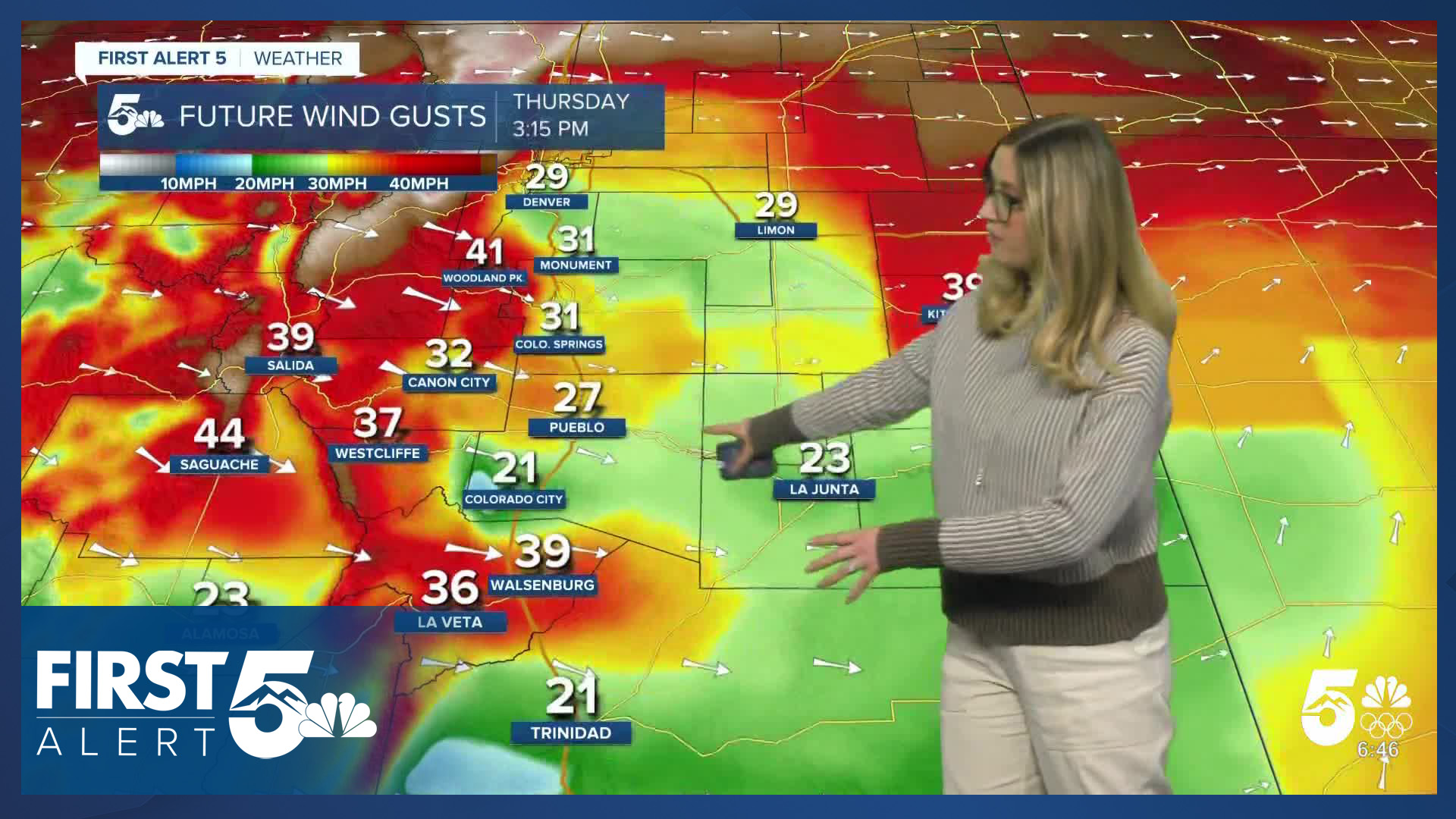
Thursday Fire Danger:
Widespread warmth, dry air, and wind make a return on Thursday. A RED FLAG WARNING is in effect for the zones highlighted in red from 11 am until 9 pm.

Colorado Springs forecast: Low: 26; High: 70;
RED FLAG WARNING from 11 am until 9 pm. Wind will be out of the W at 10-15 mph, gusting to 35 mph. Humidity will drop to 10% or less. Temperatures will be warm and near the record of 72.
Pueblo forecast: Low: 26; High: 74;
RED FLAG WARNING from 11 am until 9 pm. Wind will be out of the W at 15 mph, gusting to 35 mph. Humidity will drop to 10% or less. Temperatures will be warm and near the record of 78.
Canon City forecast: Low: 33; High: 71;
RED FLAG WARNING from 11 am until 9 pm. Thursday will be warm and windy with W wind at 15-20 mph gusting to 35 mph.
Woodland Park forecast: Low: 26; High: 57;
Thursday will be a windy one with W wind sustained at 15-25 mph gusting to 45 mph. It will be partly cloudy and mild.
Tri-Lakes forecast: Low: 28; High: 66;
RED FLAG WARNING from 11 am until 9 pm. It will be warm but windy on Thursday with W wind out of the WNW at 15 mph gusting to 30 mph.
Plains forecast: Low: 20s; High: 70s;
RED FLAG WARNING from 11 am until 9 pm for the eastern plains highlighted in red above. It will be a warm day in the mid to upper 70s. The wind will be breezy out of the W at 10-15 mph gusting 20-30 mph.
Walsenburg and Trinidad forecast: Low: 29/28; High: 68/73;
RED FLAG WARNING from 11 am until 9 pm. A warm and gusty day with W wind at 15-20 mph gusting 30-40 mph.
Mountains forecast: Low: teens-20s; High: 50s-60s;
RED FLAG WARNING from 11 am until 9 pm for the San Luis Valley. It will be a mild day in the mountain valleys with sunshine and gusty winds. Wind will be out of the W at 15-25 mph gusting 35-50 mph.
Extended outlook forecast:
Warm weather sticks around on Friday and Saturday. Fire danger remains high in this time frame as well.
A strong cold front comes in Saturday night into Sunday morning, bringing light snow on Sunday morning to Teller County and El Paso County. Sunday will be chilly in the 40s and 50s.
Next week is trending warm with record heat possible Tuesday through Friday (at least). Highs will be in the 70s to 90s by the end of the week!
____
Curious about the First Alert 5 Weather Storm Impact Scale? Check out our cheatsheet explainer.
Watch KOAA News5 on your time, anytime with our free streaming app available for your Roku, FireTV, AppleTV and Android TV. Just search KOAA News5, download and start watching.
