



Today’s Forecast:
After a devastating weekend of flooding in the Beulah area that resulted in one death, our weather across Southern Colorado will quiet down early this week.
This morning will begin with mostly sunny skies and pleasant, less humid conditions. Temperatures today will warm by around 3-6 degrees from yesterday, topping out in the 80s and 90s on the Plains. Temperatures in the mountain valleys and high terrain will warm into the 60s and 70s today.
Lingering moisture and daytime heating will allow for at least a few spotty showers in the mountains and Pikes Peak Region. Storms that move east into the Plains could turn severe, with 1" hail and 50-60 mph wind gusts the main threats.
Colorado Springs forecast: High: 85; Low: 59. Storms will be less numerous today as we should see a small break from the monsoon. This will allow for a warm-up as highs return to the middle 80s this afternoon.
Pueblo forecast: High: 91; Low: 61. After a stormy weekend, skies today in the Steel City will be mostly dry. With drier air in our forecast early this week, highs will be allowed to warm into the lower 90s. which is near average for this time of the year.
Canon City forecast: High: 89; Low: 63. A cooler and less humid morning will give way to lower storm chances this afternoon, with only around a 20% chance of a storm today in eastern Fremont County.
Woodland Park forecast: High: 77; Low: 53. After a rough and tumble weekend, storms will be more isolated in nature today in Teller County. Our temperatures will be warming back to the upper 70s today before reaching the 80s on Tuesday.
Tri-Lakes forecast: High: 80s; Low: 50s. Highs will return to the 80s this afternoon, with sunshine early giving way to some isolated thunderstorms this afternoon.
Plains forecast: High: 80s/90s; Low: 50s/60s. After a rainy morning on the southeastern Plains, drier air will punch into the state this afternoon, with fewer storms expected today compared to this past weekend. Storms that do form on the Raton Mesa could reach low-end severe levels as they move into eastern Las Animas and Baca counties.
Walsenburg and Trinidad forecast: High: 80s/90s; Low: 50s/60s. Storms that form over the southern Sangres today will move across the southern I-25 corridor after 1-2 pm, and should wrap up well before sunset this evening.
Mountains forecast: High: 60s/70s; Low: 40s/50s. Scattered thunderstorms will form towards the early afternoon hours, with our best chances for rain today south of Highway 50.
Extended outlook forecast:
High pressure will bring the heat on Tuesday, with 90s returning to Colorado Springs for the first time since last Wednesday. Temperatures in Pueblo will hit the upper 90s.
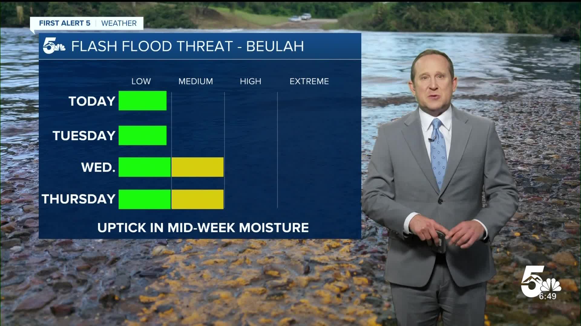
Storm chances will ramp back up on Wednesday once our next cold front arrives. Highs will cool down to the mid 80s in Colorado Springs before warming into the upper 80s on Thursday. Heavy rain producing thunderstorms will be possible once again around the Aspen Acres burn scar, with an increased risk of flash flooding.
Highs in the 90s will return to the Plains from Friday into the weekend. Dry skies are likely through Saturday, with a chance of thunderstorms returning to our forecast by Sunday afternoon.
____
Curious about the First Alert 5 Weather Storm Impact Scale? Check out our cheatsheet explainer.
Watch KOAA News5 on your time, anytime with our free streaming app available for your Roku, FireTV, AppleTV and Android TV. Just search KOAA News5, download and start watching.
