

Tonight's Forecast:
A Flood Watch will remain in effect until 8 pm for parts of Southern Colorado, with the threat for flooding driven by the potential for slow moving, intense thunderstorms. Areas most at risk would include places like Manitou Springs and Fountain, and other locations that have seen a lot of rain over the past few days. Avoid hanging out near swollen creeks, rivers and streams as muddy soil can easily collapse during and after heavy rainfall.

Rain showers should wind down near the I-25 corridor around 9 pm, with rain coming to an end on the Plains by midnight in most areas.
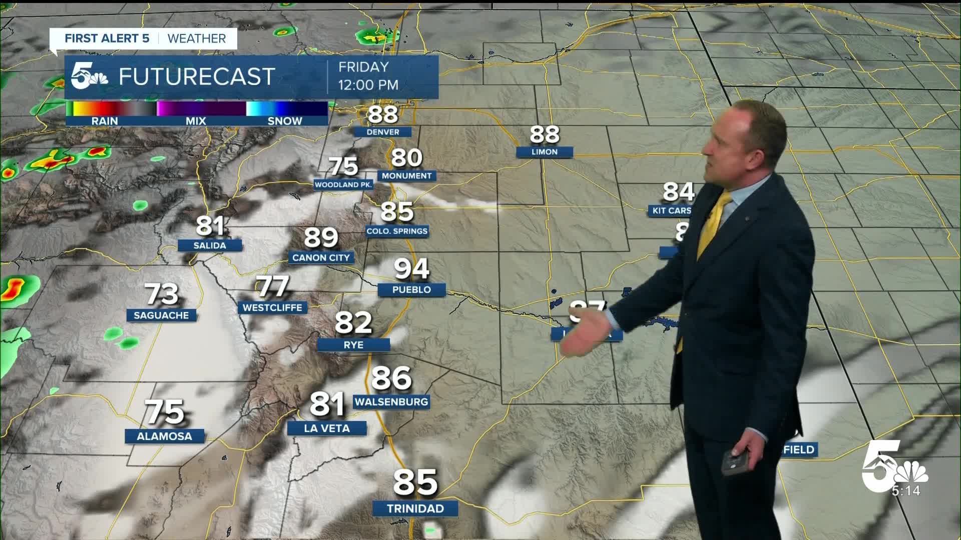
Colorado Springs forecast: Low: 57; High: 88; Hazy skies in the morning will give way to increasing clouds Friday afternoon as showers blossom over the mountains. Unlike the past few days, storm coverage in the Pikes Peak Region should be much more hit or miss in nature.
Pueblo forecast: Low: 59; High: 96; After some refreshing changes and rain on Thursday, Friday's forecast will feature mainly dry skies and a healthy boost in temperatures, with highs returning to the middle 90s.
Canon City forecast: Low: 62; High: 92; The work week started hot, and after a few cooler days, the heat will return on Friday as highs climb back into the lower 90s. On top of Friday's warm-up, we'll also see the potential for spotty afternoon showers.
Woodland Park forecast: Low: 50; High: 77; While showers will become less of a factor east of the mountains on Friday, scattered showers and thunderstorms will remain in our forecast across Teller County from Friday into the weekend.
Tri-Lakes forecast: Low: 50s; High: 80s; Mostly sunny skies Friday morning will give way to a mostly cloudy and warm afternoon, with only slight chance of shower or thunderstorm over northern El Paso County.
Plains forecast: Low: 60s; High: 90s; As the atmosphere dries out on Friday, temperatures will rebound by as much as 10-15 degrees from today, with only a very small chance of a shower for areas closest to I-25.
Walsenburg and Trinidad forecast: Low: 50s/60s; High: 80s; Warming highs and fewer thunderstorms on Friday will lead to another uptick in thunderstorms this weekend as a weak monsoon pattern sets up over Southern Colorado.
Mountains forecast: Low: 40s; High: 60s/70s; Hazy skies and areas of smoke will continue to be a problem for the mountains due to large wildfires burning in the state. A chance for scattered showers and thunderstorms will follow Friday afternoon, with both severe and flood threats much lower than today.
Extended outlook forecast:
After hit or miss showers on Friday on the Plains, a weak monsoon pattern this weekend will allow for daily storm chances to return to our forecast. Thunderstorms should be fairly scattered each afternoon, but could disrupt plans during the day. Highs over the weekend will warm into the 80s and 90s for most of Southern Colorado, with some cooler 70s for the higher terrain.
Moisture looks to get cut off early next week, allowing for fewer thunderstorms and hotter highs on the Plains, and an ongoing threat of afternoon thunderstorms in the mountains. Increasing moisture towards the middle of next week will help to improve rain chances as our next cold front moves into the state on Thursday.
____
Curious about the First Alert 5 Weather Storm Impact Scale? Check out our cheatsheet explainer.
Watch KOAA News5 on your time, anytime with our free streaming app available for your Roku, FireTV, AppleTV and Android TV. Just search KOAA News5, download and start watching.
