


Today’s Forecast:
The potent upper-level low that has been sending us energy over the last few days is moving east today into Colorado. Energy in front of the low is responsible for morning storms in the western and southern mountains and San Luis Valley. Patchy clouds will be in place this morning in southern Colorado, which will break up a bit providing more sunshine into the late morning hours.
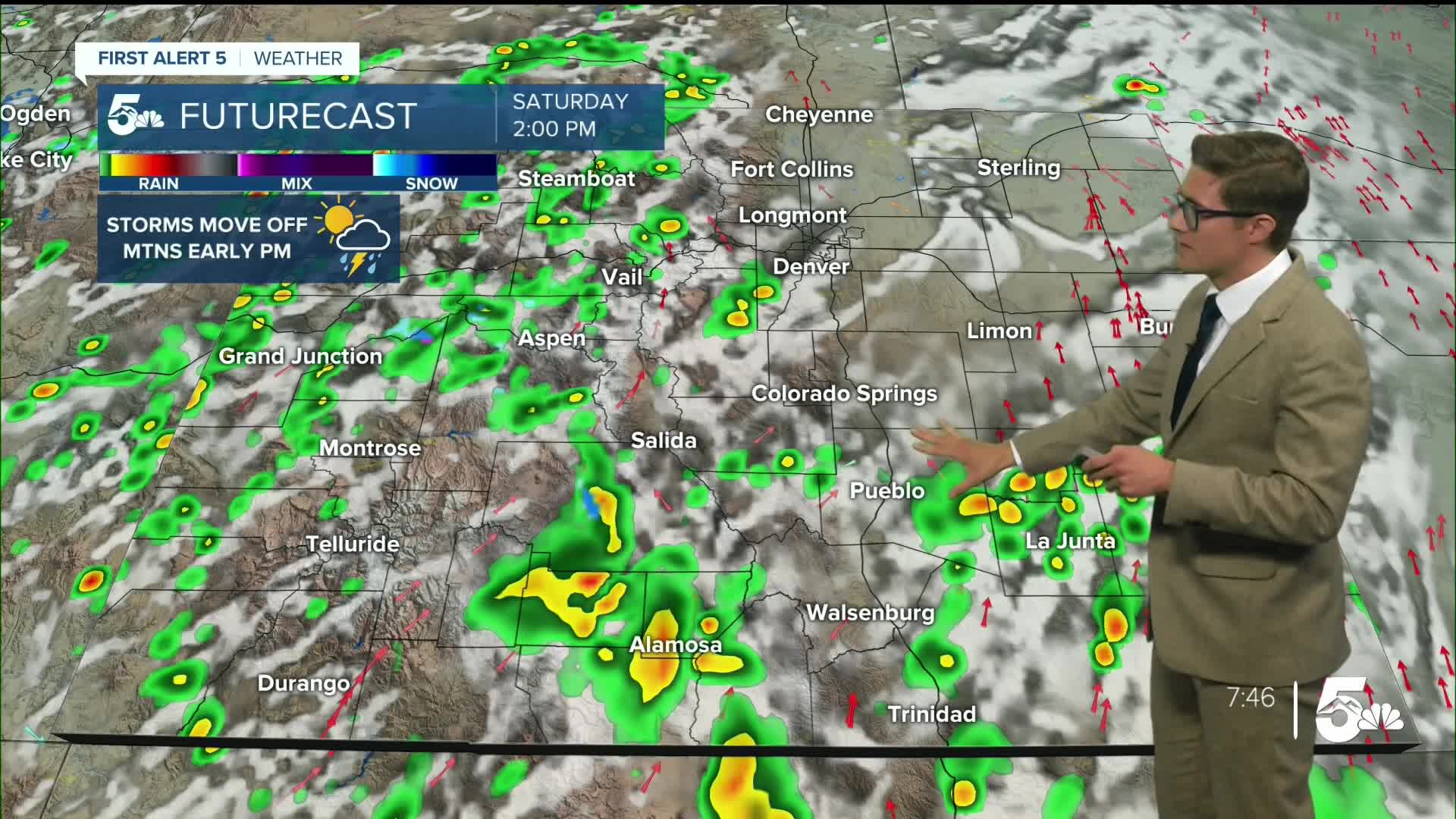
Compared to Friday, the main differences today are in storm timing and intensity. Storms today will again be scattered and relatively quick-moving. They'll arrive - much - earlier than yesterday - moving off the mountains between late morning and lunchtime, and through I-25 during the early afternoon. These storms will be capable of lightning, gusty wind, and small hail. Therefore, you may want to avoid exposed outdoor spaces in the late AM to early PM hours where there is no nearby shelter. This is not an all-day event, so most of your outdoor plans will be fine as long as you keep that in mind.
The storms should intensify as they continue to move east, with a few strong to severe storms possible during late afternoon on the eastern plains. Quarter sized hail, and 60 mph wind gusts, are the primary concerns there.
Skies should clear out this evening - after dinnertime, so most evening plans should be fine.
Colorado Springs forecast: High: 76; Low: 47.
Patchy morning clouds interspersed with periods of mostly sunny conditions. Scattered showers and thunderstorms early in the afternoon and otherwise partly cloudy. A few late evening showers are also possible. South winds at 10-15 mph.
Pueblo forecast: High: 83; Low: 50.
More sun than clouds this morning, with isolated afternoon thunderstorms possible. South winds at 5-10 mph.
Canon City forecast: High: 78; Low: 50.
Partly sunny with scattered thunderstorms in the afternoon. West winds at 5-10 mph.
Woodland Park forecast: High: 65; Low: 38.
Mostly sunny through about 11 AM, with scattered thunderstorms possible after that. Southwest winds at 5-10 mph.
Tri-Lakes forecast: High: 70s; Low: 40s.
Partly sunny with scattered early afternoon thunderstorms. A couple of these storms could be strong with gusty winds and small hail. West winds in the AM, south after 12 PM, at 5-10 mph. Stronger wind ahead of any shower or storm moving off the mountains.
Plains forecast: High: 80s; Low: 50s.
Partly to mostly cloudy for most of the day. Scattered afternoon thunderstorms - capable of gusty wind, lightning, and small hail. A few storms will be capable of 1" hail and 60 mph wind gusts. South winds at 10-25 mph, gusting to 40 mph this afternoon.
Walsenburg and Trinidad forecast: High: 74/75; Low: 47.
More clouds than sun with a good chance of a late morning to early afternoon t-storm. West winds at 10-15 mph.
Mountains forecast: High: 50s/60s; Low: 30s.
Partly sunny with scattered thunderstorms by late morning. Mixed precipitation above 12,500 feet, snow above 13,000 feet, with minimal accumulations. Southwest winds at 10-25 mph.
Frost is possible tonight in the southern San Luis Valley, and isolated in the high mountain valleys above 10,000 feet.
Extended outlook forecast:
Frost is possible in the southern San Luis Valley in the early morning with a frost advisory in place from 3 AM - 9 AM. Make sure to bring any sensitive plants inside or cover them.
Sunday will start with a few patchy clouds, with an isolated light shower possible primarily over and north of the Palmer Divide area. Mainly clear conditions south of Colorado Springs. Skies will increasingly clear heading into the afternoon. Temperatures will be cooler still than today - with most spots in the 70s; 60s in the lower mountain areas, 50s if you're heading up high.
The beginning of the work week will be dry, and warm, with highs rebounding to the 80s with plenty of sunshine. Our next cold front will arrive Wednesday bringing in the next chance for storms, and cooler temperatures.
____
Curious about the First Alert 5 Weather Storm Impact Scale? Check out our cheatsheet explainer.
Watch KOAA News5 on your time, anytime with our free streaming app available for your Roku, FireTV, AppleTV and Android TV. Just search KOAA News5, download and start watching.
