



Today’s Forecast:
After some delightful, fall-like weather on Monday, temperatures will rebound this afternoon by as much as 3-7 degrees on the first official day of fall. Highs will warm into the 70s and 80s on the Plains, with a mix of 60s and 70s for the higher elevation areas.
By this afternoon, moisture from New Mexico will begin to spread northward into Colorado. This will allow for a chance for showers and thunderstorms this afternoon and evening, with storms fairly spotty in coverage on the Plains. Today's best chances for rain will be across the mountains, especially the San Juan Mountains.
Colorado Springs forecast: High: 77; Low: 53. After warming into the lower 70s on Monday, our high in the upper 70s will warm above today's average high of 75. This afternoon and evening between 3-7 pm, we will see the potential for spotty showers and thunderstorms.
Pueblo forecast: High: 82; Low: 56. Dry skies this morning will give way to a chance of spotty afternoon/evening showers and thunderstorms. Highs today will return to the 80s after warming into the middle 70s on Monday.
Canon City forecast: High: 80; Low: 57. Rain chances will begin to increase this afternoon, with peak coverage this week expected from midday Wednesday to midday Thursday.
Woodland Park forecast: High: 68; Low: 46. Highs today will rebound into the upper 60s, with a chance of thunderstorms this afternoon and evening in Teller County.
Tri-Lakes forecast: High: 70s; Low: 40s/50s. Our weather this morning will be nice ahead of a warmer afternoon that will feature at least a slight chance of rain and thunderstorms.
Plains forecast: High: 70s/80s; Low: 50s/60s. While we have seen some early morning showers on the far southeastern Plains, skies will remain mostly dry the rest of the morning ahead of a warm and breezy afternoon, with spotty thunderstorms possible.
Walsenburg and Trinidad forecast: High: 70s; Low: 50s. Warmer highs on Tuesday, along with the potential for scattered afternoon and evening showers and thunderstorms.
Mountains forecast: High: 50s/60s; Low: 40s. After a relatively quiet Monday, rain chances will increase in the mountains starting today, with heavier rain possible from midday Wednesday into midday Thursday.
Extended outlook forecast:
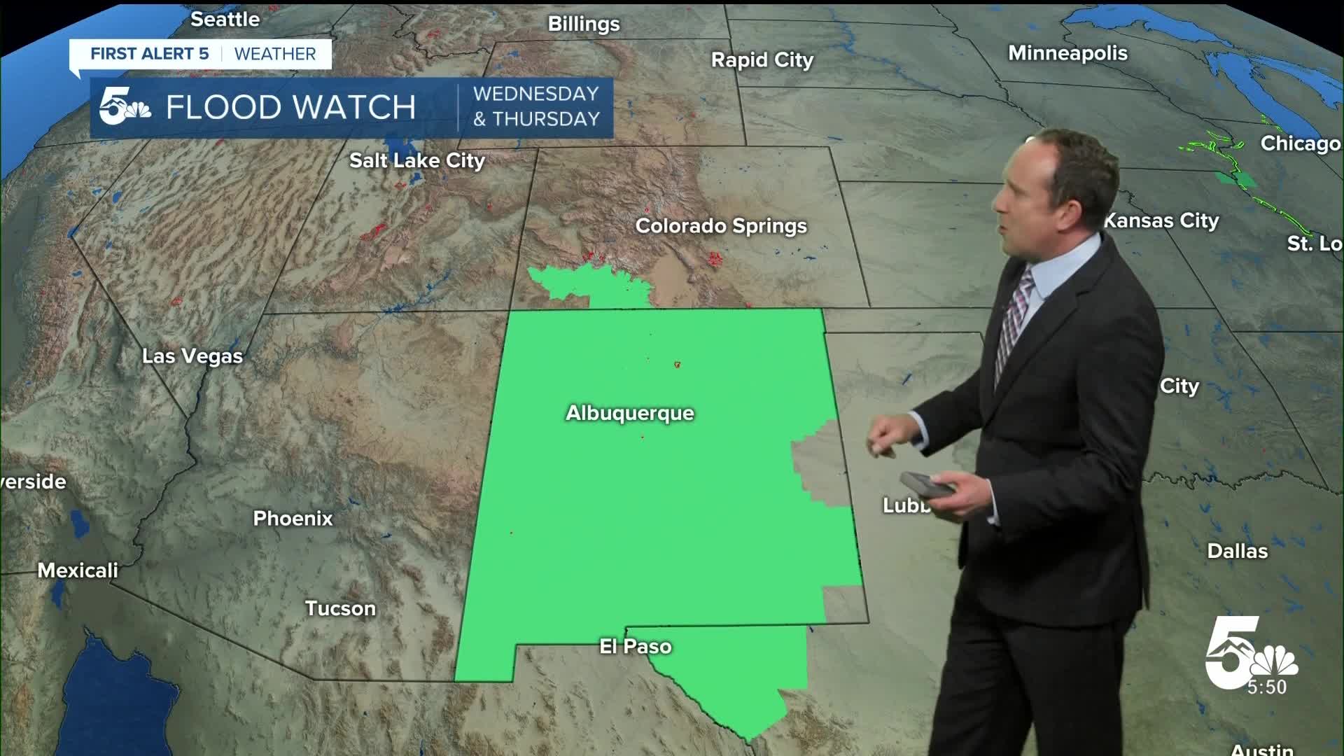
Heavy rain will spread into Colorado on Wednesday, and a Flood Watch has been issued for the San Juan Mountains from noon Wednesday until very late Thursday night. As much as 1-3" of rain could fall in these areas, with locally higher amounts very likely.
Closer to home, we will see a wetter and cooler forecast from midday Wednesday into midday Thursday, including a chance for rain Wednesday night and Thursday morning. Highs will warm into the lower 70s on Wednesday and the upper 60s on Thursday.
Drier air arrives on Friday, with fewer thunderstorms in our forecast and a high in the lower 70s. Our weather this weekend will be dry and warm, with highs in Colorado Springs in the lower 80s.
____
Curious about the First Alert 5 Weather Storm Impact Scale? Check out our cheatsheet explainer.
Watch KOAA News5 on your time, anytime with our free streaming app available for your Roku, FireTV, AppleTV and Android TV. Just search KOAA News5, download and start watching.
