



Today’s Forecast:
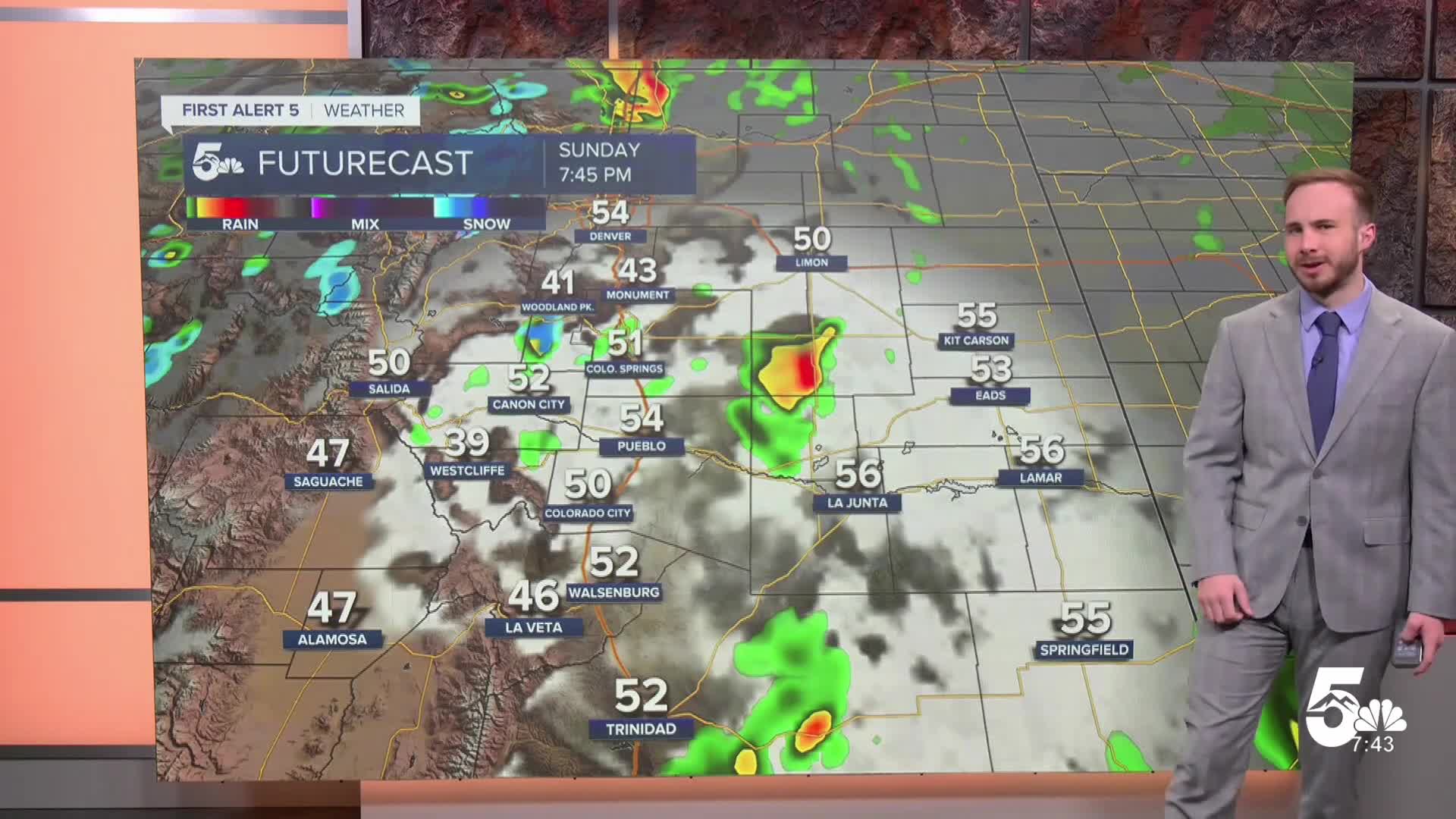
A cold front dropping across the region brings a dramatic temperature drop and widespread rain to the eastern plains. The flash flooding threat along the Continental Divide has eased, as the heaviest rainfall shifts east. Pockets of the far eastern plains could see an additional 1 to 2 inches of rain today and tonight. Snow levels will drop over the high country, bringing 5 to 8 inches of fresh snow to the highest mountain peaks. Highs today reach the 50s to low 60s for the plains, before overnight lows drop into the 30s across the high valleys and the upper 30s to low 40s for the plains.
Watch News5's full forecast in the video below:
Local City Breakdown
Colorado Springs: Low: 40 | High: 54
Expect a chilly Saturday as a cold front knocks temperatures down by nearly 20 degrees. Clouds will thicken through the morning, with light rain showers building by the afternoon and evening. Northerly winds gusting up to 15 mph will add an extra chill to the air.
Pueblo: Low: 42 | High: 60
A damp, cool day is ahead with highs topping out in the lower 60s. Rain chances increase through Saturday afternoon and evening, accompanied by an easterly breeze. Periods of steady, moderate rain will continue through the night.
Canon City: Low: 43 | High: 58
Cool, fall-like weather takes over today with highs struggling to reach the upper 50s. Skies remain mostly cloudy, with scattered rain showers developing during the afternoon alongside a persistent easterly breeze.
Woodland Park: Low: 33 | High: 45 Raw and chilly conditions keep highs locked in the mid-40s. Rain showers build during the afternoon. As overnight temperatures fall near freezing, showers could mix with a few snow flurries late tonight.
Extended Forecast
An upper-level low tracking out of Arizona keeps Southern Colorado cold and wet through the weekend. A steady warming trend returns by mid-week.
Saturday – Sunday: A strong cold front holds daytime highs in the 50s and low 60s across lower elevations. Widespread rain showers, isolated thunder, and heavy rain focus along the eastern plains, while high mountain peaks pick up several inches of snow. Sunday will be the coldest day of the stretch with lingering, trapped cloud cover and showers.
Monday: The storm system weakens and pulls away to the northeast. A few early morning showers may linger near the Kansas border before clearing skies take over. Temperatures begin to recover with highs reaching the upper 50s and low 60s.
Tuesday – Friday: Drier southwesterly flow settles over the region for the rest of the workweek. Expect a stretch of pleasant, mostly sunny days with highs rebounding back into the upper 60s and lower 70s.
____
Curious about the First Alert 5 Weather Storm Impact Scale? Check out our cheatsheet explainer.
Watch KOAA News5 on your time, anytime with our free streaming app available for your Roku, FireTV, AppleTV and Android TV. Just search KOAA News5, download and start watching.
