

Today’s Forecast:
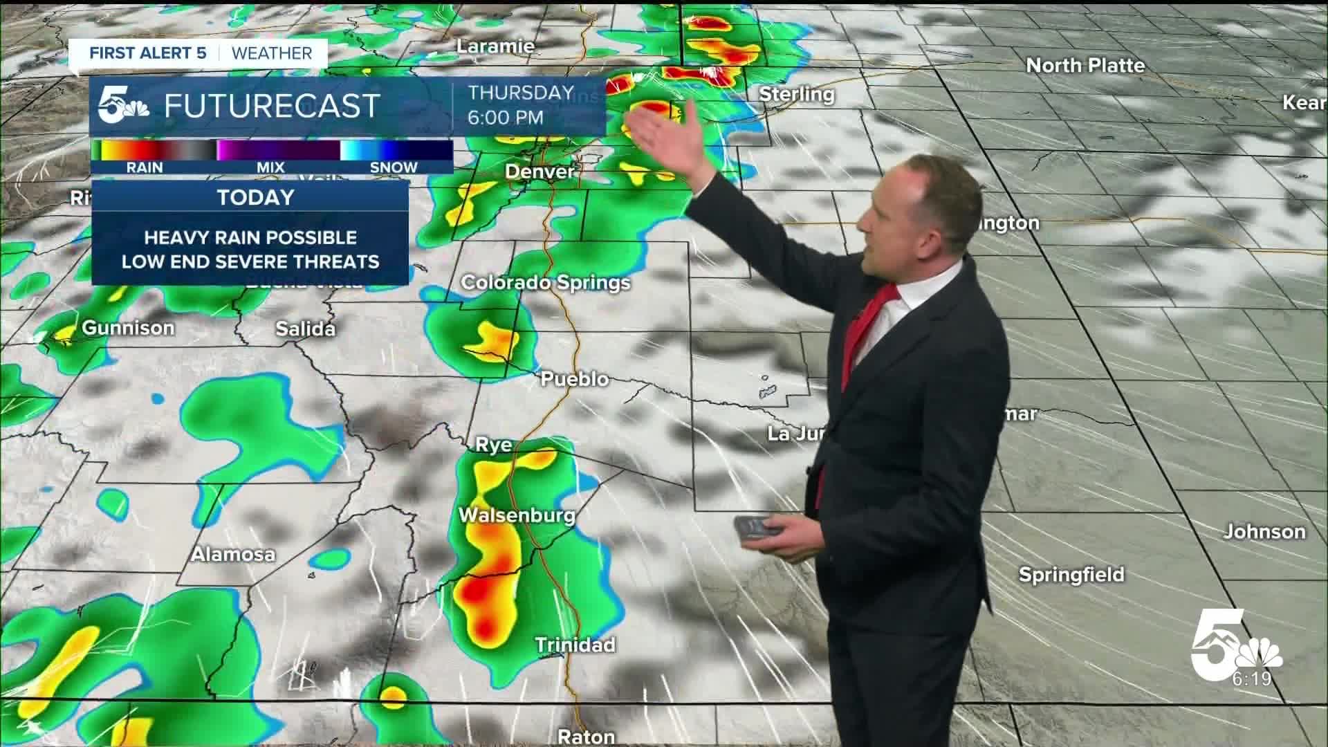
After a very busy day on Wednesday, a monsoon weather pattern will keep our weather active again on Thursday. Mild and muggy conditions this morning will give way to another round of storms in the mountains by early this afternoon. As storms move east, they will be capable of heavy rainfall, small hail, gusty winds and frequent lightning. Much like yesterday, we also can't rule out a tornado or two, although threats appear lower than Wednesday. Due to days of heavy rain already in some areas, flooding will be the main concern this afternoon, especially north of Highway 50.
Highs will remain well below average on Thursday, only warming into the 70s and 80s for most of Southern Colorado.
Colorado Springs forecast: High: 78; Low: 55. After heavy rain and intense thunderstorms on Wednesday, we're looking at a rinse and repeat pattern today across the Pikes Peak Region. With the potential for heavy rain back in the forecast, the threat for flooding will remain a concern.
Pueblo forecast: High: 85; Low: 58. Since near record heat back on Monday, it has been a wet and stormy week across Southern Colorado. Today's forecast will remain on the stormy side as late afternoon and evening thunderstorms are likely across the county.
Canon City forecast: High: 82; Low: 59. Much like yesterday, we'll see cooler than average highs on Thursday and another round of showers and thunderstorms this afternoon. Fueled by the monsoon, storms today look to be as widespread as yesterday.
Woodland Park forecast: High: 71; Low: 46. Storms will make an encore performance this afternoon across Teller County, firing off as early as the lunch hour. Storms today will be capable of heavy rainfall, frequent lightning, gusty winds and hail.
Tri-Lakes forecast: High: 70s; Low: 50s. After some pretty nasty hail and heavy rain back on Wednesday, we're looking at the potential for more strong and severe storms on Thursday. Keep an eye on the sky for rain anytime after 2 or 3 pm.
Plains forecast: High: 70s/80s; Low: 50s/60s. Showers that develop along the eastern mountains slopes this afternoon will move east into the Plains this evening. Much like yesterday, storms today will be capable of flooding and heavy rain, with the main threats today expected north of Highway 50.
Walsenburg and Trinidad forecast: High: 70s/80s; Low: 50s. Another round of showers and thunderstorms this afternoon will keep our forecast on the busy side. Severe threats will be lower than yesterday on the southern I-25 corridor, with lower end flood threats still something to watch today and Friday.
Mountains forecast: High: 60s/70s; Low: 40s. With the monsoon tap still turned on high, more rain can be expected across the southeastern mountains on Thursday, with an ongoing threat for flash flooding, gusty winds and small hail. The heaviest rain today is expected north of Highway 50.
Extended outlook forecast:
We'll see one more day with the potential for intense afternoon thunderstorms and heavy rainfall on Friday before drier air works its way back into the state this weekend. Highs on Friday will warm into the 80s on the Plains, with 80s and 90s this weekend.
A few lingering showers will remain possible Saturday afternoon, with drier skies from Sunday into next week. With those anticipated drier changes in our forecast, we're expecting 90s next week in Colorado Springs and the potential for near record-breaking heat on Tuesday. Triple digits will be possible next week on the southeastern Plains.
____
Curious about the First Alert 5 Weather Storm Impact Scale? Check out our cheatsheet explainer.
Watch KOAA News5 on your time, anytime with our free streaming app available for your Roku, FireTV, AppleTV and Android TV. Just search KOAA News5, download and start watching.
