


Today’s Forecast:
Decreasing moisture, and incoming upper-level ridging, both reduce the chance of storms today in southern Colorado. A highly isolated storm chance exists early this afternoon favoring the Palmer Divide and areas north of U.S. 24 (e.g. north of downtown Colorado Springs), and the Raton Mesa and far southeast plains. A few rumbles of thunder are possible with these isolated quick moving showers on an otherwise dry and warmer day.
Also, remember the sunscreen. Our peak sun angle is now above 70 degrees, which is to say...very powerful, direct sunlight between 11 AM - 3 PM!
Colorado Springs forecast: High: 70; Low: 45.
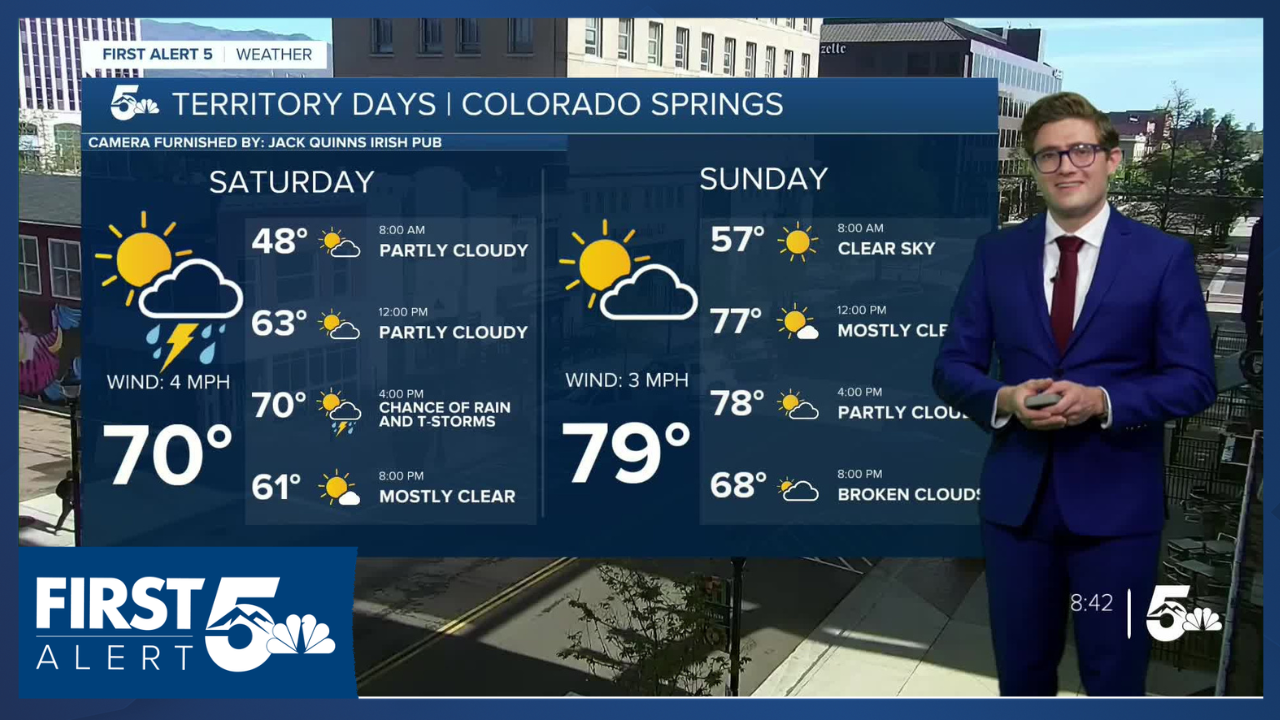
Decreasing clouds until 12 PM becoming mostly sunny and very nice for Territory Days. An isolated shower or weak t-storm may try to form near the Palmer Divide or possibly along the Rampart Range into the Pikes Peak Massif in the early afternoon. There's a 20% chance of a shower or t-storm between 2-6 PM...do not change your plans for that potential. Just pay attention to the western sky in that time frame for any dark cloud bases. Southerly winds at 5-15 mph.
Pueblo forecast: High: 77; Low: 45.
Mostly to completely sunny skies today. Moisture is insufficient to produce storms, and there's also a lack of upper level support. Easterly winds at 10-15 mph this afternoon.
Canon City forecast: High: 76; Low: 48.
Mostly sunny through noon, partly cloudy in the afternoon, and generally dry. Southeast winds at 10-15 mph.
Woodland Park forecast: High: 64; Low: 38.
Mostly sunny this morning, with an isolated t-storm possible this afternoon. West winds at 10-15 mph. Storm chances today are lower than in recent days, hovering at 30% this afternoon. I wouldn't plan for it.
Tri-Lakes forecast: High: 60s; Low: 40s.
Mostly sunny with south winds at 10-15 mph through the morning. Isolated showers and t-storms possible between 1-7 PM. The chance is higher than in other areas, but still low.
Plains forecast: High: 70s; Low: 40S.
Mostly sunny through the AM, partly cloudy this afternoon. South of highway 50 and east of a line running N-S through La Junta, isolated late afternoon t-storms are possible. In Baca County, marginally severe storm conditions will exist in the late afternoon.
Walsenburg and Trinidad forecast: High: 73/75; Low: 46.
Sunny with northerly winds at 5-10 mph.
Mountains forecast: High: 60s; Low: 40S.
Sunny this morning, partly cloudy this afternoon and notably warm. Northwest winds at 10-15 mph.
Extended outlook forecast:
Upper-level ridging continues to build Sunday and Monday. Sunday will be mainly dry, and warm with highs climbing above average. It will be a nice outdoor day, with isolated afternoon mountain thunderstorms. If you're planning on a 14er (full disclosure: I am), or anything particularly tall, be off the summit by noon. No such issues across I-25 or the plains, though.
On Memorial Day, a southern stream disturbance will push moisture into the southwestern part of the state which will track northeast during the day. This is likely to produce scattered to numerous mountain-focused thunderstorms after 12 PM. Aim to be below treeline by noon on Monday. As always, watch the sky and be prepared to turn around earlier if the skies look threatening. Partly cloudy skies along I-25 and continued warm temperatures.
By Tuesday, the ridge will pivot off to the northeast of Colorado and therefore transition into a blocking pattern as upper level energy more fully pivots into the state. This will lead to scattered afternoon thunderstorms in the Pikes Peak Region and south, along with slightly cooler highs. It will be gusty, as southeasterly winds increase in response to the incoming upper low, with gusts to 35 mph in the afternoon. To be very technical this is called a mass response (so that's the weather lesson of the day). In essence, wind develops to replace rising air at the surface due to the upper low, coupled with a weak lee trough.
The unsettled pattern continues Wednesday thanks to the blocking ridge to the northeast, with Thursday looking a bit drier ahead of more unsettled conditions at the end of next week. Highs will remain in the 70s in the Pikes Peak Region, 80s in the Arkansas River Valley.
____
Curious about the First Alert 5 Weather Storm Impact Scale? Check out our cheatsheet explainer.
Watch KOAA News5 on your time, anytime with our free streaming app available for your Roku, FireTV, AppleTV and Android TV. Just search KOAA News5, download and start watching.
