


Tonight's Forecast:
The current Red Flag Warnings over Pueblo and Fremont counties and the San Luis Valley should be allowed to expire at 8 pm. The other story will be the strong north winds this evening behind a fast-moving cold front. Gusts to 40 mph will be possible, with blowing over the Plains.
COLORADO SPRINGS: Low: 29; High: 50. Chilly morning lows will set the stage for a cooler and breezy day across the Pikes Peak Region. By late Monday evening, the upslope flow could lead to areas of drizzle or some scattered snow showers.
PUEBLO: Low: 32; High: 58. A bright and chilly morning will give way to increasing clouds and cooler than normal afternoon temperatures. We should stay dry on Monday before a chance for rain and snow showers by Tuesday.
CANON CITY: Low: 33; High: 56. Dry, cooler and breezy on Monday. By late Monday night and Tuesday morning, moisture is expected to increase, leading to scattered rain and snow showers.
WOODLAND PARK: Low: 23; High: 45. After a beautiful weekend, we'll see a cool start to the week across Teller County. A chance for snow showers will be possible by late Monday night, with more snow likely into Tuesday.
TRI-LAKES: Low: 20s; High: 40s. Similar to Teller County, Monday will be dry and chilly up towards the Palmer Divide. By late Monday night, snow showers will begin to develop, with snow showers through Tuesday.
PLAINS: Low: 20s/30s; High: 50s/60s. Breezy and cooler on Monday, with dry skies expected before more active weather develops around the middle of the week.
WALSENBURG/TRINIDAD: Low: 30s; High: 50s/60s. Cooler and breezy on Monday, with highs down around 10-20 degrees from what we saw this weekend. Rain and snow showers will be possible very late Monday night, with better chances Tuesday.
MOUNTAINS: Low: 10s/20s; High: 30s/40s. Breezy and cooler during the day, with increasing chances for snow showers heading into Monday night and Tuesday.
Extended Outlook:
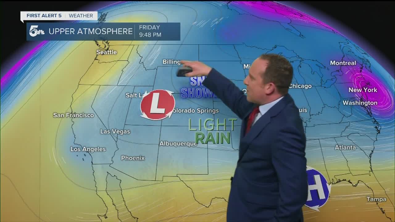
An area of low pressure will develop over the Great Basin early this week and it will generate several waves of energy that will keep our extended forecast very active. The first disturbance will bring rain and snow showers to Southern Colorado on Tuesday. Snow levels will remain above 6,000 feet, with several inches of snow likely over parts of the Pikes Peak Region. Wednesday looks mostly dry for now, with another disturbance bringing a chance for thunderstorms and thundersnow on Thursday.
KOAA News5 on your time, streaming on your Roku, FireTV, AppleTV and AndroidTV.
News5 App | First Alert 5 Weather App | Youtube | Facebook | Instagram | Twitter
