

Today’s Forecast:
Southwesterly flow will continue to keep Colorado in the crosshairs of a dry and windy weather pattern. The wind will begin to increase by mid to late morning, with gusts this afternoon region-wide around 30-40 mph. The highest gusts will be in the mountains. This will drop humidity down to the single digits this afternoon. Criteria will once again be met for RED FLAG WARNINGS, in effect from 10 am to 10 pm.
Low-level moisture on the eastern Plains will allow for additional threats of showers and thunderstorms today. Given the lift and energy in the atmosphere this afternoon, storms today will be capable of 1.5" hail and wind gusts to 70 mph. We'll be watching Baca, Prowers and Kiowa counties most closely.
Colorado Springs forecast: High: 89; Low: 56. After strong wind gusts and some moisture on Tuesday, today's forecast will be dry, gusty and warmer. Highs will warm into the upper 80s in Colorado Springs. A RED FLAG WARNING will remain in effect from 10 am to 10 pm.
Pueblo forecast: High: 96; Low: 58. It will be about 5 degrees hotter today, with gusty and dry downslope wind gusts to 30 mph. A RED FLAG WARNING has been issued for today, in effect from 10 am to 10 pm.
Canon City forecast: High: 94; Low: 58. Dry and windy weather will continue on Wednesday, with temperatures this afternoon up by as much as 3-5 degrees from yesterday. A RED FLAG WARNING has been issued for today, and will remain in effect from 10 am to 10 pm.
Woodland Park forecast: High: 79; Low: 48. Teller County will be back under a RED FLAG WARNING today, in effect from 10 am to 10 pm. Peak gusts this afternoon could top 40 mph in some areas.
Tri-Lakes forecast: High: 80s; Low: 50s. Dry skies and hazy sunshine can be expected on Wednesday, with more high fire danger this afternoon. A RED FLAG WARNING will stay in effect today from 10 am to 10 pm.
Plains forecast: High: 90s; Low: 50s/60s. It will once again be a mixed bag of weather today on the Plains, with high fire danger for areas closest to I-25, and thunderstorms along the Colorado-Kansas border. Storms that move into Baca, Prowers and Kiowa counties could turn severe.
Walsenburg and Trinidad forecast: High: 80s/90s; Low: 50s. Dry, downsloping wind will keep fire danger on the elevated to critical side today, with a RED FLAG WARNING in effect from 10 am to 10 pm.
Mountains forecast: High: 60s/70s; Low: 40s. After some high-based showers and windy thunderstorms on Tuesday, drier air will punch back into the state today, with a RED FLAG WARNING in effect in many mountain zones from 10 am to 10 pm.
Extended outlook forecast:
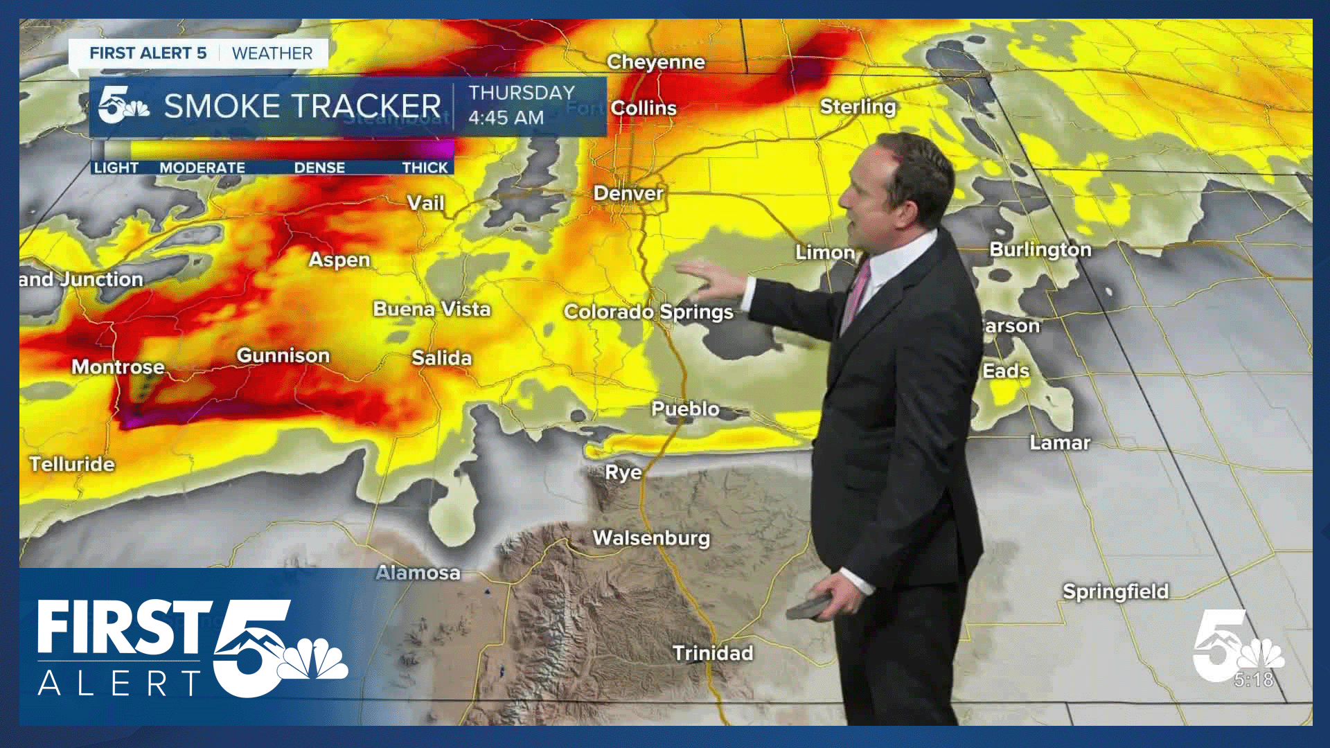
Unfortunately, we don't see any major changes in the weather pattern through the end of the week. RED FLAG WARNINGS will return on Thursday, with a FIRE WEATHER WATCH already issued by the National Weather Service. Thursday's warning does include El Paso County. Friday's watch does not.
Late this week, it will turn hot! Highs will rebound into the 90s on Thursday, peaking in the middle 90s and 100s on Friday.
Your forecast for July 4th is calling for partly cloudy skies and a high of around 90 degrees in Colorado Springs. Moisture will increase late this weekend and next week, with a daily chance of thunderstorms entering the forecast.
____
Curious about the First Alert 5 Weather Storm Impact Scale? Check out our cheatsheet explainer.
Watch KOAA News5 on your time, anytime with our free streaming app available for your Roku, FireTV, AppleTV and Android TV. Just search KOAA News5, download and start watching.
