


Tonight's Forecast:
A Flood Watch will remain in effect for parts of Southern Colorado through midnight tonight. Tonight's watch does not include El Paso, Teller and/or Pueblo counties, as the focus of the heaviest rain should stay south of Highway 50.
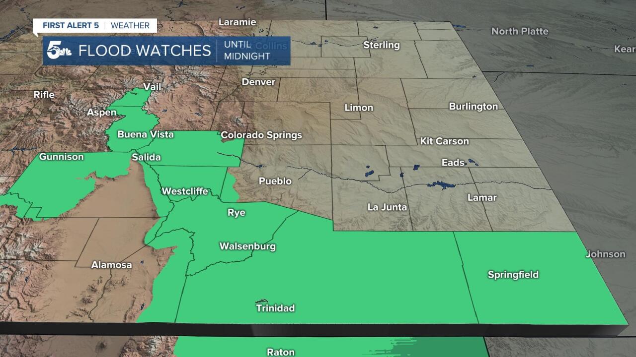
Rain should clear out from the I-25 corridor between 9 pm and midnight, but is likely to linger over the southeastern Plains through early Wednesday morning.
Colorado Springs forecast: Low: 54; High: 77; After a couple of active weather days, we'll see a return to a much more mellow pattern on Wednesday, with mild highs and only a slight chance of an afternoon thunderstorm.
Pueblo forecast: Low: 59; High: 85; We'll see a few degrees of warming on Wednesday, and a very low end chance of an afternoon thunderstorm as drier weather is expected for most of us.
Canon City forecast: Low: 61; High: 79; A slight warm-up on Wednesday after a cooler and unsettled day on Tuesday. Lingering moisture could trigger a few afternoon thunderstorms, but any threats of severe weather and/or flooding will not be widespread enough to warrant a Weather Alert day in the county.
Woodland Park forecast: Low: 47; High: 68; Sunshine is expected to return to Teller County by Wednesday morning, with increasing clouds and the potential for a few isolated thunderstorms by the afternoon.
Tri-Lakes forecast: Low: 40s/50s; High: 70s; A bright and beautiful day Wednesday after a couple of stormy ones. While most areas should stay dry, we can't rule out an isolated thunderstorm over the Palmer Divide tomorrow afternoon.
Plains forecast: Low: 50s/60s; High: 70s/80s; Rain will remain in the forecast through late tonight and in the far eastern Plains, showers could continue into early Wednesday morning. Partly cloudy skies and a slight chance of thunderstorms will follow by Wednesday afternoon.
Walsenburg and Trinidad forecast: Low: 40s/50s; High: 60s/70s; The southern I-25 corridor will stay a little more active than the rest of us over the next 24 hours. Periods of heavy rain will be possible through early Wednesday morning, with scattered thunderstorms back in the forecast by tomorrow afternoon.
Mountains forecast: Low: 40s/50s; High: 60s; Showers and thunderstorms will remain in the forecast over the mountains and mountain valleys on Wednesday. The most active part of the day looks to be between 12 pm and 6 pm, with lightning and pockets of heavy rain the main threats.
Extended outlook forecast:
Our driest day of the week will come on Thursday, and as sunshine returns, highs will rebound into the 80s and 90s across the Plains. The monsoonal flow will gradually spread back east towards the I-25 corridor by Friday, with a few isolated storms returning to the forecast from Colorado Springs to Pueblo.
Better chances for rain will follow this weekend, along with cooler daytime highs. Because of the threat for rain, plan any outdoor activities early as thunderstorms and lightning could delay or cancel activities made for the afternoon hours.
____
Curious about the First Alert 5 Weather Storm Impact Scale? Check out our cheatsheet explainer.
Watch KOAA News5 on your time, anytime with our free streaming app available for your Roku, FireTV, AppleTV and Android TV. Just search KOAA News5, download and start watching.
