

Today’s Forecast:
Much like yesterday, Tuesday will begin with a widespread blanket of stratus clouds extending from the foothills east into the Plains. Areas of fog, drizzle and mist will also be possible this morning, with some potential impacts to the morning commute.
As the upslope flow eases from yesterday, I'm expecting at least partial clearing today for the Pikes Peak Region, I-25 corridor and eastern Plains. This should allow for a few degrees of warming compared to yesterday. Even with the aforementioned warming today, highs will still be as much as 10-15 degrees below seasonal averages.
Colorado Springs forecast: High: 57; Low: 42. After a high of 52 degrees on Monday, our high today will only show modest gains for Colorado Springs. If you're hoping to see the sun today, overcast skies this morning will give way to better clearing this afternoon.
Pueblo forecast: High: 62; Low: 46. Overcast and foggy skies this morning will give way to a better chance for sunshine this afternoon. Highs will remain fall-like on Tuesday, only warming into the lower 60s.
Canon City forecast: High: 60; Low: 47. Even though we'll see less clouds than what we saw on Monday, temperatures today will remain well below average, only warming to near 60 degrees.
Woodland Park forecast: High: 57; Low: 36. A lowering stratus base should keep most of the clouds below Woodland Park on Tuesday, meaning that we'll truly live up to our nickname of "The City Above the Clouds".
Tri-Lakes forecast: High: 50s; Low: 40s. After yesterday's abrupt change in the weather, you might be a little more used to it today. Tuesday's forecast will continue to feature mostly cloudy skies and below average highs.
Plains forecast: High: 50s/60s; Low: 40s. Morning clouds will give way to partly cloudy and cool afternoon. As more energy moves into the southeastern Plains this afternoon, we can't rule out a few spotty showers or thunderstorms.
Walsenburg and Trinidad forecast: High: 50s/60s; Low: 30s/40s. Cloudy skies this morning will give way to a mostly sunny and cool afternoon, with a slight chance for a shower or thunderstorm through late this evening.
Mountains forecast: High: 40s/50; Low: 30s. With the lower level clouds on the eastern Plains, skies in the mountains will once again feature more blue than gray. By the afternoon, some energy coming out of New Mexico could lead to a few isolated showers or thunderstorms.
Extended outlook forecast:
After areas of low clouds and fog Wednesday morning, a building ridge of high pressure will switch us to more of a downslope breeze by the afternoon. This will lead to ample sunshine and significant warming. Highs will soar into the middle to upper 70s and 80s on the Plains on Wednesday, with even warmer highs on Thursday.
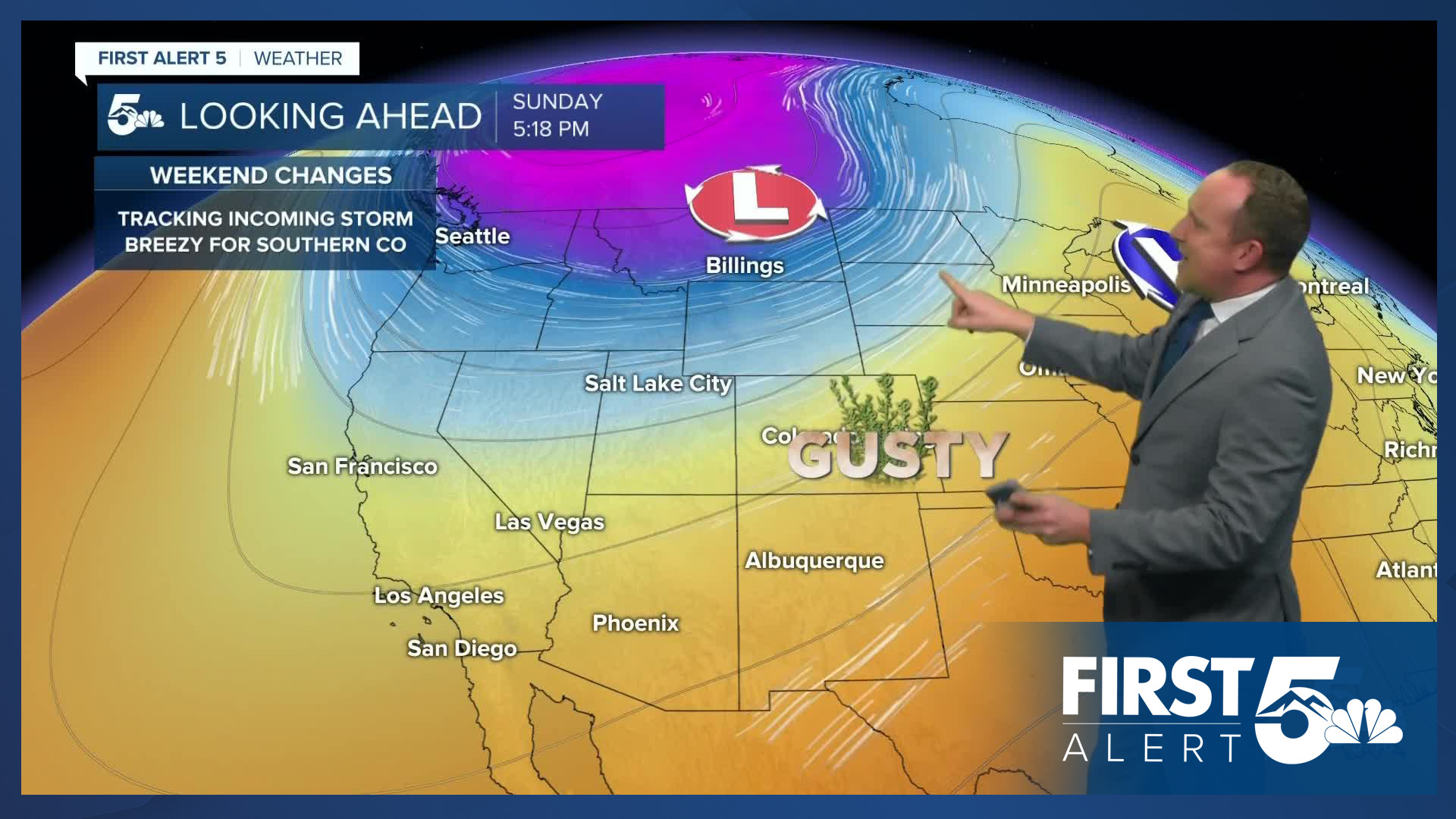
Friday's forecast is calling for increasing clouds. With less sunshine, highs will top out in the middle 70s in Colorado Springs and lower 80s in Pueblo. An incoming storm will bring some changes this weekend. For now, I continue to support the idea of warm and breezy conditions outside of the mountains, with only a slight chance for showers east of the Front Range.
____
Curious about the First Alert 5 Weather Storm Impact Scale? Check out our cheatsheet explainer.
Watch KOAA News5 on your time, anytime with our free streaming app available for your Roku, FireTV, AppleTV and Android TV. Just search KOAA News5, download and start watching.
