

Today’s Forecast:
After record-breaking heat on Sunday, temperatures today will be as much as 20-25 degrees cooler across Southern Colorado. An overnight cold front will be the reason for today's cool down. Temperatures will top out in the 50s and 60s this afternoon.
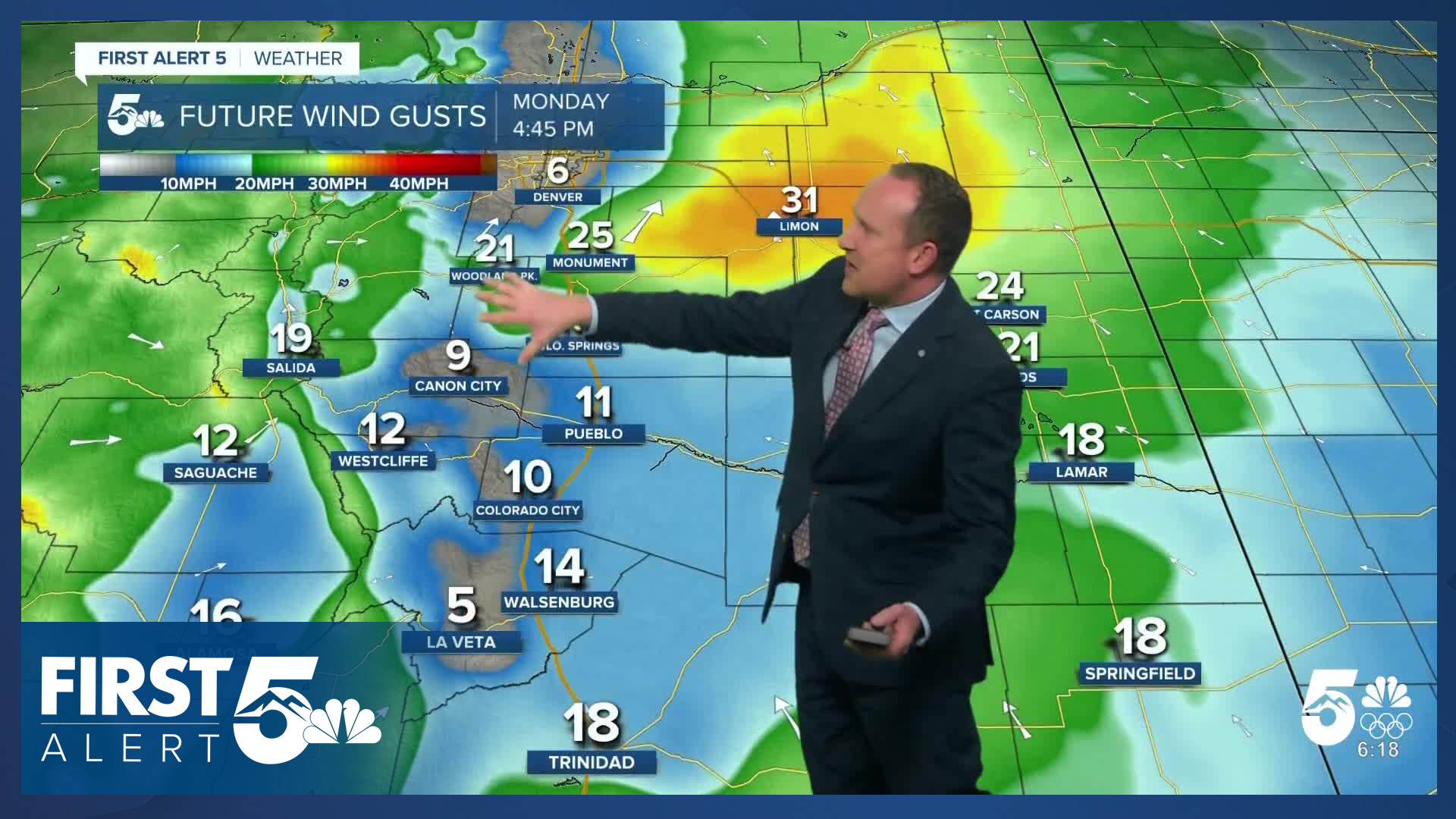
Monday's forecast will also be breezy to gusty in the wake of last night's cold front. Northerly winds this morning will turn southerly and southwesterly this afternoon, with gusts around 20-30 mph.
Colorado Springs forecast: High: 56; Low: 37. After we tied the hottest November day on record on Sunday with a high of 78 degrees, temperatures today will be more than 20 degrees cooler, and much closer to average.
Pueblo forecast: High: 61; Low: 33. Yesterday's high of 86 degrees went down as the hottest November day on record for the Steel City. Today's highs will be much cooler, only warming into the lower 60s.
Canon City forecast: High: 60; Low: 42. Near average temperatures on Monday will follow the 80s that we saw on Sunday. Our weather today will be breezy, with a decent amount of mid and upper level clouds.
Woodland Park forecast: High: 58; Low: 34. The first week of November will begin with partly to mostly cloudy skies, breezy south winds, and highs in the upper 50s.
Tri-Lakes forecast: High: 50s/60s; Low: 30s/40s. We're expecting to see cooler highs on Monday, with partly to mostly cloudy skies this afternoon, and peak southerly wind gusts to 30 mph.
Plains forecast: High: 50s/60s; Low: 30s/40s. Gusty northerly winds this morning will turn more southerly this afternoon, with peak gusts today in some areas up to 35 mph. Highs today will be much cooler than Sunday, topping out in the 50s and 60s.
Walsenburg and Trinidad forecast: High: 60s; Low: 40s. A nice and fall-like start to the week will give way to another warm one on Tuesday as highs rebound back into the 70s.
Mountains forecast: High: 40s/50s; Low: 20s/30s. Statewide snowpack right now is currently at 28% of average and the potential for snow this week in Southern Colorado remains very low, with only a small chance for snow in the northern mountains on Friday.
Extended outlook forecast:
For the rest of the week, it will be a roller coaster ride of temperatures. Tuesday's highs will soar back into the 70s and 80s on the Plains. Tuesday's record high in Colorado Springs sits at 78 degrees, with Pueblo's record at 82 degrees.
Wednesday's highs will cool back down to the 60s and lower 70s, with just minor day to day changes throughout the rest of the week. While snow is not expected to happen this week, the wind could prove problematic at times. Thursday looks like our windiest day. With gusts to 30 mph and low relative humidity, fire danger will also be elevated across Southern Colorado.
____
Curious about the First Alert 5 Weather Storm Impact Scale? Check out our cheatsheet explainer.
Watch KOAA News5 on your time, anytime with our free streaming app available for your Roku, FireTV, AppleTV and Android TV. Just search KOAA News5, download and start watching.
