

Today’s Forecast:
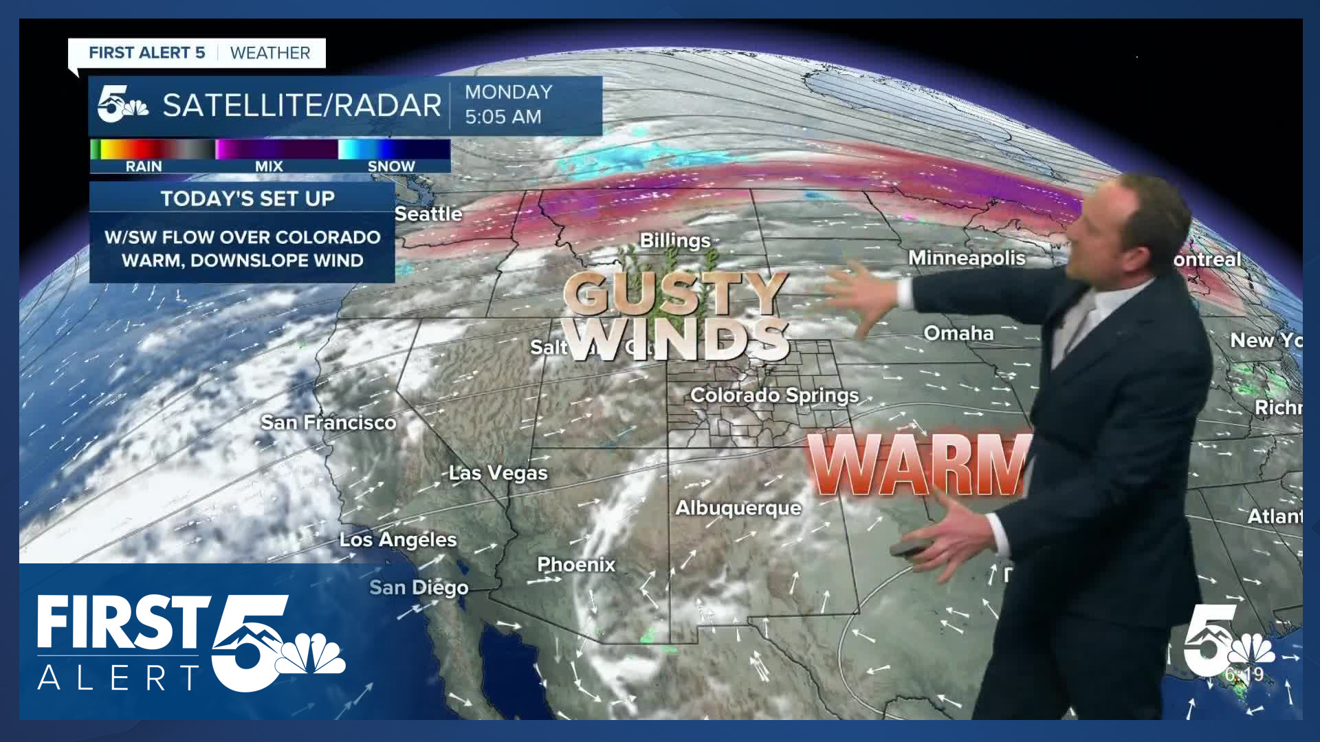
The work week will begin hot, dry, and gusty. A Red Flag Warning has been issued for parts of Southern Colorado on Monday, in effect from 11 am to 8 pm. Driven by 30-40 mph wind gusts, relative humidity will have the potential to fall into the single digits and teens for multiple hours this afternoon.
The downslope wind will drive temperatures up, with highs today soaring into the 70s and 80s. Several heat records will be in jeopardy this afternoon, from Colorado Springs to Pueblo to Alamosa.
Colorado Springs forecast: High: 79; Low: 47. Fire danger will be high enough to warrant another Red Flag Warning day in Colorado Springs, in effect from 11 am to 8 pm. Today's record high is 78°F, last set in 2010.
Pueblo forecast: High: 86; Low: 46. Hot, dry and gusty weather will bring more high fire danger to Pueblo County on Monday, and the potential for record-breaking heat this afternoon. Our current record sits at 83°F, and was last set in 2010.
Canon City forecast: High: 82; Low: 49. Today's forecast will look and feel familiar to what we've seen a lot of over the past 3-4 months. Temperatures will be well above average this afternoon, driven by wind gusts to 35 mph. A Red Flag Warning will remain in effect today from 11 am to 8 pm.
Woodland Park forecast: High: 70; Low: 39. Highs today will be more than 20 degrees above average, something familiar to us these past few months. Another familiar theme is high fire danger, and today we'll see a return to Red Flag Warnings in Teller County.
Tri-Lakes forecast: High: 70s; Low: 40s. Warm and gusty on Monday, with peak afternoon wind gusts up around 30 mph. If you're paying close attention to the skies today, you might notice storm clouds forming this afternoon. Due to dry air at the surface, any showers that develop are likely to evaporate before reaching the ground, with chances for rain only around 10%.
Plains forecast: High: 80s; Low: 40s/50s. Hot and dry, with a Red Flag Warning in effect from 11 am to 8 pm. Some of the hottest areas today could see highs approaching the 90-degree mark.
Walsenburg and Trinidad forecast: High: 70s/80s; Low: 40s. Hot, windy and dry, with a Red Flag Warning in effect from 11 am to 8 pm. Peak wind gusts in parts of Huerfano County could top 40 mph this afternoon.
Mountains forecast: High: 60s; Low: 30s. Windy, with a slight chance of a shower this afternoon in the mountains. Peak gusts in the high country today will be around 40-50 mph.
Extended outlook forecast:
In the long-term period, active weather is expected to make a return to Southern Coloraod. A cold front on Tuesday morning will drop highs to the 60s and 70s, with a chance for rain showers to develop towards the late afternoon and evening hours. In the mountains, rain and snow showers can be expected by Tuesday afternoon.
Wednesday will be even cooler, with a chance for showers throughout the day, as well as a few thunderstorms into the afternoon hours. High will warm into the 50s, 60s and lower 70s on Wednesday. Thursday will be windy and warmer, with highs returning to the 60s and 70s. A colder storm arrives on Friday, with a chance for a wintry mix or light snow by Friday evening. The track of the late week storm is still in question, and nailing this down will make a difference in what type of precipitation we see and how much. Stay tuned...
____
Curious about the First Alert 5 Weather Storm Impact Scale? Check out our cheatsheet explainer.
Watch KOAA News5 on your time, anytime with our free streaming app available for your Roku, FireTV, AppleTV and Android TV. Just search KOAA News5, download and start watching.
