

Today’s Forecast:
An early morning cold front backing up against I-25 from the eastern Plains is spreading clouds into Southern Colorado this morning. Behind the front, temperatures will be much cooler, with highs this afternoon only warming into the 60s for most areas.
Scattered showers and thunderstorms will develop this afternoon along the eastern mountain slopes, before spreading east into the Plains late this afternoon and evening. With the best instability and moisture today over the southeastern Plains, we will again see a small chance for severe hail and wind in parts of Las Animas and Baca counties on Friday. Severe weather is not expected along the I-25 corridor.
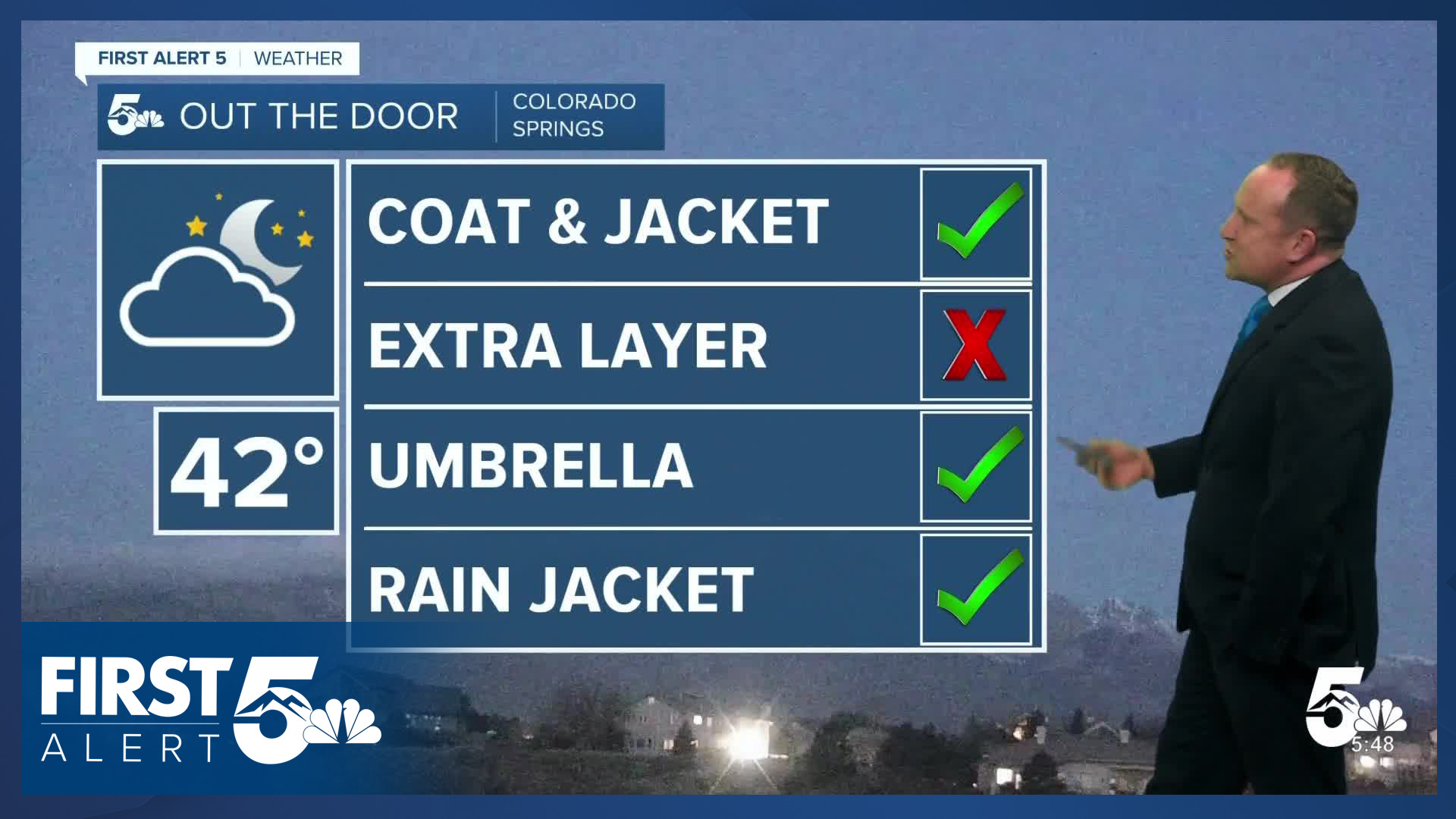
Colorado Springs forecast: High: 62; Low: 42. Overcast skies and cooler highs can be expected as we wrap up the week in the 60s. Increasing moisture will bring us another round of scattered showers and thunderstorms towards the late afternoon and evening hours.
Pueblo forecast: High: 65; Low: 42. After warming into the lower 80s on Thursday, temperatures will take a big hit this afternoon in the Steel City, only warming into the middle 60s. Skies will be mostly cloudy and to cloudy on Friday, with a chance for showers and thunderstorms towards the evening hours.
Canon City forecast: High: 65; Low: 45. Partly to mostly cloudy skies this morning will turn unsettled by the afternoon as hit or miss showers develop across the area. An isolated thunderstorm or two will also be possible today before rain showers diminish late this evening.
Woodland Park forecast: High: 60; Low: 37. Partly cloudy skies this morning will give way to the another round of showers and thunderstorms this afternoon. Showers should wrap up before midnight, and will once again be hit or miss in nature.
Tri-Lakes forecast: High: 50s/60s; Low: 30s/40s. After yesterday's warm-up, today's forecast will be cooler and cloudier. Rain showers and thunderstorms will be possible, mainly after 3 pm, with showers wrapping up by midnight.
Plains forecast: High: 50s/60s; Low: 30s/40s. Breezy S/SE winds will help to pump in Gulf moisture into the Plains today. This will act as fuel for storms that are likely to develop late this afternoon and evening. A few stronger storms will be possible today south of Highway 50, with a small chance for severe storms in parts of Las Animas and Baca counties.
Walsenburg and Trinidad forecast: High: 60s/70s; Low: 40s. Much like the rest of Southern Colorado, we'll see a cooler end to the week along the southern I-25 corridor. Skies will turn overcast this afternoon, with around a 50% chance of showers and thunderstorms.
Mountains forecast: High: 50s/60s; Low: 30s. We'll see a fairly typical spring-like day in the high country, with sunshine early giving way to increasing clouds and showers this afternoon and evening. Snow levels today will be around 10,000 to 11,000 feet.
Extended outlook forecast:
Saturday brings a mixed bag of weather to Southern Colorado and the Pikes Peak Region. On one hand, we will see a continued chance of showers and thunderstorms. On the other hand, it will be warmer and windier. In Colorado Springs, rain chances Saturday afternoon will hover around 50%, with our highs rebounding into the lower 70s. On the eastern Plains, dry lightning strikes could lead to additional fire starts.
The wind will increase by Sunday and Monday, with peak gusts in the 30 to 40 mph range. The gusty wind, combined with dry air and worsening drought conditions, will lead to high fire danger. Tuesday's storm, which once looked promising for rain and snow showers, continues to trend weaker and farther north. Based on today's analysis, I've cooled highs to the 50s and 60s on Tuesday, with a chance for showers (for now) in parts of Southern Colorado.
____
Curious about the First Alert 5 Weather Storm Impact Scale? Check out our cheatsheet explainer.
Watch KOAA News5 on your time, anytime with our free streaming app available for your Roku, FireTV, AppleTV and Android TV. Just search KOAA News5, download and start watching.
