


Today’s Forecast:
After hitting a high of 77 degrees on Sunday...today will feel solidly like October across the Pikes Peak Region.
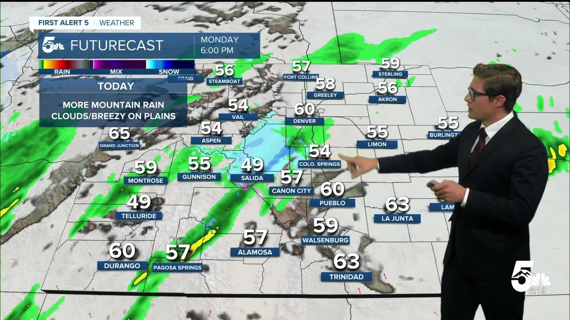
Following yesterday's potent cold front, temperatures today will be a solid 15 degrees cooler as we climb to the middle 50s this afternoon.
For most of the morning we'll be in the 40s - grab a jacket!
The big story this weekend was the tragic flooding across the San Juan mountains, some locations picking up over 4 inches of rainfall. That rainfall coming from the remnants of Tropical Storm Priscilla. Major flooding in Pagosa Springs inundated homes with the San Juan River cresting above 12.6 feet, which is major flood stage, and a levee breached in Vallecito Creek. While that water level has gone back down along the San Juan river- more rain is on the way.
The remnants of another tropical system - Tropical Storm Raymond - is moving into southwestern Colorado. A new flood watch is active and will remain in place through noon tomorrow. Given the current situation, avoiding travel through the U.S. 160 corridor between South Fork and Durango, would be a good idea if you don't need to go.
Across southern Colorado, today will be breezy, with upslope winds in the 10-20 mph range, gusting at times to 25 mph this afternoon into the Front Range. This will help keep temperatures cool and keep periodic and increasing cloud cover in place today. As usual, there will be micro-climate differences in this regard.
Colorado Springs forecast: High: 57; Low: 42.
A crisp fall feel in the air today with dew points (a measure of how wet/dry the air is) quite low and highs solidly below average. It's a great day for a fall sweater. This morning will be mainly sunny with southeast winds at 10-15 mph. Clouds will increase this afternoon with winds increasing to 10-20 mph with the most noticeable wind in the north and east parts of El Paso county. A few weak sprinkles/showers are possible late this afternoon into the overnight - but you'll be in the minority if you see them.
Pueblo forecast: High: 63; Low: 44.
A cool and mild start to the week with skies turning slowly from mostly sunny, to partly sunny, to mostly cloudy as you move from morning to evening. A spot PM shower is possible late in the day, but it's a mainly dry forecast overall and you'll be lucky if you do get any rain. Winds from the east southeast thius morning at 10 mph, increasing to 10-20 mph this afternoon.
Canon City forecast: High: 59; Low: 45.
Patchy morning clouds will slowly transition to a mostly cloudy sky by the PM commute. An isolated shower or two is certainly possible today and you may want to keep a rain jacket or umbrella handy. It shouldn't be a big deal though and given the light nature of any rain you won't need both. East southeast winds at 5-10 mph increasing to 10-20 mph this afternoon.
Woodland Park forecast: High: 51; Low: 36.
A few morning high clouds will drift in and out on an overall chilly day in the city above the clouds. Skies will remain mostly sunny/filtered sunshine through late morning before turning mostly cloudy by late afternoon. Isolated showers in the mid-afternoon, generally after 3 PM - shouldn't be a big deal. Winds out of the south southwest at 10-15 mph in the morning shifting southwest at 15-20 mph in the afternoon.
Tri-Lakes forecast: High: 50s; Low: 40s.
Breezy and cool today across northern El Paso county. Mostly sunny this morning with a few high cirrus clouds, turning mostly cloudy by evening. An isolated shower with even a rumble of thunder is possible late this afternoon into the early evening. The most likely place for that would be right along and next to the Ramparts. The cloud deck will get low tonight - leading to patchy fog. South winds at 10-20 mph.
Plains forecast: High: 50s/60s; Low: 40s.
Mostly cloudy skies for much of the day mixed with periods of partly cloudy conditions at times - that's more likely the farther north of the Colorado-New Mexico border that you are. East winds at 10-15 mph. Spotty showers tonight with some fog overnight.
Walsenburg and Trinidad forecast: High: 63/66; Low: 43/47.
Mostly sunny becoming partly cloudy by late morning, and eventually mostly cloudy as tropical moisture moves in from the southwest. Upslope east winds at 5-10 mph this morning, increasing to 10-15 mph this afternoon with a weak shot for a shower tonight.
Mountains forecast: High: 50s; Low: 30s.
Partly cloudy becoming cloudy by mid-afternoon. Isolated rain showers this afternoon in the southern mountains, more widespread in the central mountains with snow showers above 12,000 feet during the day, 9,500 feet tonight.
Extended outlook forecast:
Light showers will work through the eastern plains overnight, with fog in the cards Tuesday morning in parts of the Pikes Peak Region and Arkansas River Valley as upslope flow continues. That fog will burn off through the morning and eventually temperatures warm back to the 70s and 80s under partly cloudy skies.
We warm up further Wednesday ahead of a series of fronts and systems cooling us back below average by the end of the week. We're reaching the time of year where freezes are becoming possible - so this would be a good week to blow out your sprinklers if you live above around 6,000 feet of elevation.
____
Curious about the First Alert 5 Weather Storm Impact Scale? Check out our cheatsheet explainer.
Watch KOAA News5 on your time, anytime with our free streaming app available for your Roku, FireTV, AppleTV and Android TV. Just search KOAA News5, download and start watching.
