


Today’s Forecast:
High pressure continues to strengthen today across the west, and high temperatures today will be several degrees warmer than the last two days. Expect mainly sunny skies through the morning hours as temperatures climb. Clouds form in the mountains early this afternoon with incoming energy and mid-level moisture from the west. Eventually, these should form isolated high-based thunderstorms...emphasis on isolated. They will then move off the mountains into the southern Front Range corridor.
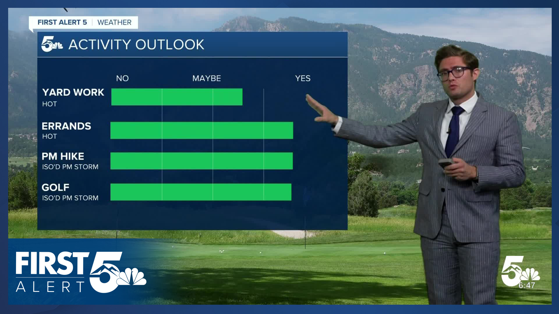
Today's showers and rumblers are most likely to produce gusty winds more than anything else where they do make it onto the plains.
It will also be breezy today, particularly over the eastern plains where wind gusts in the 35-40+ mph range are possible. Winds will be out of the south southeast, gusting to 20-25 mph this afternoon in Colorado Springs and Pueblo.
Colorado Springs forecast: High: 84; Low: 54.
Sunny through the morning and partly cloudy this afternoon. An isolated late afternoon thunderstorm is possible, but the odds of it hitting your home specifically is low - about 20%. It will be breezy as well this afternoon with south southeasterly winds, at 15-25 mph. Today's record high is 84.
Pueblo forecast: High: 90; Low: 53.
Sunny this morning with increased clouds after 2:00 PM. An isolated late afternoon to early evening thunderstorm is possible which would produce gusty winds - most likely around or after the evening commute. Today's record high is 94.
Canon City forecast: High: 88; Low: 57.
HOT today in Canon City - with sunshine through 1:00 PM, followed by developing cumulus clouds through the afternoon which may produce an isolated storm or two later in the day. That's not the headline though. The main story is the heat.
Woodland Park forecast: High: 76; Low: 48.
Mostly sunny this morning, becoming partly cloudy this afternoon. An isolated thunderstorm is possible after 1:00 PM, but impacts look low - you won't get much rain out of them.
Tri-Lakes forecast: High: 80s; Low: 50s.
Sunny this morning becoming partly cloudy this afternoon. It will also be breezy to gusty, particularly east of I-25 toward Black Forest with south winds at 15-25 mph after 12:00 PM.
Plains forecast: High: 80s/90s; Low: 50s.
Sunny, gusty, and hot. Southeast winds increasing from 10-15 to 20-30 mph this afternoon and gusting to 40 mph after 12 PM. Partly cloudy in the late afternoon.
Walsenburg and Trinidad forecast: High: 85/88; Low: 59/55.
Sunny this morning, partly cloudy this afternoon with an isolated late afternoon shower or weak thunderstorm possible, but unlikely.
Mountains forecast: High: 80s; Low: 50s.
Sunny this morning, with scattered thunderstorms this afternoon. These storms will produce gusty winds. South winds at 10-15 mph.
Extended outlook forecast:
Thursday morning begins with slightly more cloud cover than today, which clears briefly during the mid to late morning on the plains. Skies return to being partly cloudy in the afternoon. Highs will still be in the mid-80s in the Pikes Peak Region. We're likely to be fairly similar temperature wise in Pueblo and the lower Arkansas River Valley tomorrow with highs still in the low 90s. Shower chances will be lower than today, with a few threatening looking clouds in the mountains early in the afternoon.
Friday will still be warm, with conditions similar to today - about a 20-25% chance of an afternoon shower in Colorado Springs with gusty wind the main issue, and highs in the mid-80s. Friday could also have a few showers over the Raton Pass, while Pueblo looks dry. Woodland Park also has an isolated PM sprinkle or storm chance but it currently looks weak.
We stay warm Saturday, and Sunday will be breezy to gusty with southwesterly winds, with a late day cold front shifting the wind direction.
A better chance for moisture arrives Monday with an approaching region of low pressure. Temperatures will be about 10-15 degrees cooler, a noticeable change.
____
Curious about the First Alert 5 Weather Storm Impact Scale? Check out our cheatsheet explainer.
Watch KOAA News5 on your time, anytime with our free streaming app available for your Roku, FireTV, AppleTV and Android TV. Just search KOAA News5, download and start watching.
