

Disclaimer: This is sponsored content. All opinions and views are of Monarch Mountain and does not reflect the same of KOAA.
Colorado's ski resorts are facing a challenging start to the season as snow continues to be scarce across the mountains, with current snowpack levels ranking in the 5th percentile for mid-December.
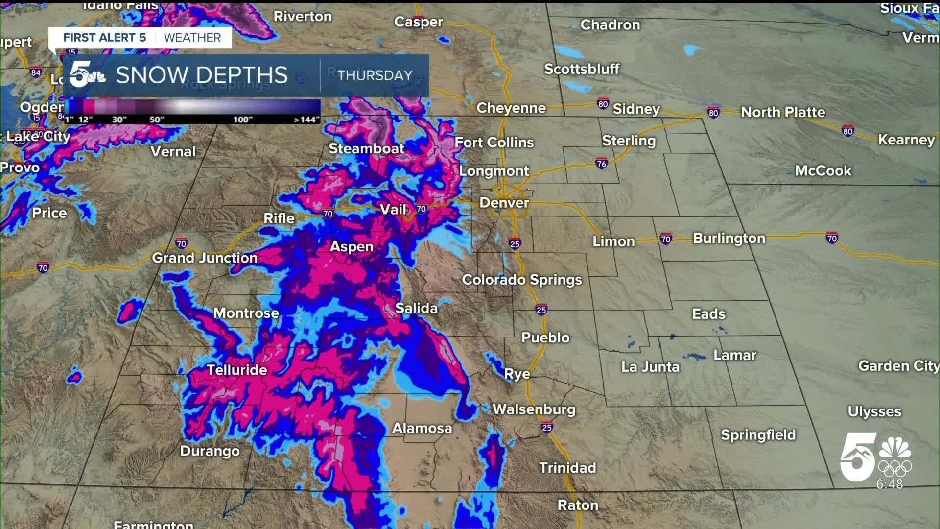
The La Nina weather pattern has brought unusually warm temperatures and minimal snowfall to the state's mountain regions. After seeing some snowpack recovery in early December, snow depth numbers have declined again, leaving 95 out of 100 years with more snow than Colorado currently has.
The stark difference becomes apparent when comparing Colorado resorts to East Coast destinations. Stowe Mountain in Vermont has accumulated 110 inches of snow so far this season, while Steamboat Springs has only received 35 inches. Several Colorado resorts have less than one-third the seasonal snow of their eastern counterparts.
Warm temperatures have also hampered snowmaking operations at multiple resorts, with several locations having significant bare patches on their slopes - which is highly atypical at this point in December.
This weekend's weather forecast shows Breckenridge and Vail will experience highs in the 30s to low 40s, with major wind conditions expected Friday, breezes Saturday, and calmer skies Sunday.
Northern resorts may see some relief Saturday, with Steamboat Springs likely to receive the most snow from an incoming system, though accumulations will still only amount to several inches.
Keystone and Arapahoe Basin will also see snow showers Saturday with cooler temperatures, experiencing highs in the 20s and 30s.
A high wind warning will remain in effect for the northern mountains through Friday afternoon. While conditions will stay gusty Saturday, the winds should be more manageable, though blowing snow may create difficult morning travel conditions.
Sunday promises calmer weather as Saturday's system brings light to moderate off-and-on snow into early Sunday morning. The northern mountains will see the most accumulation, but Interstate 70 corridor resorts could also pick up a few inches.
Looking ahead, a potential pattern change late Christmas week may bring more snow to the mountains by next weekend, offering hope for improved conditions. Other than that - keep doing your snow dances.
This story was written and reported on-air by a journalist and has been converted to this platform with the assistance of AI. Our editorial team verifies all reporting on all platforms for fairness and accuracy.
__
Watch KOAA News5 on your time, anytime with our free streaming app available for your Roku, FireTV, AppleTV and Android TV. Just search KOAA News5, download and start watching.
