



Today’s Forecast:
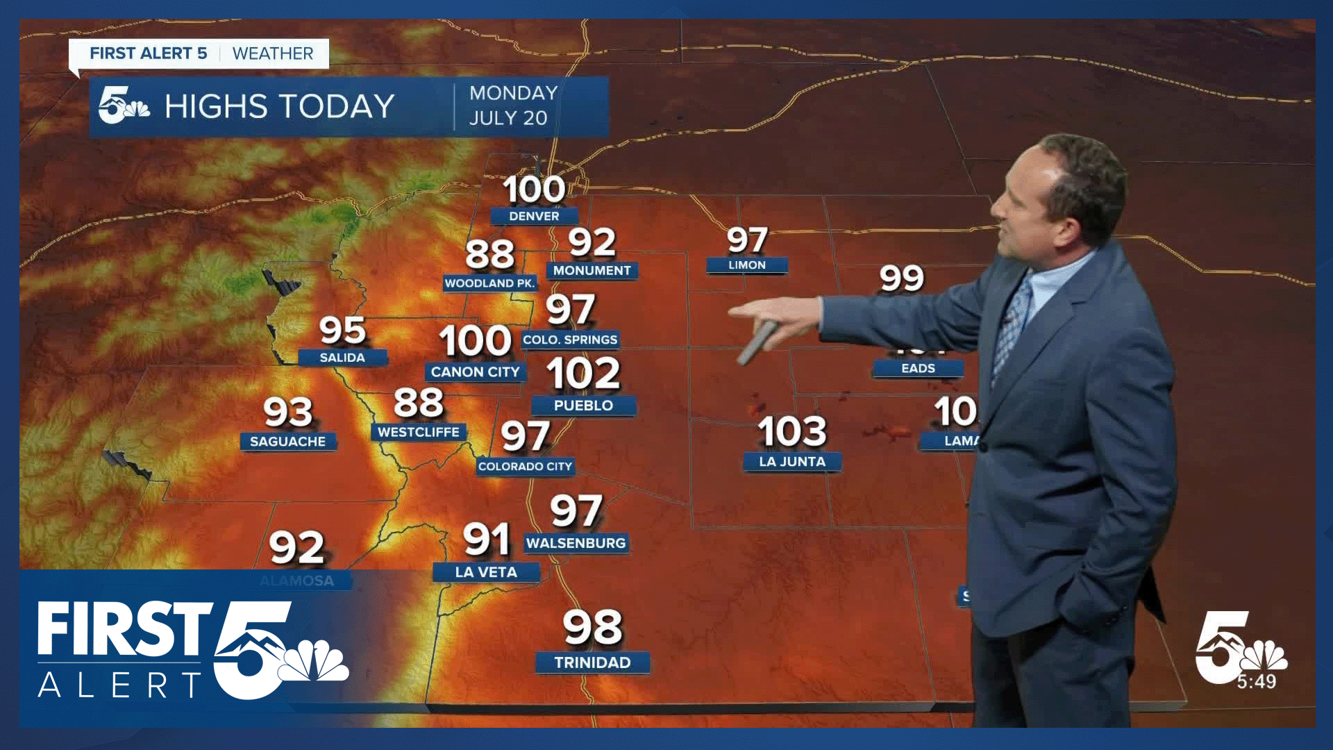
A large dome of high pressure parked over Colorado will bring some serious heat to our forecast this afternoon. Highs will soar into the 90s and 100s for I-25 and the eastern Plains, and record breaking temperatures will be possible for some areas. In the higher terrain, highs today will warm into the 80s and lower 90s.
For the start of the week, monsoon moisture will stay confined to the mountains. Storms will be scattered this afternoon and evening, and flooding is not expected to be a big concern.
Colorado Springs forecast: High: 97; Low: 65. While not the hottest day of the year, today's high of 97°F will easily be our hottest of the month so far. It will also be hot enough to threaten today's heat record of 98, last set in 2005.
Pueblo forecast: High: 102; Low: 68. After three days in the 100s in June, we've yet to experience any triple digit heat this month. Today this will change, with a hot high of 102°F this afternoon. Record: 108 (2005).
Canon City forecast: High: 100; Low: 68. Today's heat dome will push temperatures into the triple digits this afternoon around Canon City, Florence and Penrose. Rain is not expected this afternoon or evening.
Woodland Park forecast: High: 88; Low: 57. Even Teller County will be hot on Monday. While we won't see 90s and 100s like in the lower elevations, we will be in the upper 80s today, which is about 10 degrees above average.
Tri-Lakes forecast: High: 90s; Low: 50s/60s. Well above average highs can be expected this afternoon as highs climb well into the 90s in northern El Paso County. Plan for hikes and outdoor activities this morning before the heat settles in.
Plains forecast: High: 90s/100s; Low: 60s/70s. Temperatures will heat up quickly this morning, peaking this afternoon in the triple digits in many areas. Temperatures tonight will be warm, only cooling down to the upper 60s and 70s.
Walsenburg and Trinidad forecast: High: 90s; Low: 60s. Monday's forecast will be a hot one, with our highs today easily climbing into the middle to upper 90s.
Mountains forecast: High: 80s; Low: 50s. High country heat today will give way to a cooler and wetter weather pattern starting on Tuesday as the North American monsoon builds across the Centennial State. If we do see any showers today, they would most likely form out towards the Continental Divide.
Extended outlook forecast:
As high pressure begins to shift to the east, a cold front will drop in from the north on Tuesday. This will allow for a slight cool down and a better influx of moisture into the state. Our high in Colorado Springs will warm into the lower 90s, with a few isolated storms possible by the afternoon and evening hours.
A stronger disturbance will move into the state in the mid-week period, increasing the potential for more widespread showers and heavier rain. This could result in some urban flooding, but probably of more significance, a higher risk of flooding around the Aspen Acres fire.
Highs will remain hot this week. We'll continue to see highs in the 90s Tuesday and Wednesday before cooling down to the upper 80s Thursday and Friday.
____
Curious about the First Alert 5 Weather Storm Impact Scale? Check out our cheatsheet explainer.
Watch KOAA News5 on your time, anytime with our free streaming app available for your Roku, FireTV, AppleTV and Android TV. Just search KOAA News5, download and start watching.
