


Tonight's Forecast:
Clouds continue to clear overnight as dry air moves in. This will allow temperatures to drop very low by Monday at sunrise. Layer up accordingly!
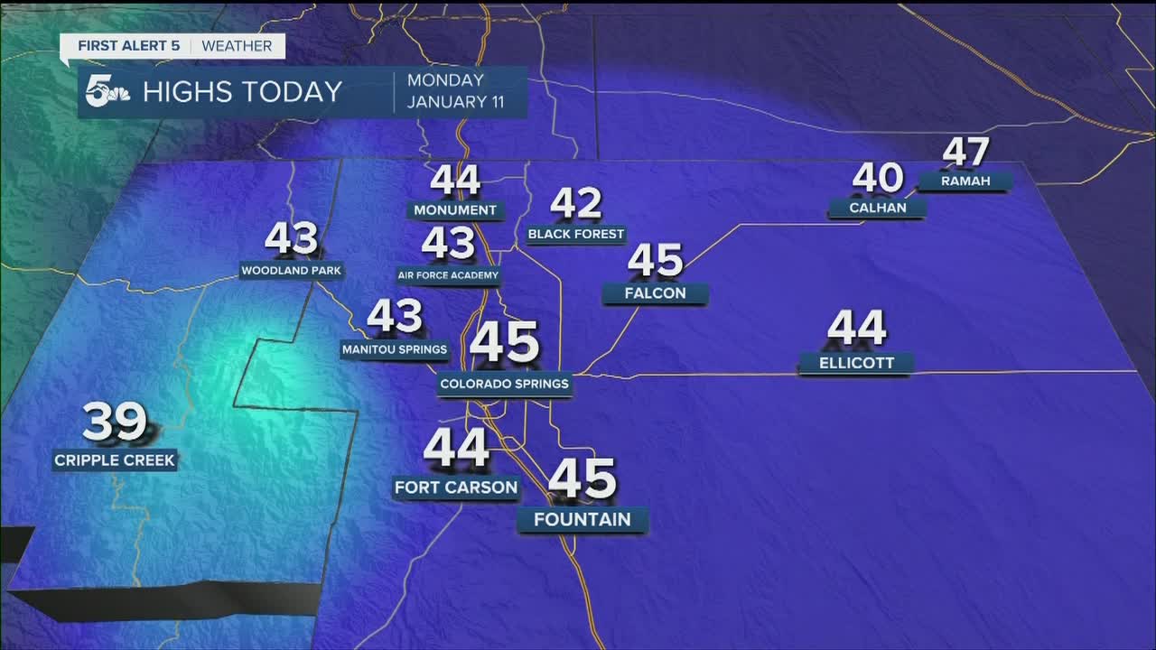
COLORADO SPRINGS: Low: 8; High: 45. More sun tomorrow and feeling chilly in the afternoon with snow lingering on the ground.
PUEBLO: Low: 7; High: 47. Very cold to start and chilly in the afternoon, but back to near average high temperatures.
CANON CITY: Low: 12; High: 48. Sunny tomorrow with chilly temperatures.
WOODLAND PARK: Low: 10; High: 43. Chilly on Monday with sunshine and light winds.
TRI-LAKES: Low: single digits; High: 40s. Warming up to the low 40s with sunshine tomorrow.
PLAINS: Low: single digits/teens; High: 40s. Frigid start and making it to the mid-40s under a sunny sky Monday.
WALSENBURG/TRINIDAD: Low: teens; High: 40s. Very cold tonight and feeling chilly tomorrow in the low to mid-40s.
MOUNTAINS: Low: single digits/negatives; High: 30s. Frigid night, especially in mountain valleys where negatives will be the lows. Sunshine and chilly during the day.
Extended Outlook:
High pressure off the west coast will aid in warming temperatures and dry conditions next week. Temperatures will be in the 40s in the mountains and 50s in the plains for most of the week.
